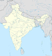
ගොනුව:India relief location map.jpg

මෙම පෙරදසුනෙහි විශාලත්වය: 557 × 600 පික්සල. අනෙකුත් විභේදනයන්: 223 × 240 පික්සල | 446 × 480 පික්සල | 713 × 768 පික්සල | 951 × 1,024 පික්සල | 1,500 × 1,615 පික්සල.
මුල් ගොනුව (1,500 × 1,615 පික්සල, ගොනු විශාලත්වය: 1.91 මෙ.බ., MIME ශෛලිය: image/jpeg)
ගොනු ඉතිහාසය
එම අවස්ථාවෙහිදී ගොනුව පැවැති ආකාරය නැරඹීමට දිනය/වේලාව මත ක්ලික් කරන්න.
| දිනය/වේලාව | කුඩා-රූපය | මාන | පරිශීලක | පරිකථනය | |
|---|---|---|---|---|---|
| වත්මන් | 13:56, 14 ඔක්තෝබර් 2020 | 1,500 × 1,615 (1.91 මෙ.බ.) | NordNordWest | upd Telangana/Andhra Pradesh | |
| 15:48, 17 ජූලි 2020 | 1,500 × 1,615 (1.91 මෙ.බ.) | NordNordWest | + Ladakh | ||
| 15:51, 31 ජූලි 2016 | 1,500 × 1,615 (1.93 මෙ.බ.) | Julieta39 | According with User:NordNordWest: Thick grey line = de facto & de jure recognised borders; slim grey line = de facto contested borders; broken grey line = claimed borders. | ||
| 12:30, 31 ජූලි 2016 | 1,500 × 1,615 (1.9 මෙ.බ.) | NordNordWest | Reverted to version as of 20:09, 5 June 2014 (UTC); no text in location maps, has to work in all languages | ||
| 16:50, 30 ජූලි 2016 | 1,500 × 1,615 (1.94 මෙ.බ.) | Julieta39 | More clarely : Thick grey line = de facto & de jure recognised borders ; Slim grey line = de facto contested borders ; Broken grey line = claimed borders (cbI = by India, cbP = by Pakistan, cbC = by China). | ||
| 20:09, 5 ජූනි 2014 | 1,500 × 1,615 (1.9 මෙ.බ.) | NordNordWest | + Telangana | ||
| 14:21, 7 ජූනි 2011 | 1,500 × 1,615 (1.95 මෙ.බ.) | NordNordWest | + missing Nagaland | ||
| 15:31, 23 අප්රේල් 2010 | 1,500 × 1,615 (2 මෙ.බ.) | Uwe Dedering | {{Information |Description={{en|1=Location map of India. Equirectangular projection. Strechted by 106.0%. Geographic limits of the map: * N: 37.5° N * S: 5.0° N * W: 67.0° E * E: 99.0° E Made with Natural Earth. Free vector and raster map data @ natur |
ගොනු භාවිතය
පහත දැක්වෙන පිටු 80 ක් විසින් මෙම ගොනුව භාවිතා කෙරෙයි:
- අමරාවතී ස්තූපය
- අයිහොලේ
- ආම්බිවලී ලෙන්
- උණ්ඩවල්ලි ලෙන්
- උදයගිරි, ඔඩිෂා
- උපර්කෝට් ලෙන්
- එලිෆන්ටා ලෙන්
- කඩියා ඩුන්ගර් ලෙන්
- කරාඩ් ලෙන්
- කාන්හෙරී ලෙන්
- කාර්ලා ලෙන්
- කුඩා ලෙන්
- කේසරියා ස්තූපය
- කොට්ටූරු ධනදිබ්බලු
- කෝණ්ඩානා ලෙන්
- කෝල්වි ලෙන්
- කෝසම්බි
- ඛම්භාලීඩා ලෙන්
- ඛාප්රා කෝඩියා ලෙන්
- ඛේද් ලෙන්
- ගිජ්ඣකූටය
- ගුණ්ටුපල්ලි බෞද්ධ ස්මාරක සමූහය
- ඝටෝත්කච ලෙන්
- ඝෝරාවාඩී ලෙන්
- ඨානාලේ ලෙන්
- තලාජා ලෙන්
- තුල්ජා ලෙන්
- දිදාර්ගන්ජ් යක්ෂි
- ධම්නාර් ලෙන්
- ධාන්ක් ලෙන්
- නාසික් ලෙන්
- නේනාවලී ලෙන්
- පන්හාලාකාජී ලෙන්
- පාටන් ලෙන්
- පාටලීපුත්ර
- පැට්නා කෞතුකාගාරය
- පිතල්ඛෝරා
- පිප්රහ්වා
- පෝහාලේ ලෙන්
- බරාබර් ලෙන්
- බල බෝධිසත්ත්ව ප්රතිමාව
- බහ්රෝට් ලෙන්
- බාඝ් ලෙන්
- බාදාමි ලෙන් දේවාල
- බාවා ප්යාරා ලෙන්
- බින්නායග බෞද්ධ ලෙන්
- බේඩ්සේ ලෙන්
- භර්හුත්
- භාජා ලෙන්
- භූතේස්වර යක්ෂියෝ
- මණ්ඩපේශ්වර් ලෙන්
- මථුරා
- මථුරා හෙරක්ලිස්
- මන්මෝඩි ලෙන්
- මහාකාලී ලෙන්
- යේර්ඵාල් ලෙන්
- රත්නගිරි, ඔඩිස්සා
- ලෙන්යාද්රි
- ලෝමස් ඍෂි ලෙන
- වායී ලෙන්
- වික්රමශිලා
- වෛශාලී (පුරාතන නගරය)
- ශ්රාවස්තී
- ශිර්වල් ලෙන්
- ශිව්නේරි ලෙන්
- සංකස්ස
- සාංචිය
- සානා ලෙන්
- සාරනාත්
- සාරු මාරු
- සියෝත් ලෙන්
- හම්පි
- හාථියාගෝර් බෞද්ධ ලෙන්
- සැකිල්ල:Location map India
- Module:Location map/data/India
- Module:Location map/data/India/doc
- Module:Location map/data/India2
- Module:Location map/data/India2/doc
- Module:Location map/data/India3
- Module:Location map/data/India3/doc
ගෝලීය ගොනු භාවිතය
පහත දැක්වෙන අනෙකුත් විකියන් මගින් මෙම ගොනුව භාවිතා කරයි:
- ace.wikipedia.org හි භාවිතය
- af.wikipedia.org හි භාවිතය
- als.wikipedia.org හි භාවිතය
- am.wikipedia.org හි භාවිතය
- anp.wikipedia.org හි භාවිතය
- ar.wikipedia.org හි භාවිතය
- ast.wikipedia.org හි භාවිතය
- as.wikipedia.org හි භාවිතය
- azb.wikipedia.org හි භාවිතය
- az.wikipedia.org හි භාවිතය
- Şablon:Yer xəritəsi Hindistan
- Benqal körfəzi
- Andaman dənizi
- Bandipur Milli Parkı
- Lakkadiv dənizi
- Səkkizinci Dərəcə boğazı
- Doqquzuncu Dərəcə boğazı
- Onuncu Dərəcə boğazı
- Dunkan boğazı
- Polk boğazı
- Caldapara Milli Parkı
- Cafna yarımadası
- Kathiyavar yarımadası
- Hindustan
- Tar (səhra)
- Andaman adaları
- Nikobar adaları
- Mahatma Qandi Dəniz Milli Parkı
- Şrixarikota
මෙම ගොනුවේ තවත් ගෝලීය භාවිත බලන්න.


