Murles
Jump to navigation
Jump to search
Murles | |
|---|---|
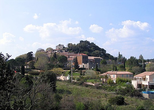 A general view of Murles | |
 Coat of arms | |
Location of Murles  | |
 Murles  Murles | |
| Coordinates: 43°41′24″N 3°44′48″E / 43.69°N 3.7467°E | |
| Country | France |
| Region | Occitania |
| Department | Hérault |
| Arrondissement | Lodève |
| Canton | Saint-Gély-du-Fesc |
| Government | |
| • Mayor (2020–2026) | Eric Riguet[1] |
| Area 1 | 24.06 km2 (9.29 sq mi) |
| Population (2021)[2] | 352 |
| • Density | 15/km2 (38/sq mi) |
| Time zone | UTC+01:00 (CET) |
| • Summer (DST) | UTC+02:00 (CEST) |
| INSEE/Postal code | 34177 /34980 |
| Elevation | 80–298 m (262–978 ft) (avg. 216 m or 709 ft) |
| 1 French Land Register data, which excludes lakes, ponds, glaciers > 1 km2 (0.386 sq mi or 247 acres) and river estuaries. | |
Murles (French pronunciation: [myʁl]; Occitan: Murlas) is a commune in the Hérault department in the Occitanie region in southern France.
Population
| Year | Pop. | ±% |
|---|---|---|
| 1962 | 40 | — |
| 1968 | 47 | +17.5% |
| 1975 | 67 | +42.6% |
| 1982 | 126 | +88.1% |
| 1990 | 200 | +58.7% |
| 1999 | 233 | +16.5% |
| 2008 | 282 | +21.0% |
See also
References
- ^ "Répertoire national des élus: les maires". data.gouv.fr, Plateforme ouverte des données publiques françaises (in French). 9 August 2021.
- ^ "Populations légales 2021" (in French). The National Institute of Statistics and Economic Studies. 28 December 2023.
Wikimedia Commons has media related to Murles.
| International | |
|---|---|
| National | |
This Hérault geographical article is a stub. You can help Wikipedia by expanding it. |
Categories:
- Pages using gadget WikiMiniAtlas
- CS1 French-language sources (fr)
- Use dmy dates from August 2023
- Articles with short description
- Short description is different from Wikidata
- Coordinates on Wikidata
- Pages using infobox settlement with image map1 but not image map
- Pages with French IPA
- Articles containing Occitan (post 1500)-language text
- Commons category link from Wikidata
- Articles with VIAF identifiers
- Articles with BNF identifiers
- Articles with BNFdata identifiers
- Articles with J9U identifiers
- Communes of Hérault
- All stub articles
- Hérault geography stubs
- Pages using the Kartographer extension