La Carla, Texas
La Carla, Texas | |
|---|---|
| Coordinates: 26°26′7″N 98°44′26″W / 26.43528°N 98.74056°W | |
| Country | United States |
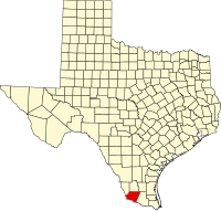
| State | Texas |
| County | Starr |
| Area | |
| • Total | 0.1 sq mi (0.3 km2) |
| • Land | 0.1 sq mi (0.3 km2) |
| • Water | 0.0 sq mi (0 km2) |
| Population (2010) | |
| • Total | 70 |
| • Density | 700/sq mi (270/km2) |
| Time zone | UTC-6 (Central (CST)) |
| • Summer (DST) | UTC-5 (CDT) |
| Zip Code | 78582 |
La Carla is a census-designated place (CDP) in Starr County, Texas, United States. This was a new CDP for the 2010 census, with a population of 70.[1]
Geography
[edit]La Carla is located at 26°26′7″N 98°44′26″W / 26.43528°N 98.74056°W (26.435385, -98.740592).[2]
Demographics
[edit]| Census | Pop. | Note | %± |
|---|---|---|---|
| 2010 | 70 | — | |
| U.S. Decennial Census[3] 1850–1900[4] 1910[5] 1920[6] 1930[7] 1940[8] 1950[9] 1960[10] 1970[11] 1980[12] 1990[13] 2000[14] 2010[15] | |||
Education
[edit]The CDP is within the Rio Grande City Grulla Independent School District (formerly Rio Grande City Consolidated Independent School District)[16]
References
[edit]- ^ "Population and Housing Unit Counts, 2010 Census of Population and Housing" (PDF). Texas: 2010.
- ^ "La Carla, Texas :: Boundary Map of La Carla, Texas".
- ^ "Decennial Census by Decade". United States Census Bureau.
- ^ "1900 Census of Population - Population of Texas By Counties And Minor Civil Divisions" (PDF). United States Census Bureau.
- ^ "1910 Census of Population - Supplement for Texas" (PDF). United States Census Bureau.
- ^ "1920 Census of Population - Number of Inhabitants - Texas" (PDF). United States Census Bureau.
- ^ "1930 Census of Population - Number of Inhabitants - Texas" (PDF). United States Census Bureau.
- ^ "1940 Census of Population - Number of Inhabitants - Texas" (PDF). United States Census Bureau.
- ^ "1950 Census of Population - Number of Inhabitants - Texas" (PDF). United States Census Bureau.
- ^ "1960 Census of Population - Number of Inhabitants - Texas" (PDF). United States Census Bureau.
- ^ "1970 Census of Population - Number of Inhabitants - Texas" (PDF). United States Census Bureau.
- ^ "1980 Census of Population - Number of Inhabitants - Texas" (PDF). United States Census Bureau.
- ^ "1990 Census of Population - Population and Housing Unit Counts - Texas" (PDF). United States Census Bureau.
- ^ "2000 Census of Population - Population and Housing Unit Counts - Texas" (PDF). United States Census Bureau.
- ^ "2010 Census of Population - Population and Housing Unit Counts - Texas" (PDF). United States Census Bureau.
- ^ "2020 CENSUS - SCHOOL DISTRICT REFERENCE MAP: Starr County, TX" (PDF). U.S. Census Bureau. Retrieved August 28, 2022. - 2010 map