Stretford
| Stretford | |
|---|---|
 Trafford Town Hall in Stretford | |
| Population | Expression error: "37,455 (2001 Census)" must be numeric |
| OS grid reference | SJ795945 |
| • London | 163 mi (262 km) SSE |
| Metropolitan borough | |
| Metropolitan county | |
| Region | |
| Country | England |
| Sovereign state | United Kingdom |
| Post town | MANCHESTER |
| Postcode district | M32 |
| Dialling code | 0161 |
| Police | Greater Manchester |
| Fire | Greater Manchester |
| Ambulance | North West |
| UK Parliament | |
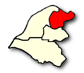
Stretford (pop. 37,500) is a town within the Metropolitan Borough of Trafford, in Greater Manchester, England. Lying on flat ground between the River Mersey and the Manchester Ship Canal, it is 3.8 miles (6.1 km) to the southwest of Manchester City Centre, 3.0 miles (4.8 km) south-southwest of Salford and 4.2 miles (6.8 km) northeast of Altrincham. Stretford is contiguous with the towns of Chorlton-cum-Hardy to the east, Urmston to the west, Salford to the north, and Sale to the south. The Bridgewater Canal bisects the town.
Historically a part of Lancashire, during much of the 19th century Stretford was an agricultural village known locally as Porkhampton; a reference to the large number of pigs produced for the nearby Manchester market. It was also an extensive market gardening area, producing over 500 long tons (508 t) of vegetables each week for sale in Manchester by 1845. The arrival of the Manchester Ship Canal in 1894, and the subsequent development of the Trafford Park Industrial Estate in the north of the town, accelerated the industrialisation which began in the late 19th century. By 2001, less than 1% of the population of Stretford was employed in agriculture.
Stretford has been the home of Manchester United Football Club since 1910, and of the Lancashire County Cricket Club since 1864. Notable residents have included the industrialist and philanthropist John Rylands, the sufragette Emmeline Pankhurst, the painter L. S. Lowry, Morrissey of The Smiths, and Jay Kay of Jamiroquai.
History
The origin of the name Stretford is "street" (Old English straet) on a ford across the River Mersey.[1] The principal road through Stretford, the A56 Chester Road, follows the line of the old Roman road from Deva Victrix (Chester) to Mamucium (Manchester), crossing the Mersey into Stretford at Crossford Bridge, built at the location of the ancient ford.[2]
In 1212, there were two manors in the area now called Stretford. The land in the south, close to the River Mersey, was held by Hamon de Mascy, while the land in the north, closer to the River Irwell, was held by Henry de Trafford.[3] In about 1250, a later Hamon de Mascy gave the Stretford manor to his daughter, Margery. She in turn, in about 1260, granted Stretford to Richard de Trafford at a rent of one penny. The de Mascy family shortly afterwards released all rights to their lands in Stretford to Henry de Trafford, the Trafford family thus acquiring the whole of Stretford, after which the two manors descended together.[2]
The de Trafford family leased out large parts of the land, much of it to tenants who farmed at subsistence levels. Although there is known to have been a papermill operating in 1765, the area remained largely rural until the early 20th-century development of Trafford Park in the north of the town.[4] Until then Stretford "remained in the background of daily life in England",[5] except for a brief cameo role during the Jacobite rebellion of 1745, when Crossford Bridge was destroyed by Bonnie Prince Charlie's army during its abortive advance on London; the bridge was quickly rebuilt.[5]
Until the 1820s, one of the main cottage industries in Stretford was the hand weaving of cotton. There were reported at one time to have been 302 handlooms operating in Stretford, providing employment for 780 workers, but by 1826 only four were still being used, as the mechanised cotton mills of nearby Manchester replaced hand weaving looms.[6] As Manchester continued to grow, it offered a good and easily accessible market for Stretford's agricultural products, in particular rhubarb, once known locally as Stretford beef. By 1836, market gardening had become so extensive around Stretford that one writer described it as the "garden of Lancashire".[7] In 1845, over 500 long tons (508 t) of vegetables were being produced each week for the Manchester market.[8] Stretford also became well-known for its pig market and the production of black puddings, leading to the village being given the nickname Porkhampton. A local dish, known as Stretford Goose, was made from pork stuffed with sage and onions. During the 1830s, between 800 and 1,000 pigs a week were being slaughtered for Manchester.[9]
Situated on the border with Manchester, Stretford became a fashionable place to live during the middle of the 19th century.[10] Large recreation areas were built, such as the Royal Botanical Gardens, opened in 1831. The gardens were sited in Old Trafford on the advice of scientist John Dalton, because the prevailing south-westerly wind kept the area clear of the city's airborne pollution.[11] In 1857, the gardens hosted the Art Treasures Exhibition, the largest art exhibition ever held in the UK.[12] A purpose-built iron and glass building was constructed at a cost of £38,000 to house the 16,000 exhibits.[13] The gardens were also chosen as a site for the Royal Jubilee Exhibition of 1887, celebrating Queen Victoria's 50-year reign. The exhibition ran for more than six months and was attended by more than 4.75 million visitors.[13] The gardens were converted into an entertainment resort in 1907, and hosted the first speedway meeting in Greater Manchester on 16 June 1928.[14] There was also greyhound racing from 1930, and an athletics track. The complex was demolished in the late 1980s, and all that remains is the entrance gates, close to what is now the White City Retail Park. The gates were designated a Grade II listed structure in 1987.[15]
The arrival of the Manchester Ship Canal in 1894, and the subsequent development of the Trafford Park industrial estate in the north of the town – the first planned industrial estate in the world[16] – had a substantial effect on the growth of Stretford. The population in 1891 was 21,751, but by 1901 it had increased by 40% to 30,436 as people were drawn to the town by the promise of work in the new industries at Trafford Park.[17][18]
During the Second World War, Trafford Park was largely turned over to the production of war materiel, including the Avro Manchester heavy bomber, and the Rolls-Royce Merlin engines used to power both the Spitfire and the Lancaster.[19] That resulted in Stretford being the target for heavy bombing, particularly during the Manchester Blitz of 1940. On the nights of 22/23 and 23/24 December 1940 alone, 124 incendiaries and 120 high-explosive bombs fell on the town, killing 73 people and injuring many more. Among the buildings damaged or destroyed during the war were Manchester United's Old Trafford football ground, All Saints' Church, St Hilda's Church, and the children's library in King Street.[20][21][22] A memorial to those residents who lost their lives in the bombing was erected in Stretford Cemetery in 1948. The memorial sits over the communal grave of the 17 unidentified people who were killed in the blitz of December 1940.[23]
Between 1972 and 1975, what is now the B&Q store in Great Stone Road was the 3,000-capacity Hardrock theatre and Village discotheque, hosting some of that period's major artists in their prime. Led Zeppelin, David Bowie, Bob Marley, Elton John, Hawkwind, Yes, Chaka Khan, Deep Purple, Curved Air and Lou Reed were amongst those who appeared. Tangerine Dream was the last band to perform at the Hardrock, on 19 October 1975.[24] In more recent years, Lancashire Cricket Club's Old Trafford ground, next door, has provided a concert venue for bands such as Angels & Airwaves, Arctic Monkeys, Foo Fighters, Oasis, Richard Ashcroft and The Strokes, with audiences in excess of 40,000.[25][26]
Transport history
Stretford's growth was fuelled by the transport revolutions of the 18th and especially the 19th century: the Bridgewater Canal reached Stretford in 1761, and the railway in 1849. The completion of the Manchester South Junction and Altrincham Railway (MSJAR) in 1849, passing through Stretford, led to the population of the town nearly doubling in a decade, increasing from 4,998 in 1851 to 8,757 by 1861.[27]
Situated on the main A56 road between Chester and Manchester, many people passed through the town, and as the traffic increased, inns were built to provide travellers with stopping places. One of the earliest forms of public transport through Stretford was the stagecoach; the Angel Hotel, on the present day site of the Bass Drum public house,[28] was one of the main stopping places in the town.[29] The stagecoach service through Stretford is believed to have ended some time in the 1840s, about the time that horse drawn tram cars arrived, in 1845;[30] electric trams were introduced in 1902.[31] After the Second World War the trams were replaced by buses.[32]
The MSJAR railway line through Stretford was electrified in 1931, and was converted to light rail operation in 1992, becoming part of the Manchester Metrolink tram network. The first Metrolink tram through Stretford ran on 15 June 1992.[33]
Governance
Civic history

Stretford was part of the ancient parish of Manchester, within the historic county boundaries of Lancashire.[34] Following the Poor Law Amendment Act of 1834, a national scheme for dealing with the relief of the poor, Stretford joined the Chorlton Poor Law Union in 1837, one of three such unions in Manchester,[35] before transferring to the Barton-upon-Irwell Poor Law Union in 1849.[34] In 1867, Stretford Local Board of Health was established, assuming responsibility for the local government of the area in 1868.[36] The board's responsibilities included sanitation and the maintenance of the highways, and it had the authority to levy rates to pay for those services. The local board continued in that role until it was superseded by the creation of Stretford Urban District Council in 1894,[34] as a result of the Local Government Act 1894.
Stretford Urban District became the Municipal Borough of Stretford in 1933,[34] giving it borough status in the United Kingdom. Stretford Borough Council was granted its arms on 20 February 1933.[37] The roses are the red roses of Lancashire, and the lion in the centre represents John of Gaunt, 1st Duke of Lancaster. Above the lion are a crossed flail and scythe; the flail comes from the arms of the de Trafford family; the scythe is a reminder of the agricultural history of the area; the thunderbolts above represent the importance of electricity in Stretford's industrial development. The boat at the bottom represents Stretford's links to the sea via the Manchester Ship Canal.[37]
In 1974, as a result of the Local Government Act 1972, the Municipal Borough of Stretford was abolished and Stretford has, since 1 April 1974, formed part of the Metropolitan Borough of Trafford, in Greater Manchester.[34] Trafford Town Hall – previously Stretford Town Hall – is the administrative centre of Trafford.
Political representation
The constituency of Stretford was created in 1885, and existed until 1997, when it was replaced by the present constituency of Stretford and Urmston. Beverley Hughes, a member of the Labour Party, has been the MP since the constituency was created. At the 2005 General Election, Hughes won the seat with a majority of 7,851, representing 51.0% of the vote. The Conservatives took 30.4% of the vote, the Liberal Democrats 14.0%, the Respect Party 2.5%, and the United Kingdom Independence Party 2.2%.[38]
Stretford is one of the four major urban areas in Trafford; the other three are Altrincham, Sale and Urmston. The area historically known as Stretford, between the River Irwell in the north and the River Mersey in the south, has since 2004 been divided between the Trafford local government wards of Clifford, Longford, Gorse Hill, and Stretford. Each ward is represented by three local councillors, giving Stretford 12 of the 63 seats on Trafford Council. The wards elect in thirds on a four yearly cycle.[39] As at 2007, all 12 of the councillors representing the Stretford area are members of the Labour Party.
Geography
Stretford occupies an area of 4.1 square miles (10.6 km2), just north of the River Mersey, at 53°26′48″N 2°18′31″W / 53.44667°N 2.30861°WInvalid arguments have been passed to the {{#coordinates:}} function (53.4466, -2.3086). The area is generally flat, sloping slightly southwards towards the river valley,[2] and is approximately 150 feet (46 m) above sea level at its highest point.[40] The most southerly part of Stretford lies within the flood plain of the River Mersey, and so has historically been prone to flooding. A great deal of flood mitigation work has been carried out in the Mersey Valley since the 1970s, with the stretch of the Mersey through Stretford being canalised to speed up the passage of floodwater.[41] Emergency floodbasins have also been constructed, Sale Water Park being a prominent local example, lying immediately to the south of Stretford.
Stretford comprises the local areas of Old Trafford, Gorse Hill, Trafford Park and Firswood. Its climate is generally temperate, with few extremes of temperature or weather. The mean temperature is slightly above average for the United Kingdom. Annual rainfall and average amount of sunshine are both slightly below the average for the UK.[42]
Stretford's built environment developed along the A56 road in two separate sections, corresponding to the original two manors. The area in the south, near to the border with Sale, grew around the church of St Matthew – an old alternative name for the town was Stretford St. Matthew.[43] The northern part of Stretford was centred on Old Trafford, with undeveloped countryside separating the two areas. During the 19th century, both sections merged together.[44]
The western terminus of the early medieval linear earthwork Nico Ditch is in Hough Moss, just to the east of Stretford (grid reference SJ82819491); it was probably used as an administrative boundary and dates from the 8th or 9th century.[45]
Demography
| Stretford Compared | |||
|---|---|---|---|
| 2001 UK Census | Stretford | Trafford | England |
| Total population | 37,455 | 210,145 | 49,138,831 |
| Foreign born | 17% | 8% | 9% |
| White | 73% | 92% | 91% |
| Asian | 15% | 5% | 5% |
| Black | 8% | 2% | 2% |
| Average age | 36.7 y | 38.9 y | 38.6 y |
| Over 65 years old | 15% | 16% | 16% |
As at the 2001 UK census, the Stretford area wards of Clifford, Longford, Talbot and Stretford had a total population of 37,455,[46] and a population density of 9,158 persons per square mile (3,537 per km²).[47]
Stretford residents had an average age of 36.7 years, younger than the 38.9 Trafford average.[48] For every 100 females, there were 96.7 males.[49] Of all residents, 52% were single (never married): in Trafford, 44% were single.[50] Of the 16,078 households, 37% were one-person households, 14% were married couples with dependant children, and 9% were lone parents with dependant children.[51] Of those aged 16–74 in Stretford, 33% had no academic qualifications, higher than the 25% in all of Trafford.[49]
With 83% being born in United Kingdom, there is a relatively high proportion of foreign-born residents reported. There is also a high proportion of non-white people, as 73% of residents were recorded as white. The largest minority group was Asian, at 15% of the population.[52]
In June 2004, Trafford adopted a revised set of ward boundaries, and the ward of Talbot was replaced by the new ward of Gorse Hill. Re-aligning the 2001 census figures with the 2004 ward boundaries gives Stretford a population of 42,121.[53]
In 1931, 18.7% of Stretford’s population was middle class and 19.7% working class compared to 14% middle class and 36% working class nationally. The rest of the population was made up of clerical workers and skilled manual workers. By 1971, the middle class in Stretford had declined steadily to 14.9% whilst the working class had grown to 31.3% compared to 24% middle class and 26% working class nationally. Stretford has gone against the national trend of a shrinking working class and a growing middle class.[54]
| Population growth in Stretford since 1801 | |||||||||||||||||||
|---|---|---|---|---|---|---|---|---|---|---|---|---|---|---|---|---|---|---|---|
| Year | 1801 | 1811 | 1821 | 1831 | 1841 | 1851 | 1861 | 1871 | 1881 | 1891 | 1901 | 1911 | 1921 | 1931 | 1939 | 1951 | 1961 | 1971 | 2001 |
| Population | 1,477 | 1,720 | 2,173 | 2,463 | 3,524 | 4,998 | 8,757 | 11,945 | 19,018 | 21,751 | 30,436 | 42,496 | 46,535 | 56,791 | 51,929 | 61,874 | 60,364 | 54,316 | 37,455 |
| Source: A Vision of Britain through Time[55][56][57] | |||||||||||||||||||
Economy
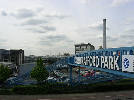
Until the end of the 19th century Stretford was a largely agricultural village. The development of the Trafford Park industrial estate in the north of the town, beginning in the late 19th century, had a significant effect on the town's subsequent development. At its peak, in 1945, the park employed an estimated 75,000 workers;[58] housing and other amenities had to be constructed on what had previously been agricultural land.[59] Trafford Park is still a very significant source of employment, containing an estimated 1,400 companies and employing about 44,000 people.[60] As at the 2001 UK census, 0.3% of Stretford's working population was employed in agriculture.[61]
The main shopping centre is Stretford Mall in the commercial centre of Stretford, previously known as Stretford Arndale. It was opened in 1969 and changed its name in 2003.[62] Stretford Mall was built on the site of the original shopping centre in the former King Street. The Trafford Centre, a large shopping and leisure complex opened in September 1998, lies to the northwest of Stretford. Frequent shuttle buses run between Stretford Metrolink tram station and The Trafford Centre, about 2.5 miles (4.0 km) away.[63]

According to the 2001 UK census, the industry of employment of residents in Stretford was 18% retail and wholesale, 14% property and business services, 13% manufacturing, 12% health and social work, 8% education, 8% transport and communications, 6% construction, 5% finance, 5% public administration and defence, 5% hotels and restaurants, 0.7% energy and water supply, 0.3% agriculture and 5% other. This was roughly in line with national figures, except for the town's relatively low percentage of agricultural workers. Many people commute into Stretford; as of the 2001 census, there were 23,595 jobs within the town, compared with the town's 13,399 employed residents.[61][64]
The census recorded the economic activity of residents aged 16–74 as 38.8% in full-time employment, 11.1% in part-time employment, 5.6% self-employed, 4.5% unemployed, 2.9% students with jobs, 5.5% students without jobs, 12.2% retired, 7.0% looking after home or family, 7.7% permanently sick or disabled, and 4.7% economically inactive for other reasons. The 4.5% unemployment rate in Stretford was high compared with the national rate of 3.3%. According to the Office for National Statistics estimates, during the period of April 2001 to March 2002, the average gross income of households in Stretford was £415 per week (£21,664 per year).[65]
Landmarks
Longford Cinema

Longford Cinema, opposite Stretford Mall, on the eastern side of the A56 Chester Road, is perhaps the most visually striking building in the town. Designed by the architect Henry Elder, it was the height of Art Deco fashion when it was opened by the Mayor of Stretford in 1936. Its unusual "cash register" frontage was intended to symbolise the business aspect of show business.[66]
The building incorporated many modern features, such as sound-proofing and under-seat heating,[67] and it was also the first cinema in Britain to make use of concealed neon lighting.[66] It had a seating capacity of 1,400 in the stalls and 600 in the circle, with a further 146 seats in the café area.[66] When built, the cinema had a short pedestrian approach to the facade, but this was removed when the A56 was widened. During World War II the building was used for concerts, including one given by a young Julie Andrews.[67] It also played host to the Hallé Orchestra after the orchestra's own home, the Free Trade Hall, was bombed and severely damaged during the Manchester Blitz of 1940.
After a change of ownership in 1950, the cinema was renamed the Stretford Essoldo. It continued to operate as a cinema until 1965, when it was converted into a bingo hall, which it remained until its closure in 1995.[67] The building has remained unused since then. It was designated a Grade II listed building in 1994.[68]
Great Stone
The Great Stone, which gave its name to the Great Stone Road, where it was located until being moved in 1925, is one of Stretford's most easily overlooked landmarks. The stone is composed of millstone grit and was probably deposited as a glacial erratic. It is rectangular in shape, about 5 feet (2 m) wide, 2 feet (1 m) deep, and 3 feet (1 m) tall, with two rectangular slots cut into its upper surface.
Several suggestions have been made for the history of the Great Stone. It may have been a plague stone, when the holes in the top would have been filled with disinfectant, through which coins exchanged between plague victims and the rest of the population would have been passed. There was a succession of plagues in Manchester from the 14th century onwards,[69] but although the stone may then have been used as a plague stone, the holes are probably too deep for that to have been its original purpose. It may have been a road marker on the Roman road between Northwich and Manchester, or some kind of a boundary marker.[70] The Great Stone is also thought to have been the base of an Anglo-Saxon cross shaft.[57] A local legend had it that the stone was slowly sinking into the earth, and that its final disappearance would mark the end of the world.[71]
When the Great Stone Road was widened in the late 19th century, the stone was moved back from the road slightly. In 1925, the stone was moved again, to its current location outside the North Lodge of Gorse Hill Park, about 328 feet (100 m) from its historical location. The stone is a Grade II listed structure.[72]
Cenotaph

Stretford Cenotaph, opposite the Chester Road entrance to Gorse Hill Park, was built as a memorial to the 580 Stretford men who lost their lives in the First World War. Their names and regiments are listed on a large bronze plaque on the wall behind the cenotaph. It was formally unveiled in 1923, by the Earl of Derby, Secretary of State for War.[73]
The cenotaph is 24 feet (7 m) high and 11 feet (3 m) wide at its base. It cost £2,000 to build, the money being raised by public subscription and a donation from the Stretford Red Cross. The memorial bears the legend "They died that we might live" on one side, and "In memory of the heroic dead" on the other. It is a Grade II listed structure.[74]
Longford Park
Longford Park is the largest park in Trafford, at 54 acres (22 ha).[75] It includes a pet's corner, botanical garden, bowling greens and children's play areas. It is also the finishing point of the annual Stretford pageant. Longford Park was the home of John Rylands, industrialist and philanthropist, from 1855 until his death in 1888.[76] The hall was demolished in 1995. Today only the front porch, the coach house and the stable buildings remain.
Public Hall
Stretford Public Hall was built in 1878 by local philanthropist John Rylands.[77] It was designed by N. Lofthouse and is located on the western side of the A56 Chester Road, opposite the Longford Cinema. Stretford’s first public lending library was established in the building in 1883.[78] At Ryland's death in 1888, his widow placed the building at the disposal of the local authority for a nominal rent, and on her own death in 1910, the building was bought by Stretford Council for £5,000.[77]
Public baths were built to the rear of the building, accessed via Cyprus Street.[79] In 1940 the new Stretford library was opened on King Street, and the public hall was rendered surplus. The building re-opened in March 1949 as the Stretford Civic Theatre, with a well equipped stage for the use of local groups. After the Stretford Leisure Centre opened in 1976, the Cyprus Street Baths wing fell into disuse, and was demolished. The remainder of the building began to fall into disrepair, despite being designated a Grade II listed building in 1987,[80] until Trafford Council refurbished and converted the building to serve as council offices in the mid-1990s. It was re-opened in 1997, once again named Stretford Public Hall.
Trafford Town Hall
Trafford Town Hall stands in a large site at the junction of Talbot Road and Warwick Road, directly opposite the Old Trafford Cricket Ground. The building was designed by architects Bradshaw, Gass and Hope of Bolton and the contractors were Edwin Marshall & Sons Ltd. Building work began 21 August 1931.[81]
The building officially came into use as Stretford Town Hall on the granting of Stretford's charter, on 16 September 1933. In 1974, on the formation of the new Trafford Metropolitan Borough, Stretford Town Hall was adopted as the base for the new council, and was renamed Trafford Town Hall. It was designated a Grade II listed building in 2007.[82]
Transport

Stretford Metrolink station is part of the Manchester Metrolink tram system, and lies on the Altrincham to Bury line. Trams leave around every six minutes between 7:15 and 18:30, and every 12 minutes at other times of the day.[83] The nearest main line railway station is Trafford Park, in the north of Stretford, on the Liverpool to Manchester line. Services are roughly every two hours in each direction, with extra services calling during the peak-hours.[84] The 20-acre (8 ha) Trafford Park Euroterminal rail freight terminal, opened in 1993, is in the Gorse Hill area of Stretford. It cost £11 million and has the capacity to deal with 100,000 containers a year. The containers are handled by two huge gantry cranes, the noise from which has led to complaints from some local residents.[85]
The town has good access to the motorway network; junction 7 of the M60 is just to the north of Stretford's boundary with Sale. The A56 road gives easy access to the south as well as to Manchester city centre in the other direction. Cycle paths exist as part of the Trafford cycle initiative.
Manchester Airport, the busiest airport in the UK outside London,[86] is about nine miles (14.5 km) to the south of Stretford.
Education
Along with the rest of Trafford, Stretford maintains a selective education system assessed by the Eleven Plus examination.
The proportion of pupils leaving Stretford Grammar School with five or more GCSEs at grades A*–C in 2006, was 98.3%, compared to an average of 66.7% for all secondary schools in Trafford and a national UK average of 61.3%.[87] Over half of the school's pupils are from minority ethnic backgrounds, and approximately a quarter of all pupils have a first language other than English, significantly above the national average.[88] Stretford Grammar was awarded specialist Science College status in September 2005. The school was assessed as "satisfactory" in its March 2006 Ofsted report.[88]
Stretford High School Community Languages College, like Stretford Grammar, has a much higher proportion than the national average of pupils with a first language other than English, a high number of them being either asylum seekers or refugees.[89] In 2004, Stretford High School was made subject to special measures, as it was considered not to be providing an adequate education for its pupils. Substantial improvement has taken place since then; the school was assessed as "satisfactory" in its November 2005 Ofsted report and was removed from special measures.[89]
Religion
| Stretford Compared | |||
|---|---|---|---|
| 2001 UK Census | Stretford | Trafford | England |
| Total population | 37,455 | 210,145 | 49,138,831 |
| Christian | 64.7% | 75.8% | 71.7% |
| Muslim | 12.4% | 3.3% | 3.1% |
| Sikh | 2.1% | 0.5% | 0.7% |
| Hindu | 0.7% | 0.6% | 1.1% |
| Buddhist | 0.3% | 0.2% | 0.3% |
| Jewish | 0.2% | 1.1% | 0.5% |
| No religion | 12.1% | 12.0% | 14.6% |
The date of the first church to be built in Stretford is unrecorded, but in a lease dated 1413, land is described as lying next to a chapel.[2] Many of the present day churches in the area were constructed during the late 19th and early 20th century, as the population of Stretford began to grow.
Methodism was a significant influence in 19th-century Stretford,[90] but of the 17 churches in the town today, only one is Methodist whereas six are Roman Catholic. The Catholic mission in Stretford was begun in 1859, in a small chapel on Herbert Street.[91]
As at the 2001 UK census, 65% of Stretford residents reported themselves as being Christian, 12% as Muslim, and 2% as Sikh. No other religion was represented at higher than 1% of the population, with 12% reporting themselves as having no religion.
Stretford is in the Roman Catholic Diocese of Salford,[92] and the Anglican Diocese of Manchester.[93]
There are two Grade II listed churches in Stretford: the Church of St Ann[94] and the Church of St Matthew.[95] St Ann's is a Roman Catholic church, built in 1862–7 by E. W. Pugin for Sir Humphrey and Lady Annette de Trafford.[94] It was officially opened by Bishop William Turner on 22 November 1863, and was consecrated in June 1867.[96] Features include a historic organ built by Jardine & Co (1867) and a good number of fine stained glass windows by Hardman & Co of Birmingham. St Matthew’s church was built in 1842 by W. Hayley in the Gothic Revival style, with additional phases in 1869, 1906, and 1922.[95]
Sports
Stretford has been the home of Manchester United Football Club since 1910, when the club moved to its present Old Trafford ground, the western end of which is still unofficially called the Stretford End.
Old Trafford was originally the home of Manchester Cricket Club, but became the home of Lancashire County Cricket Club in 1864 upon that club's formation. The ground is on Talbot Road, Stretford, where it has been since 1856. Similar to its counterpart, one end of the Old Trafford cricket ground is called the Stretford End. It has been a test venue since 1884 and has hosted three World Cup semi-finals.[97] After the 2005 Ashes Test, when more than 20,000 fans had to be turned away,[98] the decision was made to increase the ground's capacity from 20,000 to 25,000. Initial plans included building a new stadium on the site of Trafford Town Hall, opposite the present ground. However, Trafford Council voted against the demolition of the town hall and instead, in 2007, signed an agreement jointly with Lancashire County Cricket Club, Ask Developments, and Tesco, to redevelop the ground on its present site.[99]

The new cricket ground will be at the heart of a 750,000 square feet (69,677 m2) development which will also include business space, residential, retail, hotel and leisure facilities. The preferred development scheme is scheduled to be announced early in 2008.[99] Over £25 million is expected to be invested in the redevelopments at Old Trafford.[97]
Stretford Stadium, adjoining Longford Park, is the home of Trafford Athletic Club. Trafford is one of the UK's top athletic clubs, with over 100 members having competed at international level.[100]
The Stretford Leisure Centre, run by Trafford Community Leisure Trust, is next to Stretford High School and near to Old Trafford football and cricket grounds. The centre has a 25-metre pool, a 20-metre children's pool, a gym, two squash courts, eight badminton courts and a cafe. Trafford Water Sports Centre lies just across Stretford's southern border with Sale, about one mile (1.6 km) from Stretford town centre.
Culture and cultural references
Although Stretford town centre is busy during the day, there is very little in the way of a night-time economy.[101] There are no restaurants or other entertainments except for a number of public houses and members-only social clubs. There are two public libraries, Lostock Library and Stretford Library, run by Trafford Council.
The Stretford Pageant is an annual Rose Queen festival held on the last Saturday of June; the inaugural pageant was staged in 1919.[102] There is a procession of decorated floats through the streets, collecting money for local charities and ending at Longford Park, where the Rose Queen is crowned. The tradition of the Rose Queen derives from an earlier event organised by St Peter's Church from 1909 until the pageant began in 1919. Various other entertainments are provided in the park on the day of the pageant, such as a fun fair and a car boot sale. Stretford Pageant, along with similar events in other parts of Trafford, is under threat because of the council's proposals to reduce funding and support for such events in the future.[103]
The Stretford Wives is a television drama that was broadcast by the BBC in August 2002, watched by 5.7 million viewers.[104] Written by Danny Brocklehurst, it is the story of three sisters living in Stretford, although most of the filming took place in nearby Salford. The programme received a mixed critical reception.[105][106]
Invention and discovery
The Stretford process was developed at the North-Western Gas Board's laboratories in Stretford, during the 1940s. It was the first liquid phase, oxidation process for removing hydrogen sulphide (H2S) from town gas to gain widespread commercial acceptance. Many Stretford plants were built worldwide.[107]
Notable people

John Rylands, industrialist, philanthropist, and Manchester's first multi-millionaire,[108] constructed and lived in Longford Hall, where he died in 1888. Fittingly for an area so close to Trafford Park, the world's first planned industrial estate, one of the world's first industrial espionage agents, John Holker, was born in Stretford in 1719.[109][110]
Perhaps two of Stretford's more famous residents were the sufragette Emmeline Pankhurst and painter L. S. Lowry. The 1881 English census records Pankhurst and her family living at 3 Chester Road. Lowry was born in Barratt Street, Stretford in 1887.[111]
Musicians who have lived in the area include Morrissey, the front man of 80s alternative rock band The Smiths, whose family moved to 384 King's Road, Stretford, when he was 10 years old. Jay Kay, lead singer and songwriter of Jamiroquai, was born in Stretford in 1969. Oldham Athletic manager and former Éire and Sheffield Wednesday footballer John Sheridan was born in Stretford.[112]
References
Notes
- ^ Nicolaisen, Gelling & Richards, The Names of Towns and Cities in Britain, p. 177.
- ^ a b c d "Townships: Stretford". A History of the County of Lancaster: Volume 4 (1911), p. 329–335. British History Online. Retrieved 2007-04-07.
- ^ Masterson and Cliff, Stretford: An Illustrated History, p. 12.
- ^ Masterson and Cliff, Stretford: An Illustrated History, p. 13.
- ^ a b Masterson and Cliff, Stretford: An Illustrated History, p. 15.
- ^ Masterson and Cliff, Stretford: An Illustrated History, p. 38.
- ^ Scola, Feeding the Victorian City: the food supply of Manchester, 1770–1870, p. 97.
- ^ Scola, Feeding the Victorian City: the food supply of Manchester, 1770–1870, p. 105.
- ^ Masterson and Cliff, Stretford: An Illustrated History, p. 19–20.
- ^ Masterson and Cliff, Stretford: An Illustrated History, p. 23.
- ^ "Archive of the Royal Botanical and Horticultural Society of Manchester and the Northern Counties". The Archives Hub. Retrieved 2008-01-10.
- ^ "Manchester 1857, a City of Industry". Manchester Art Gallery. Retrieved 2008-01-15.
- ^ a b Masterson and Cliff, Stretford: An Illustrated History, p. 107–110.
- ^ "White City Track". UK Running Track Directory. Retrieved 2008-01-09.
- ^ "Entrance Portal and Lodges to Former White City Greyhound Track". Images of England. Retrieved 2008-01-09.
- ^ Nicholls, Trafford Park: The First Hundred Years, p. xiii.
- ^ "1901 Census of England and Wales". A Vision of Britain Through Time. Great Britain Historical GIS Project. Retrieved 2007-07-12.
- ^ Nevell, The Archaeology of Trafford, p. 24.
- ^ Nicholls, Trafford Park: The First Hundred Years, p. 103–104.
The Rolls-Royce Merlin engine was made by Ford, under licence. The factory produced 34,000 engines, and employed 17,316 people. - ^ "All Saints Church". Trafford Lifetimes. Trafford Council. Retrieved 2007-08-02.
- ^ "St. Hilda's church showing bomb damage". Trafford Lifetimes. Trafford Council. Retrieved 2007-08-02.
- ^ "Bomb damage to the children's library, King Street". Trafford Lifetimes. Trafford Council. Retrieved 2007-08-02.
- ^ Masterson and Cliff, Stretford: An Illustrated History, p. 156.
- ^ Greenhalgh, Simon (2007-08-03). "Stretford's 'Hardrock' down memory lane". Messenger Newspapers. Retrieved 2008-12-08.
- ^ Anon. "Old Trafford Cricket Ground music venue". Drowned in Sound. Retrieved 2007-05-23.
- ^ Anon (2006-06-19). "Foo Fighters at Old Trafford Cricket Ground - 7/10". Drowned in Sound. Retrieved 2007-05-23.
{{cite web}}: Check date values in:|date=(help) - ^ Nevell, The Archaeology of Trafford, p. 25.
- ^ "Bass Drum". Trafford Lifetimes. Trafford Metropolitan Borough Council. Retrieved 2007-07-11.
- ^ Masterson and Cliff, Stretford: An Illustrated History, p. 40.
- ^ Masterson and Cliff, Stretford: An Illustrated History, p. 36,40.
- ^ "Historian reviews 1,000 years of town history". Sale and Altrincham Messenger. Retrieved 2008-01-10.
- ^ "A Short History of Road Passenger Transport in Greater Manchester". Greater Manchester's Museum of Transport. Retrieved 2008-01-10.
- ^ "History" (PDF). Metrolink. Retrieved 2008-01-16.
- ^ a b c d e "Greater Manchester Gazetteer". Greater Manchester County Records Office. Retrieved 2007-07-02.
- ^ "Manchester Archives and Local Studies: A Guide to Poor Law and Workhouse Records" (PDF). Manchester City Council. Retrieved 2008-01-09.
- ^ Masterson and Cliff, Stretford: An Illustrated History, p. 88–89.
- ^ a b "Civic Heraldry of England & Wales". Retrieved 2007-05-20.
- ^ "Stretford and Urmston constituency election results". Guardian.co.uk. Retrieved 2007-08-04.
- ^ Trafford Metropolitan Borough Council. "Trafford Council Constitution 2007". Trafford.gov.uk. Retrieved 2008-01-06.
- ^ "Stretford, United Kingdom". Global Gazetteer, Version 2.1. Falling Rain Genomics, Inc. Retrieved 2007-07-02.
- ^ "Mersey Bank Park and the River Mersey". Mersey Valley Countryside Warden Service. Retrieved 2007-07-02.
- ^ Met Office (2007). "Annual UK weather averages". Met Office. Retrieved 2007-04-23.
- ^ "A vision of Stretford Ch/CP". A Vision of Britain Through Time. Retrieved 2008-01-10.
- ^ Masterson and Cliff, Stretford: An Illustrated History, p. 20–21.
- ^ Nevell, The Archaeology of Trafford, p. 40–41.
- ^ "Clifford (Ward): Population (UV01)". Office for National Statistics. Retrieved 2007-05-06.
• "Longford (Ward): Population (UV01)". Office for National Statistics. Retrieved 2007-05-06.
• "Talbot (Ward): Population (UV01)". Office for National Statistics. Retrieved 2007-05-06.
• "Stretford (Ward): Population (UV01)". Office for National Statistics. Retrieved 2007-05-06. - ^ "Clifford (Ward): Population Density (UV02)". Office for National Statistics. Retrieved 2007-05-06.
• "Longford (Ward): Population Density (UV02)". Office for National Statistics. Retrieved 2007-05-06.
• "Talbot (Ward): Population Density (UV02)". Office for National Statistics. Retrieved 2007-05-06.
• "Stretford (Ward): Population Density (UV02)". Office for National Statistics. Retrieved 2007-05-06. - ^ "Clifford (Ward): Age Structure (KS02)". Office for National Statistics. Retrieved 2008-01-17.
• "Longford (Ward): Age Structure (KS02)". Office for National Statistics. Retrieved 2008-01-17.
• "Talbot (Ward): Age Structure (KS02)". Office for National Statistics. Retrieved 2008-01-17.
• "Stretford (Ward): Age Structure (KS02)". Office for National Statistics. Retrieved 2008-01-17. - ^ a b "Key Figures for 2001 Census: Census Area Statistics". Office for National Statistics. Retrieved 2008-01-17.
• "Key Figures for 2001 Census: Census Area Statistics". Office for National Statistics. Retrieved 2008-01-17.
• "Key Figures for 2001 Census: Census Area Statistics". Office for National Statistics. Retrieved 2008-01-17.
• "Key Figures for 2001 Census: Census Area Statistics". Office for National Statistics. Retrieved 2008-01-17. - ^ "Clifford (Ward): Marital Status (KS04)". Office for National Statistics. Retrieved 2008-01-17.
• "Longford (Ward): Marital Status (KS04)". Office for National Statistics. Retrieved 2008-01-17.
• "Talbot (Ward): Marital Status (KS04)". Office for National Statistics. Retrieved 2008-01-17.
• "Stretford (Ward): Marital Status (KS04)". Office for National Statistics. Retrieved 2008-01-17. - ^ "Clifford (Ward): Household Composition (KS20)". Office for National Statistics. Retrieved 2008-01-17.
• "Longford (Ward): Household Composition (KS20)". Office for National Statistics. Retrieved 2008-01-17.
• "Talbot (Ward): Household composition (KS20)". Office for National Statistics. Retrieved 2008-01-17.
• "Stretford (Ward): Household Composition (KS20)". Office for National Statistics. Retrieved 2008-01-17. - ^ "Clifford (Ward): Ethnic Group (UV09)". Office for National Statistics. Retrieved 2008-01-17.
• "Longford (Ward): Ethnic Group (UV09)". Office for National Statistics. Retrieved 2008-01-17.
• "Talbot (Ward): Ethnic Group (UV09)". Office for National Statistics. Retrieved 2008-01-17.
• "Stretford (Ward): Ethnic Group (UV09)". Office for National Statistics. Retrieved 2008-01-17. - ^ "Clifford Ward Profile". Trafford Council. Retrieved 2007-05-08.
• "Longford Ward Profile". Trafford Council. Retrieved 2007-05-08.
• "Gorse Hill Ward Profile publisher=Trafford Council". Retrieved 2007-05-08.{{cite web}}: Missing pipe in:|title=(help)
• "Stretford Ward Profile". Trafford Council. Retrieved 2007-05-08. - ^ "Stretford social class". Vision of Britain. Retrieved 2008-01-08.
- ^ "Stretford MB/UD: Total Population". A Vision of Britain through Time. Retrieved 2008-01-05.
- ^ "Stretford USD: Total Population". A Vision of Britain through Time. Retrieved 2008-12-05.
- ^ a b Nevell, The Archaeology of Trafford, p. 87.
- ^ Nevell (1997), The Archaeology of Trafford, p. 130–3.
- ^ Masterson and Cliff, Stretford: An Illustrated History, p. 43.
- ^ "Salford Quays & Trafford Park". Manchester Investment and Development Agency Service Ltd. Retrieved 2007-07-03.
- ^ a b "Clifford (Ward): Industry of Employment (UV34)". Office for National Statistics. Retrieved 2007-12-12.
• "Longford (Ward): Industry of Employment (UV34)". Office for National Statistics. Retrieved 2007-12-12.
• "Talbot (Ward): Industry of Employment (UV34)". Office for National Statistics. Retrieved 2007-12-12.
• "Stretford (Ward): Industry of Employment (UV34)". Office for National Statistics. Retrieved 2007-12-12. - ^ "Arndale Centre opening". Trafford Lifetimes. Trafford Council. Retrieved 2008-01-10.
- ^ "Getting Here by Bus and Train". The Trafford Centre. Retrieved 2008-01-09.
- ^ "Clifford Ward: Economic Activity (UV28)". Office for National Statistics. Retrieved 2007-12-12.
• "Longford Ward: Economic Activity (UV28)". Office for National Statistics. Retrieved 2007-12-12.
• "Talbot Ward: Economic Activity (UV28)". Office for National Statistics. Retrieved 2007-12-12.
• "Stretford Ward: Economic Activity (UV28)". Office for National Statistics. Retrieved 2007-12-12. - ^ "Clifford (Ward), Income: Model-Based Estimates". Office for National Statistics. Retrieved 2007-12-12.
• "Longford (Ward), Income: Model-Based Estimates". Office for National Statistics. Retrieved 2007-12-12.
• "Talbot (Ward), Income: Model-Based Estimates". Office for National Statistics. Retrieved 2007-12-12.
• "Stretford (Ward), Income: Model-Based Estimates". Office for National Statistics. Retrieved 2007-12-12. - ^ a b c Rendell, Cinemas of Trafford, p. 55.
- ^ a b c "Longford Cinema". Retrieved 2007-04-04.
- ^ "Longford Cinema". Images of England. Retrieved 2007-08-12.
- ^ "The City and Parish of Manchester". A History of the County of Lancaster: Volume 4. British History Online. Retrieved 2008-01-08.
- ^ "The Great Cross, Streford". Pastscape.org.uk. Retrieved 2008-01-08.
- ^ Massey, A History of Stretford, p. 25.
- ^ "The Great Stone Stretford". Images of England. Retrieved 2008-01-08.
- ^ "Stretford Cenotaph". National Recording Project. Public Monument and Sculpture Association. Retrieved 2008-08-13.
- ^ "Stretford Cenotaph". Images of England. Retrieved 2008-01-08.
- ^ "Longford Park". Trafford Metropolitan Borough. Retrieved 2007-07-13.
- ^ Masterson and Cliff, Stretford: An Illustrated History, p. 73.
- ^ a b Masterson and Cliff, Stretford: An Illustrated History, p. 83.
- ^ Masterson and Cliff, Stretford: An Illustrated History, p. 118.
- ^ "Stretford Baths". Trafford Council. Retrieved 2007-07-07.
- ^ "Stretford Civic Theatre". Images of England. Retrieved 2007-12-06.
- ^ "Stretford Town Hall". Trafford Council. Retrieved 2007-07-07.
- ^ "Listings report, Autumn 2007". The Twentieth Century Society. Retrieved 2007-12-06.
- ^ "Tram Times". Metrolink. Retrieved 2007-05-06.
- ^ "Station Facilities: Trafford Park (TRA)". National Rail Enquiries. Retrieved 2008-01-09.
- ^ Nicholls, Trafford Park: The First Hundred Years, p. 161.
- ^ Wilson, James (26 April 2007). "A busy hub of connectivity". Financial Times – FT report – doing business in Manchester and the NorthWest. The Financial Times Limited.
{{cite news}}: Check date values in:|date=(help) - ^ "Longford Ward Profile". Trafford Council. Retrieved 2007-05-08.
- ^ a b "Stretford Grammar School". Ofsted. 2006-03-29. Retrieved 2007-05-10.
{{cite web}}: Check date values in:|date=(help) - ^ a b "Stretford High School Community Languages College". Ofsted. 2006-03-02. Retrieved 2007-05-10.
{{cite web}}: Check date values in:|date=(help) - ^ Masterson and Cliff, Stretford: An Illustrated History, p. 11.
- ^ Massey, A History of Stretford, p. 126.
- ^ "Parishes of the Diocese". Catholic Diocese of Salford. Retrieved 2007-05-07.
- ^ "The Church of England Diocese of Manchester". Retrieved 2007-05-07.
- ^ a b "Church of St Ann". Images of England. Retrieved 2007-08-12.
- ^ a b "Church of St Matthew". Images of England. Retrieved 2007-08-12.
- ^ Massey, A History of Stretford, p. 127.
- ^ a b Anon (2007-05-09). "Cricket ground makes 150 not out". BBC Online. Retrieved 2007-05-23.
{{cite web}}: Check date values in:|date=(help) - ^ Anon (2006-04-21). "Ashes to Ashes". BBC Online. Retrieved 2007-05-23.
{{cite web}}: Check date values in:|date=(help) - ^ a b "Four-way agreement on Old Trafford future". Lancashire County Cricket Club. Retrieved 2007-08-16.
- ^ "Trafford Athletic Club". Retrieved 2007-03-26.
- ^ "Stretford Ward Profile". Trafford Council. Retrieved 2007-05-08.
- ^ Masterson and Cliff, Stretford: An Illustrated History, p. 115.
- ^ Vine, Katherine (2007-10-26). "Brassed off over Festival Funding". Manchester Metro News. Retrieved 2008-01-17.
- ^ Deans, Jason (2008-08-22). "Bond shakes off Ripley drama". MediaGuardian. Retrieved 2008-01-10.
- ^ Sutcliffe, Thomas (2002-08-22). "Last Night's Television". The Independent. Retrieved 2008-01-10.
- ^ Jackson, Eric (2002-08-22). "In My View – Stretford Wives". Manchester Evening News.
{{cite web}}: Text "accessdate-2008-01-10" ignored (help) - ^ "The State of Liquid Redox". Gas Technology Products. Merichem Company. 2005. Retrieved 2007-05-23.
{{cite web}}: Unknown parameter|authorfirst=ignored (|author-first=suggested) (help); Unknown parameter|authorlast=ignored (|author-last=suggested) (help) - ^ Parkinson-Bailey, Manchester: An Architectural History, p. 123.
- ^ Harris, J. R. "Holker, John (1719–1786)". Oxford Dictionary of National Biography. Oxford University Press. Retrieved 2008-01-10.
- ^ Smith, John Graham. "Science and Technology in the Early French Chemical Industry". University of Leicester. Retrieved 2008-01-11.
- ^ Levy, Mervyn rev. Spalding, Julian. "Lowry, Joseph Wilson (1803–1879)". Oxford Dictionary of National Biography. Oxford University Press. Retrieved 2008-01-10.
{{cite web}}: CS1 maint: multiple names: authors list (link) - ^ "John Sheridan". Soccerbase. Retrieved 2007-08-25.
Bibliography
- Massey, Samuel (1976). A history of Stretford. Altrincham: John Sherratt and Son Ltd. ISBN 0854270469.
- Masterson, Vicki (2002). Stretford: An Illustrated History. Derby: The Breedon Books Publishing Company. ISBN 1859833217.
{{cite book}}: Unknown parameter|coauthors=ignored (|author=suggested) (help) - Nevell, Mike (1997). The Archaeology of Trafford. Trafford Metropolitan Borough with University of Manchester Archaeological Unit. ISBN 1870695259.
- Nevell, Mike (1998). Lands and Lordships in Tameside. Tameside Metropolitan Borough Council with the University of Manchester Archaeological Unit. ISBN 1871324181.
- Nicholls, Robert (1996). Trafford Park: The First Hundred Years. Phillimore & Co Ltd. ISBN 1860770134.
- Nicolaisen W. F. H., Gelling M., & Richards M. (1970). The Names of Towns and Cities in Britain. B. T. Batsford Ltd. ISBN 0713401133.
{{cite book}}: CS1 maint: multiple names: authors list (link) - Parkinson-Bailey, John J. (2000). Manchester: An Architectural History. Manchester: Manchester University Press. ISBN 0719056063.
- Rendell, Douglas (1998). Cinemas of Trafford. Jarvis Print Group Limited. ISBN 0951256017.
- Scola, Roger (1992). Feeding the Victorian City: the food supply of Manchester, 1770–1870. Manchester University Press. ISBN 0719030889.
External links