Empire Tract
 USGS aerial imagery of the Empire Tract | |
 Empire Tract  Empire Tract  Empire Tract | |
| Geography | |
|---|---|
| Location | Northern California |
| Coordinates | 38°03′55″N 121°28′48″W / 38.06528°N 121.48000°W[1] |
| Adjacent to | Sacramento–San Joaquin River Delta |
| Highest elevation | −10 ft (-3 m)[1] |
| Administration | |
United States | |
| State | |
| County | San Joaquin |
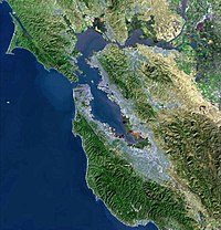
The Empire Tract is an island in the Sacramento–San Joaquin River Delta.[2] It is part of San Joaquin County, California, and managed by Reclamation District 2029.[3][4] Its coordinates are 38°03′55″N 121°28′48″W / 38.06528°N 121.48000°W[1], and the United States Geological Survey measured its elevation as −10 ft (−3.0 m) in 1981.[1] It appears on a 1952 USGS map of the area.[5]
References
- ^ a b c d U.S. Geological Survey Geographic Names Information System: Empire Tract
- ^ California State Automobile Association (2007). Coast and Valley: Bay Area to Southern California (Map). 1:560,000. American Automobile Association.
- ^ "Municipal Service Review: Selected San Joaquin County Reclamation Districts" (PDF). San Joaquin Local Agency Formation Commission. E Mulberg & Associates. 18 March 2018. Archived (PDF) from the original on 14 March 2021. Retrieved 24 February 2021.
- ^ "Reclamation Districts Map" (PDF). San Joaquin County Geographic Information Systems. San Joaquin County. 16 September 2020. Archived (PDF) from the original on 24 November 2020. Retrieved 24 February 2021.
- ^ United States Geological Survey (1952). "Terminous Quadrangle, California" (Map). United States Department of the Interior Geological Survey. 1:24000.
Map: Islands of Suisun Bay and the Sacramento–San Joaquin River Delta | |
|---|---|
 |
This San Joaquin County, California–related article is a stub. You can help Wikipedia by expanding it. |