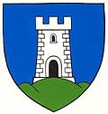
Altlichtenwarth
Appearance
Altlichtenwarth | |
|---|---|
 | |
| Coordinates: 48°39′N 16°48′E / 48.650°N 16.800°E | |
| Country | Austria |
| State | Lower Austria |
| District | Mistelbach |
| Government | |
| • Mayor | Franz Gaismeier |
| Area | |
| • Total | 20.45 km2 (7.90 sq mi) |
| Elevation | 783 m (2,569 ft) |
| Population (1 January 2016)[1] | |
| • Total | 764 |
| • Density | 37/km2 (97/sq mi) |
| Time zone | UTC+1 (CET) |
| • Summer (DST) | UTC+2 (CEST) |
| Postal code | 2144 |
| Area code | 02533 |
| Website | www.altlichtenwarth.at |
Altlichtenwarth is a town in the district of Mistelbach in the Austrian state of Lower Austria.
Population
| Year | Pop. | ±% |
|---|---|---|
| 1783 | 726 | — |
| 1794 | 578 | −20.4% |
| 1830 | 882 | +52.6% |
| 1846 | 1,073 | +21.7% |
| 1851 | 1,005 | −6.3% |
| 1869 | 931 | −7.4% |
| 1880 | 1,055 | +13.3% |
| 1890 | 1,196 | +13.4% |
| 1900 | 1,388 | +16.1% |
| 1923 | 1,286 | −7.3% |
| 1951 | 1,393 | +8.3% |
| 1961 | 1,254 | −10.0% |
| 1971 | 1,048 | −16.4% |
| 1981 | 895 | −14.6% |
| 1991 | 808 | −9.7% |
| 2001 | 783 | −3.1% |
| 2007 | 774 | −1.1% |
References

