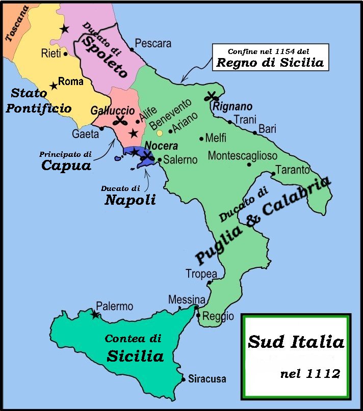
English: This is a political map of southern Italy in 1112 AD/
CE, the date when
Roger II of Sicily reached his
age of majority, also showing the border of the Kingdom of Sicily in 1154, on his death.
"The rarity of surviving records makes it impossible to draw a map of comital [counts'] responsibiities in southern Italy at the beginning of the twelth century." Matthew, p. 23.
As noted by Matthew, the political situation in southern Italy is much more complex than this map shows. There were numerous
counts and semi-independent cities throughout the region. Moreover, the near-constant rebellions and conquests continually re-arranged the map.