Zámrsky: Difference between revisions
Content deleted Content added
m →References: add authority control |
population, infobox |
||
| Line 1: | Line 1: | ||
{{Infobox settlement |
{{Infobox settlement |
||
|name=Zámrsky |
| name = Zámrsky |
||
| other_name = |
|||
|settlement_type=Municipality |
| settlement_type = [[Obec|Municipality]] |
||
|image_skyline=Zámrsky, kaple Panny Marie Hostýnské.jpg |
|||
<!-- images, nickname, motto --> |
|||
| ⚫ | |||
| |
| image_skyline = Zámrsky, kaple Panny Marie Hostýnské.jpg |
||
| ⚫ | |||
|image_flag=Zámrsky vlajka.jpg |
| image_flag = Zámrsky vlajka.jpg |
||
| ⚫ | |||
| image_shield = Zámrsky znak.jpg |
|||
| ⚫ | |||
<!-- location --> |
|||
| ⚫ | |||
| ⚫ | |||
| ⚫ | |||
| ⚫ | |||
|subdivision_type2=[[Districts of the Czech Republic|District]] |
|||
| ⚫ | |||
| ⚫ | |||
| ⚫ | |||
| ⚫ | |||
| |
| subdivision_type2 = [[Districts of the Czech Republic|District]] |
||
| ⚫ | |||
| ⚫ | |||
<!-- maps and coordinates --> |
|||
| ⚫ | |||
| image_map = |
|||
| ⚫ | |||
| map_caption = |
|||
| ⚫ | |||
| pushpin_map = Czech Republic |
|||
| ⚫ | |||
| pushpin_relief = 1 |
|||
| ⚫ | |||
| pushpin_map_caption = Location in the Czech Republic |
|||
| ⚫ | |||
| coordinates_footnotes = |
|||
<!-- government type, leaders --> |
|||
| leader_title = |
|||
| leader_name = |
|||
<!-- established --> |
|||
| established_title = First mentioned |
|||
| established_date = 1141 |
|||
<!-- area --> |
|||
| area_footnotes = |
|||
| area_total_km2 = 8.01 |
|||
<!-- elevation --> |
|||
| elevation_footnotes = |
|||
| ⚫ | |||
<!-- population --> |
|||
| ⚫ | |||
| population_footnotes = <ref>{{cite web |title=Population of Municipalities – 1 January 2022|url=https://www.czso.cz/csu/czso/population-of-municipalities-1-january-2022|publisher=[[Czech Statistical Office]]|date=2022-04-29}}</ref> |
|||
| ⚫ | |||
| ⚫ | |||
<!-- time zone(s) --> |
|||
| timezone1 = [[Central European Time|CET]] |
|||
| utc_offset1 = +1 |
|||
| timezone1_DST = [[Central European Summer Time|CEST]] |
|||
| utc_offset1_DST = +2 |
|||
<!-- postal codes, area code --> |
|||
| ⚫ | |||
| postal_code = 753 01 |
|||
| area_code_type = |
|||
| area_code = |
|||
<!-- website, footnotes --> |
|||
| ⚫ | |||
| footnotes = |
|||
}} |
}} |
||
| ⚫ | |||
| ⚫ | |||
| ⚫ | |||
The municipality covers an area of {{convert|8|km2|sqmi}}, and has a population of 198 (as at 3 July 2006). |
|||
| ⚫ | |||
==References== |
==References== |
||
{{reflist}} |
|||
*[http://www.olomouc.czso.cz/lexikon/mos_vdb.nsf/okresy/CZ0714/ Olomouc Regional Statistical Office: Municipalities of Přerov District] |
|||
{{commons category|Zámrsky}} |
|||
{{Přerov District}} |
{{Přerov District}} |
||
{{authority control}} |
{{authority control}} |
||
Revision as of 07:34, 10 October 2022
Zámrsky | |
|---|---|
 Chapel of Our Lady of Hostýn | |
 Flag  Coat of arms | |
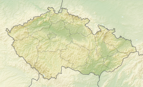 Zámrsky Location in the Czech Republic | |
| Coordinates: 49°30′23″N 17°49′40″E / 49.50639°N 17.82778°E | |
| Country | |
| Region | Olomouc |
| District | Přerov |
| First mentioned | 1141 |
| Area | |
| • Total | 8.01 km2 (3.09 sq mi) |
| Elevation | 340 m (1,120 ft) |
| Population (2022-01-01)[1] | |
| • Total | 233 |
| • Density | 29/km2 (75/sq mi) |
| Time zone | UTC+1 (CET) |
| • Summer (DST) | UTC+2 (CEST) |
| Postal code | 753 01 |
| Website | www |
Zámrsky is a municipality and village in Přerov District in the Olomouc Region of the Czech Republic. It has about 200 inhabitants.
Zámrsky lies approximately 28 kilometres (17 mi) east of Přerov, 43 km (27 mi) east of Olomouc, and 253 km (157 mi) east of Prague.
References
Wikimedia Commons has media related to Zámrsky.
| Authority control databases: National |
|---|
This Olomouc Region location article is a stub. You can help Wikipedia by expanding it. |