Tanunda, South Australia: Difference between revisions
No edit summary |
|||
| (45 intermediate revisions by 32 users not shown) | |||
| Line 1: | Line 1: | ||
{{Use dmy dates|date=August |
{{Use dmy dates|date=August 2021}} |
||
{{Use Australian English|date=August 2012}} |
{{Use Australian English|date=August 2012}} |
||
{{Infobox Australian place | type = town |
{{Infobox Australian place | type = town |
||
| Line 6: | Line 6: | ||
| image = Tanunda.jpg |
| image = Tanunda.jpg |
||
| caption = Looking across the vineyards towards Tanunda from [[Mengler Hill]] Lookout |
| caption = Looking across the vineyards towards Tanunda from [[Mengler Hill]] Lookout |
||
| coordinates = {{coord|34|31|0|S|138|58|0|E|display=inline,title}} |
|||
| latd =34 |latm =31 |lats =0 |
|||
| longd =138 |longm =58 |longs =0 |
|||
| pushpin_label_position = top |
| pushpin_label_position = top |
||
| lga = Barossa Council |
| lga = Barossa Council |
||
| postcode = 5352 |
| postcode = 5352 |
||
| pop = 4, |
| pop = 4,710 |
||
| pop_year = {{CensusAU| |
| pop_year = {{CensusAU|2021}} |
||
| pop_footnotes = |
|||
| pop_footnotes = <ref>[http://www.censusdata.abs.gov.au/ABSNavigation/prenav/LocationSearch?locationLastSearchTerm=Tanunda&locationSearchTerm=Tanunda&newarea=UCL426000&submitbutton=View+QuickStats+%3E&mapdisplay=on&collection=Census&period=2006&areacode=UCL426000&geography=&method=Place+of+Usual+Residence&productlabel=&producttype=QuickStats&topic=&navmapdisplayed=true&javascript=true&breadcrumb=PL&topholder=0&leftholder=0¤taction=104&action=401&textversion=false&subaction=1 Australian Bureau of Statistics (25 October 2007)]. Tanunda (Urban Centre/Locality). ''2006 Census Quickstats''. Retrieved on 2008-05-29</ref> |
|||
| est = 1848 |
| est = 1848 |
||
| stategov = [[Electoral district of Schubert|Schubert]] |
| stategov = [[Electoral district of Schubert|Schubert]] |
||
| Line 20: | Line 19: | ||
| dir1 = North East |
| dir1 = North East |
||
| location1= [[Adelaide]] via [[File:Australian National Route A20.svg|25px]] [[File:Australian Alphanumeric State Route B19.svg|25px]] |
| location1= [[Adelaide]] via [[File:Australian National Route A20.svg|25px]] [[File:Australian Alphanumeric State Route B19.svg|25px]] |
||
| near-n = |
| near-n = [[Nuriootpa, South Australia|Nuriootpa]] |
||
| near-ne = [[Angaston, South Australia|Angaston]] |
|||
| ⚫ | |||
| ⚫ | |||
}} |
|||
| near-ne = [[Nuriootpa, South Australia|Nuriootpa]]<ref name="PLB"/> |
|||
| near-e = {{plainlist | |
|||
| ⚫ | |||
| ⚫ | |||
* [[Angaston, South Australia|Angaston]]<ref name="PLB"/> |
|||
}} |
|||
| near-se = {{plainlist | |
| near-se = {{plainlist | |
||
| ⚫ | |||
* [[Krondorf, South Australia|Krondorf]] |
* [[Krondorf, South Australia|Krondorf]] |
||
* [[Pewsey Vale, South Australia|Pewsey Vale]]<ref name="PLB"/> |
|||
}} |
}} |
||
| near-s = [[Rowland Flat, South Australia|Rowland Flat]] |
| near-s = [[Rowland Flat, South Australia|Rowland Flat]] |
||
| near-sw = [[ |
| near-sw = [[Gomersal, South Australia|Gomersal]] |
||
| near-w = [[ |
| near-w = [[Seppeltsfield, South Australia|Seppeltsfield]] |
||
| near-nw = |
| near-nw ={{plainlist | |
||
* [[ |
* [[Stone Well, South Australia|Stone Well]] |
||
* [[ |
* [[Marananga, South Australia|Marananga]] |
||
}} |
}} |
||
| ⚫ | |footnotes=<ref name="PLB">{{Cite web |url=http://maps.sa.gov.au/plb |title=Property Location Browser (Search: Tanunda, LOCB) |publisher=[[Government of South Australia]] |access-date=5 February 2016 |archive-date=7 December 2015 |archive-url=https://web.archive.org/web/20151207082745/http://maps.sa.gov.au/plb/ |url-status=dead }}</ref> |
||
}} |
}} |
||
'''Tanunda''' is a town situated in the [[Barossa Valley]] region of [[South Australia]] |
'''Tanunda''' is a town situated in the [[Barossa Valley]] region of [[South Australia]]. In the [[2021 Australian census|2021 census]], Tanunda recorded a population of 4,710 people.<ref name=":0">{{Census 2021 AUS|id=SAL41420|name=Tanunda (Suburb and Locality)|access-date=1 June 2024|quick=off}}</ref> |
||
== |
== Geography == |
||
Tanunda is located {{Convert|66|km|mi}} north-east of the state capital, [[Adelaide]].<ref name=":1">{{Cite book |last=Boon |first=Robert |title=The Concise Encyclopedia of Australia and New Zealand |publisher=Horwitz Grahame Pty Limited |year=1991 |isbn=0 7255 2236 4 |edition=10th |volume=2 |location=Sydney |pages=787}}</ref> |
|||
The first settlement in what is today referred to as Tanunda was the village of ''[[Bethany, South Australia|Bethanien]]'', settled in 1842. This village was settled by [[German people|Prussian]] immigrants who arrived with Pastor [[Gotthard Fritzsche]]. ''Langmeil'' was the next settlement in 1843, which was settled by Prussian immigrants who relocated from [[Klemzig, South Australia|Klemzig]] where they had originally settled in 1838, when they had arrived with Pastor [[August Kavel]], Tanunda village was settled sometime later. |
|||
Langmeil and Bethanien were both [[Australian place names changed from German names|renamed]] during the [[World War I|Great War]] to ''Bilyara'', and ''Bethany'' respectively. Langmeil had its name reverted from ''Bilyara'' in 1975. |
|||
==History== |
|||
As development of the Tanunda area continued, the villages of Langmeil and Tanunda were joined. Today the township is simply called Tanunda. |
|||
The town derives its name from an [[Indigenous Australian|Aboriginal]] word meaning ''water hole,''{{Citation needed|date=June 2024}} or 'wild fowl on creek.'<ref name=":1" /> |
|||
Tanunda was established as a village by Charles Flaxman, circa 1848.<ref name=":2">{{Cite web |last=Manning |first=Geoffrey |date=2012 |title=A Compendium of the Place Names of South Australia: Table Lands - Tyrone pdf |url=https://published.collections.slsa.sa.gov.au/placenamesofsouthaustralia/T.pdf |url-status=live |archive-url=https://web.archive.org/web/20240321200303/https://published.collections.slsa.sa.gov.au/placenamesofsouthaustralia/T.pdf |archive-date=21 March 2024 |access-date=1 June 2024 |website=The State Library of South Australia - Digital Publications}}</ref> |
|||
In 1856, gold was reported at Tanunda Creek.<ref name=":2" /> |
|||
[[German people|Prussian]] immigrants who arrived with Pastor [[Gotthard Fritzsche]] founded the village of [[Bethany, South Australia|Bethanien]] in 1842, the first settlement in the vicinity of today's Tanunda. One year later, Prussians relocating from [[Klemzig, South Australia|Klemzig]] on the [[Torrens River]], where they had settled upon immigrating in 1838 with Pastor [[August Kavel]], came to the Barossa Valley and founded the village of Langmeil. Their new community bore the name of a Prussian town near [[Zullichau]], from where the settlers had originated; it is now a Polish village known as [[Okunin]]. Sometime later, another village was founded and named Tanunda. Due to anti-German sentiments, both Langmeil and Bethanien were [[Australian place names changed from German names|renamed]] during the [[World War I|Great War]] to Bilyara and Bethany respectively, although Bilyara reverted to Langmeil in 1975. As development of the Tanunda area continued, the villages of Langmeil and Tanunda were joined. Today the township is simply called Tanunda.{{Citation needed|date=June 2024}} |
|||
== Demographics == |
|||
In the 1986 census, Tanunda recorded a population of 2,856 people.<ref name=":1" /> |
|||
In the [[2016 Australian census|2016 census]], Tanunda recorded a population of 4,588 people, 51.3% female and 48.7% male. The median age of the Tanunda population was 47 years, 9 years above the national median of 38. 83.4% of people living in Tanunda were born in Australia. The other top responses for country of birth were England 4.5%, Germany 0.8%, New Zealand 0.8%, Scotland 0.6% and the Netherlands 0.3%. 91.6% of people spoke only English at home; the next most common languages were 0.9% German, 0.4% Mandarin, 0.2% Italian, 0.2% Latvian and 0.1% Gujarati.<ref>{{Census 2016 AUS|id=SSC41406|name=Tanunda (State Suburb)|access-date=1 June 2024|quick=off}}</ref> |
|||
In the [[2021 Australian census|2021 census]], Tanunda recorded a population of 4,710 people, 51.4% female and 48.6% male. The median age of the Tanunda population was 48 years, 10 years above the national median of 38. 85.0% of people living in Tanunda were born in Australia. The other top responses for country of birth were England 4.4%, New Zealand 1.0%, Germany 0.9%, Scotland 0.6%, and South Africa 0.4%. 93.2% of people spoke only English at home; the next most common languages were 0.7% German, 0.4% Mandarin, 0.2% Hindi, 0.1% Nepali, and 0.1% Spanish.<ref name=":0" /> |
|||
==Industry== |
==Industry== |
||
{{See also|Barossa Valley (wine)}} |
{{See also|Barossa Valley (wine)}} |
||
Tanunda and the [[Barossa Valley]] comprise one of Australia's premier wine-growing areas, and the town is surrounded by [[vineyards]]. One such vineyard, [[Turkey Flat]], is home to [[Shiraz (wine)|Shiraz]] vines that were planted in 1847 and are believed to be the world's oldest continually producing commercial vineyard that has been authenticated.<ref name="Miscellany">G. Harding ''"A Wine Miscellany"'' |
Tanunda and the [[Barossa Valley]] comprise one of Australia's premier wine-growing areas, and the town is surrounded by [[vineyards]]. One such vineyard, [[Turkey Flat]], is home to [[Shiraz (wine)|Shiraz]] vines that were planted in 1847 and are believed to be the world's oldest continually producing commercial vineyard that has been authenticated.<ref name="Miscellany">G. Harding ''"A Wine Miscellany"'' p. 20, Clarkson Potter Publishing, New York 2005 {{ISBN|0307346358}}</ref> |
||
{{Further|Modistach (automobile)}} |
|||
==Railway== |
|||
The line from Gawler to Angaston opened through Tanunda and Nuriootpa in 1911. It was served by regular commuter passenger trains until 16 December 1968. The passing and goods sidings at the station were removed in the 1990s but the shed and goods platform remain today. In November 1996, [[TransAdelaide]] introduced Sunday-only trial passenger train services to Nuriootpa. Later, the Barossa Wine Train was introduced from Adelaide to Tanunda. This ended in 2003. The Penrice limestone train continued to use the line until June 2014. Local radio station 5BBB has occupied the station building since the mid-1990s and the line has been booked out of use. |
|||
==Culture== |
==Culture== |
||
The German heritage of Tanunda is still present today. The town has a male choir the [[Tanunda Liedertafel]], the history of which is thought to date back to |
The German heritage of Tanunda is still present today. The town has a male choir the [[Tanunda Liedertafel]], the history of which is thought to date back to 1850.{{Citation needed|date=March 2010}} There is also a [[Kegel (bowling)]] club. The Tanunda Town Band celebrated 150 years as a band in 2007 and is the oldest brass band in the Southern Hemisphere.<ref>{{cite web |url=http://tanundatownband.com/?page_id=33 |title=Tanunda Town Band - About Us |publisher=Tanunda Town Band |access-date=26 September 2014}}</ref><ref>{{cite web |url=http://www.postcards-sa.com.au/features2011/barossa_vintage.html |title=Barossa Vintage Festival 2011 |work=Postcards SA |publisher=Channel 9 South Australia |access-date=26 September 2014}}</ref> Tanunda served as the launching point for the Nazi party's effort to expand in Australia in the 1930s.<ref>{{Cite web|date=2022-02-04|title=Happy birthday, Hitler: how Australia's Nazis got away with 'the whole rotten show'|url=https://www.theguardian.com/australia-news/2022/feb/05/happy-birthday-hitler-how-australias-nazis-got-away-with-the-whole-rotten-show|access-date=2022-02-05|website=the Guardian|language=en}}</ref> |
||
The Tanunda Town Band celebrated 150 years as a band in 2007 and is the oldest brass band in the southern hemisphere<ref>{{cite web |url=http://tanundatownband.com/?page_id=33 |title=Tanunda Town Band - About Us |publisher=Tanunda Town Band |accessdate=26 September 2014}}</ref><ref>{{cite web |url=http://www.postcards-sa.com.au/features2011/barossa_vintage.html |title=Barossa Vintage Festival 2011 |work=Postcards SA |publisher=Channel 9 South Australia |accessdate=26 September 2014}}</ref> |
|||
== |
== Media == |
||
Historically, Tanunda (and Adelaide) was the home to a number of the earliest [[South Australia]]n newspapers that were printed primarily in German. German newspapers were set up by early settlers, but many were forced to close or merge due to labour shortages caused by the [[Victorian gold rush]] of the 1850s-1860s. |
|||
{{Reflist}} |
|||
* ''Deutsche Zeitung für Süd-Australien'' (1851) |
|||
* ''[[Süd Australische Zeitung]]'' (1860–1874) - Tanunda/Adelaide |
|||
* ''Australisches Unterhaltungsblatt'' (1862-1916) - a supplement to the ''Süd Australische Zeitung'' and ''Australische Zeitung'' |
|||
* ''Tanunda Deutsche Zeitung'' (1863-1869) - later renamed ''Australische Deutsche Zeitung'' |
|||
* ''Australische Deutsche Zeitung'' (1870-1874) - Tanunda/Adelaide: a Melbourne edition of the newspaper was also printed 1870–1872. |
|||
* ''[[Australische Zeitung]]'' (1875–1916) - Tanunda/Adelaide: formed by the merger of ''Süd Australische Zeitung'', and ''Australische Deutsche Zeitung''; closed due to WWI |
|||
* ''Australische Zeitung'' (1927-1929) - attempted revival |
|||
Two weekly English-language newspapers served the area: |
|||
| ⚫ | |||
*''[[The Leader (Angaston)|The Leader]]'', has been operating in the area since 1918. |
|||
* The ''[[Barossa and Light Herald]]'' from 1951, though its antecedents date from 1860. |
|||
| ⚫ | |||
* [[Adelaide Liedertafel]] |
|||
* [[Barossa Valley]] |
* [[Barossa Valley]] |
||
* [[Barossa Deutsch]] |
* [[Barossa Deutsch]] |
||
== References == |
|||
{{Light Regional Council localities}} |
{{Reflist}}{{Light Regional Council localities}} |
||
{{Barossa Council localities}} |
{{Barossa Council localities}} |
||
{{authority control}} |
|||
[[Category:Towns in South Australia]] |
[[Category:Towns in South Australia]] |
||
[[Category:Barossa Valley]] |
[[Category:Barossa Valley]] |
||
{{SouthAustralia-geo-stub}} |
|||
Latest revision as of 09:13, 15 June 2024
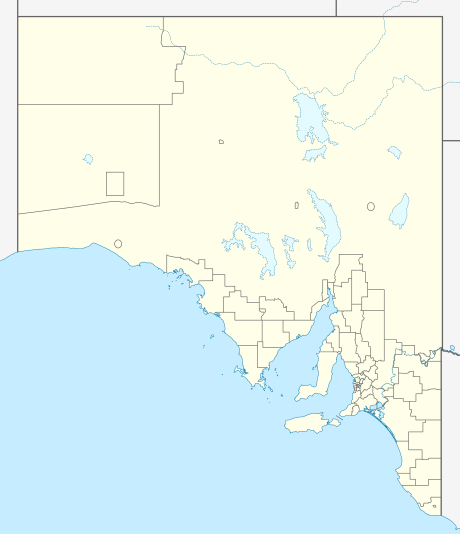
| Tanunda South Australia | |||||||||||||||
|---|---|---|---|---|---|---|---|---|---|---|---|---|---|---|---|
 Looking across the vineyards towards Tanunda from Mengler Hill Lookout | |||||||||||||||
 Tanunda | |||||||||||||||
| Coordinates | 34°31′0″S 138°58′0″E / 34.51667°S 138.96667°E | ||||||||||||||
| Population | 4,710 (2021 census) | ||||||||||||||
| Established | 1848 | ||||||||||||||
| Postcode(s) | 5352 | ||||||||||||||
| Location | 69 km (43 mi) North East of Adelaide via | ||||||||||||||
| LGA(s) | Barossa Council | ||||||||||||||
| State electorate(s) | Schubert | ||||||||||||||
| Federal division(s) | Barker | ||||||||||||||
| |||||||||||||||
| Footnotes | [1] | ||||||||||||||
Tanunda is a town situated in the Barossa Valley region of South Australia. In the 2021 census, Tanunda recorded a population of 4,710 people.[2]
Geography[edit]
Tanunda is located 66 kilometres (41 mi) north-east of the state capital, Adelaide.[3]
History[edit]
The town derives its name from an Aboriginal word meaning water hole,[citation needed] or 'wild fowl on creek.'[3]
Tanunda was established as a village by Charles Flaxman, circa 1848.[4]
In 1856, gold was reported at Tanunda Creek.[4]
Prussian immigrants who arrived with Pastor Gotthard Fritzsche founded the village of Bethanien in 1842, the first settlement in the vicinity of today's Tanunda. One year later, Prussians relocating from Klemzig on the Torrens River, where they had settled upon immigrating in 1838 with Pastor August Kavel, came to the Barossa Valley and founded the village of Langmeil. Their new community bore the name of a Prussian town near Zullichau, from where the settlers had originated; it is now a Polish village known as Okunin. Sometime later, another village was founded and named Tanunda. Due to anti-German sentiments, both Langmeil and Bethanien were renamed during the Great War to Bilyara and Bethany respectively, although Bilyara reverted to Langmeil in 1975. As development of the Tanunda area continued, the villages of Langmeil and Tanunda were joined. Today the township is simply called Tanunda.[citation needed]
Demographics[edit]
In the 1986 census, Tanunda recorded a population of 2,856 people.[3]
In the 2016 census, Tanunda recorded a population of 4,588 people, 51.3% female and 48.7% male. The median age of the Tanunda population was 47 years, 9 years above the national median of 38. 83.4% of people living in Tanunda were born in Australia. The other top responses for country of birth were England 4.5%, Germany 0.8%, New Zealand 0.8%, Scotland 0.6% and the Netherlands 0.3%. 91.6% of people spoke only English at home; the next most common languages were 0.9% German, 0.4% Mandarin, 0.2% Italian, 0.2% Latvian and 0.1% Gujarati.[5]
In the 2021 census, Tanunda recorded a population of 4,710 people, 51.4% female and 48.6% male. The median age of the Tanunda population was 48 years, 10 years above the national median of 38. 85.0% of people living in Tanunda were born in Australia. The other top responses for country of birth were England 4.4%, New Zealand 1.0%, Germany 0.9%, Scotland 0.6%, and South Africa 0.4%. 93.2% of people spoke only English at home; the next most common languages were 0.7% German, 0.4% Mandarin, 0.2% Hindi, 0.1% Nepali, and 0.1% Spanish.[2]
Industry[edit]
Tanunda and the Barossa Valley comprise one of Australia's premier wine-growing areas, and the town is surrounded by vineyards. One such vineyard, Turkey Flat, is home to Shiraz vines that were planted in 1847 and are believed to be the world's oldest continually producing commercial vineyard that has been authenticated.[6]
Railway[edit]
The line from Gawler to Angaston opened through Tanunda and Nuriootpa in 1911. It was served by regular commuter passenger trains until 16 December 1968. The passing and goods sidings at the station were removed in the 1990s but the shed and goods platform remain today. In November 1996, TransAdelaide introduced Sunday-only trial passenger train services to Nuriootpa. Later, the Barossa Wine Train was introduced from Adelaide to Tanunda. This ended in 2003. The Penrice limestone train continued to use the line until June 2014. Local radio station 5BBB has occupied the station building since the mid-1990s and the line has been booked out of use.
Culture[edit]
The German heritage of Tanunda is still present today. The town has a male choir the Tanunda Liedertafel, the history of which is thought to date back to 1850.[citation needed] There is also a Kegel (bowling) club. The Tanunda Town Band celebrated 150 years as a band in 2007 and is the oldest brass band in the Southern Hemisphere.[7][8] Tanunda served as the launching point for the Nazi party's effort to expand in Australia in the 1930s.[9]
Media[edit]
Historically, Tanunda (and Adelaide) was the home to a number of the earliest South Australian newspapers that were printed primarily in German. German newspapers were set up by early settlers, but many were forced to close or merge due to labour shortages caused by the Victorian gold rush of the 1850s-1860s.
- Deutsche Zeitung für Süd-Australien (1851)
- Süd Australische Zeitung (1860–1874) - Tanunda/Adelaide
- Australisches Unterhaltungsblatt (1862-1916) - a supplement to the Süd Australische Zeitung and Australische Zeitung
- Tanunda Deutsche Zeitung (1863-1869) - later renamed Australische Deutsche Zeitung
- Australische Deutsche Zeitung (1870-1874) - Tanunda/Adelaide: a Melbourne edition of the newspaper was also printed 1870–1872.
- Australische Zeitung (1875–1916) - Tanunda/Adelaide: formed by the merger of Süd Australische Zeitung, and Australische Deutsche Zeitung; closed due to WWI
- Australische Zeitung (1927-1929) - attempted revival
Two weekly English-language newspapers served the area:
- The Leader, has been operating in the area since 1918.
- The Barossa and Light Herald from 1951, though its antecedents date from 1860.
See also[edit]
References[edit]
- ^ "Property Location Browser (Search: Tanunda, LOCB)". Government of South Australia. Archived from the original on 7 December 2015. Retrieved 5 February 2016.
- ^ a b Australian Bureau of Statistics (28 June 2022). "Tanunda (Suburb and Locality)". 2021 Census QuickStats. Retrieved 1 June 2024.
- ^ a b c Boon, Robert (1991). The Concise Encyclopedia of Australia and New Zealand. Vol. 2 (10th ed.). Sydney: Horwitz Grahame Pty Limited. p. 787. ISBN 0 7255 2236 4.
- ^ a b Manning, Geoffrey (2012). "A Compendium of the Place Names of South Australia: Table Lands - Tyrone pdf" (PDF). The State Library of South Australia - Digital Publications. Archived (PDF) from the original on 21 March 2024. Retrieved 1 June 2024.
- ^ Australian Bureau of Statistics (27 June 2017). "Tanunda (State Suburb)". 2016 Census QuickStats. Retrieved 1 June 2024.
- ^ G. Harding "A Wine Miscellany" p. 20, Clarkson Potter Publishing, New York 2005 ISBN 0307346358
- ^ "Tanunda Town Band - About Us". Tanunda Town Band. Retrieved 26 September 2014.
- ^ "Barossa Vintage Festival 2011". Postcards SA. Channel 9 South Australia. Retrieved 26 September 2014.
- ^ "Happy birthday, Hitler: how Australia's Nazis got away with 'the whole rotten show'". the Guardian. 4 February 2022. Retrieved 5 February 2022.
| International | |
|---|---|
| National | |