Quarteira: Difference between revisions
m Bot: Migrating 12 interwiki links, now provided by Wikidata on d:q1020826 (Report Errors) |
|||
| (37 intermediate revisions by 28 users not shown) | |||
| Line 1: | Line 1: | ||
{{Infobox Portuguese subdivision |
|||
{{Geobox|Settlement |
|||
|type = parish |
|||
<!-- *** Heading *** --> |
|||
| |
|official_name = Quarteira |
||
|image_skyline = Marina de Cavacos, Quarteira (36887717511).jpg |
|||
| native_name = |
|||
| |
|image_caption = |
||
| |
|image_flag = |
||
|image_shield = LLE-quarteira1.png |
|||
| native_category = [[Freguesia (Portugal)|Freguesia]] |
|||
|image_location = |
|||
<!-- *** Names **** --> |
|||
| |
|region = [[Algarve]] |
||
| |
|CIM = [[Algarve]] |
||
| |
|district = [[Faro District|Faro]] |
||
| |
|municipality = [[Loulé]] |
||
|coordinates = {{coord|37.069|-8.103|type:adm1st_region:PT_dim:50000|display=inline,title}} |
|||
<!-- *** Image *** --> |
|||
| |
|elevation = |
||
| |
|area_total = 38.16 |
||
|population_as_of = 2011 |
|||
| image_size = 235 |
|||
|population_total = 21798 |
|||
<!-- *** Symbols *** --> |
|||
| |
|patron = |
||
| |
|area_code = 289 |
||
|postal_code = 8125 |
|||
<!-- *** Country *** --> |
|||
|website = http://www.jf-quarteira.pt/ |
|||
| country = {{flag|Portugal}} |
|||
| state_type = Region |
|||
| state = Algarve |
|||
| region_type = Subregion |
|||
| region = Algarve |
|||
| district = [[Faro (district)|Faro]] |
|||
| municipality = [[Loulé Municipality|Loulé]] |
|||
<!-- *** Family *** --> |
|||
| part_type = Localities |
|||
| part_count = 5 |
|||
| part = Fonte Santa |
|||
| part1 = Maritenda |
|||
| part2 = Quarteira |
|||
| part3 = Quatro Estradas |
|||
| part4 = Vilamoura |
|||
| landmark = |
|||
| river = Ribeira de Algibre |
|||
<!-- *** Locations *** --> |
|||
| location = Vilamoura |
|||
| elevation = 26 |
|||
| prominence = |
|||
| lat_d = 37 |
|||
| lat_m = 5 |
|||
| lat_s = 6.51 |
|||
| lat_NS = N |
|||
| long_d = 8 |
|||
| long_m = 6 |
|||
| long_s = 16.88 |
|||
| long_EW = W |
|||
| highest = |
|||
| highest_location = |
|||
| highest_region = <nowiki>Quarteira</nowiki> |
|||
| highest_state = [[Loulé Municipality|Loulé]] |
|||
| highest_elevation = |
|||
| highest_lat_d = |
|||
| highest_lat_m = |
|||
| highest_lat_s = |
|||
| highest_lat_NS = N |
|||
| highest_long_d = |
|||
| highest_long_m = |
|||
| highest_long_s = |
|||
| highest_long_EW = W |
|||
| lowest = |
|||
| lowest_location = |
|||
| lowest_region = <nowiki>Quarteira</nowiki> |
|||
| lowest_state = [[Loulé Municipality|Loulé]] |
|||
| lowest_elevation = |
|||
| lowest_lat_d = |
|||
| lowest_lat_m = |
|||
| lowest_lat_s = |
|||
| lowest_lat_NS = N |
|||
| lowest_long_d = |
|||
| lowest_long_m = |
|||
| lowest_long_s = |
|||
| lowest_long_EW = W |
|||
<!-- *** Dimensions *** --> |
|||
| length = 10.21 |
|||
| length_orientation = Northwest-Southeast |
|||
| width = 5.43 |
|||
| width_orientation = Southwest-Northeast |
|||
| area = 38.15 |
|||
| area_land = |
|||
| area_water = |
|||
| area_urban = |
|||
| area_metro = |
|||
<!-- *** Population *** --> |
|||
| population = 21798 |
|||
| population_date = 2011 |
|||
| population_type = Census |
|||
| population_urban = |
|||
| population_metro = |
|||
| population_density = 577 |
|||
| population_density_urban = |
|||
| population_density_metro = |
|||
<!-- *** History & management *** --> |
|||
| established_type = Settlement |
|||
| established = 1st Century |
|||
| established1_type = [[Parish]] |
|||
| established1 = 15 November 1297 |
|||
| established2_type = [[Civil parish]] |
|||
| established2 = c. 1916 |
|||
| established3_type = City |
|||
| established3 = 13 May 1999 |
|||
| government_type = [[LAU]] |
|||
| government = [[Freguesia (Portugal)|Freguesia]]/Junta Freguesia |
|||
| government_location = Rua Vasco da Gama |
|||
| government_region = <nowiki>Quarteira</nowiki> |
|||
| government_state = [[Loulé Municipality|Loulé]] |
|||
| government_elevation = |
|||
| government_lat_d = |
|||
| government_lat_m = |
|||
| government_lat_s = |
|||
| government_lat_NS = N |
|||
| government_long_d = |
|||
| government_long_m = |
|||
| government_long_s = |
|||
| government_long_EW = W |
|||
| mayor_type = [[Freguesia (Portugal)|President Junta]] |
|||
| mayor = José Coelho Mendes |
|||
| mayor_party = [[Socialist Party (Portugal)|PS]] |
|||
| leader_type = President Assembleia |
|||
| leader = |
|||
| leader_party = |
|||
<!-- *** Codes *** --> |
|||
| timezone = [[West European Time|WET]] |
|||
| utc_offset = 0 |
|||
| timezone_DST = [[Western European Summer Time|WEST]] |
|||
| utc_offset_DST = +1 |
|||
| iso_code = PT |
|||
| postal_code = 8125-256 Quarteira |
|||
| postal_code_type = Postal zone |
|||
| area_code = (+351) 289 XX XX XX |
|||
| area_code_type = Area code & prefix |
|||
| code = |
|||
<!-- *** UNESCO etc. *** --> |
|||
| whs_name = |
|||
| whs_year = |
|||
| whs_number = |
|||
| whs_region = |
|||
| whs_criteria = |
|||
| iucn_category = |
|||
<!-- *** Free fields *** --> |
|||
| free_type = [[Demonym]] |
|||
| free = |
|||
| free1_type = [[Patron saint]] |
|||
| free1 = |
|||
| free2_type = Parish address |
|||
| free2 = Rua Vasco da Gama, 85 R/C <br>8125-256 Quarteira |
|||
| free3_type = |
|||
| free3 = |
|||
<!-- *** Maps *** --> |
|||
| map = |
|||
| map_size = 235 |
|||
| map_caption = Location of the civil parish seat of Quarteira in the municipality of [[Loulé Municipality|Loulé]] |
|||
| map_background = |
|||
| map_locator = |
|||
| map_locator_x = 60 |
|||
| map_locator_y = 30 |
|||
<!-- *** Websites *** --> |
|||
| commons = Quarteira |
|||
| statistics = [[Instituto Nacional de Estatística]]<ref name="INE">{{citation|url=http://www.ine.pt/xportal/xmain?xpid=INE&xpgid=ine_publicacoes&PUBLICACOESpub_boui=131011251&PUBLICACOEStema=5414321&PUBLICACOESmodo=2 |title=Censos 2011 - Resultadas Preliminares|trans_title=2011 Census - Preliminary Results|publisher=Instituto Nacional de Estatística|language=Português|location=Lisbon, Portugal|language=Portuguese|accessdate=1 January 2012|year=2010|editor=INE|editor-link=Instituto Nacional de Estatística}}</ref> |
|||
| website = http://www.jf-quarteira.pt/ |
|||
<!-- *** Footnotes *** --> |
|||
| footnotes = Geographic detail from CAOP (2010)<ref>{{citation|url=http://www.igeo.pt/produtos/cadastro/caop/download/Areas_Freg_Mun_Dist_CAOP2010.zip|title=Carta Administrativa Oficial de Portugal|publisher=Instituto Geográfico Português|location=Lisbon, Portugal|language=Portuguese|accessdate=1 July 2011|year=2010|editor=IGP}}</ref> produced by Instituto Geográfico Português (IGP) |
|||
}} |
}} |
||
'''Quarteira''' ({{IPA-pt|kwɐɾˈtɐjɾɐ |
'''Quarteira''' ({{IPA-pt|kwɐɾˈtɐjɾɐ}}) is a Portuguese [[Freguesia (Portugal)|civil parish]], in the municipality (''[[concelho]]'') of [[Loulé]] in the [[Algarve]].<ref>Detail Regional Map, Algarve-Southern Portugal, {{ISBN|3-8297-6235-6}}</ref> The population in 2011 was 21,798,<ref name=ine>[http://www.ine.pt/xportal/xmain?xlang=en&xpid=INE&xpgid=ine_indicadores&indOcorrCod=0005889&contexto=pi&selTab=tab0 Instituto Nacional de Estatística]</ref> in an area of 38.16 km².<ref name=dgt>{{Cite web |url=http://www.dgterritorio.pt/cartografia_e_geodesia/cartografia/carta_administrativa_oficial_de_portugal_caop_/caop__download_/carta_administrativa_oficial_de_portugal___versao_2017__em_vigor_/ |title=Áreas das freguesias, concelhos, distritos e país |access-date=2018-11-05 |archive-url=https://web.archive.org/web/20181105172426/http://www.dgterritorio.pt/cartografia_e_geodesia/cartografia/carta_administrativa_oficial_de_portugal_caop_/caop__download_/carta_administrativa_oficial_de_portugal___versao_2017__em_vigor_/ |archive-date=2018-11-05 |url-status=dead }}</ref> |
||
==History== |
==History== |
||
[[File:Cerro da Vila Roman Ruins Saturday 20 November 2010.JPG|thumb|235px|left|The [[Roman ruins of Cerro da Vila]] located in the area of Vilamoura]] |
[[File:Cerro da Vila Roman Ruins Saturday 20 November 2010.JPG|thumb|235px|left|The [[Roman ruins of Cerro da Vila]] located in the area of Vilamoura]] |
||
The settlement of the region dates back to, at least, the Roman occupation of the Iberian |
The settlement of the region dates back to, at least, the Roman occupation of the Iberian Peninsula (at one time confused with the village of Carteia).<ref name="JFCaracter">{{cite web |title=Caracterização da Freguesia |url=http://www.jf-quarteira.pt/PT/default.asp?flag=14 |year=2011 |access-date=20 May 2012 |language=pt |location=Quarteira (Loulé), Portugal |publisher=Junta Freguesia de Quarteira |url-status=dead |archive-url=https://web.archive.org/web/20120613231421/http://www.jf-quarteira.pt/PT/default.asp?flag=14 |archive-date=13 June 2012 }}</ref> There are still other authors who suggest that settlement of the region may have begun in the era of Phoenician or Carthaginian traders.<ref name=JFCaracter/> |
||
For several centuries, Quarteira was a modest fishing village, situated on the edge of a {{convert|3|km|mi}} beach, encircled by pines.<ref name=JFCaracter/> King [[Denis of Portugal|Denis]] authorized a [[foral]] (''charter'') for the settlement on 15 November 1297.<ref name=JFCaracter/> |
For several centuries, Quarteira was a modest fishing village, situated on the edge of a {{convert|3|km|mi}} beach, encircled by pines.<ref name=JFCaracter/> King [[Denis of Portugal|Denis]] authorized a [[foral]] (''charter'') for the settlement on 15 November 1297.<ref name=JFCaracter/> |
||
| Line 175: | Line 31: | ||
In the 15th century, King [[John I of Portugal]] ordered the first cultivation of sugar cane in continental Portugal.<ref name=JFCaracter/> |
In the 15th century, King [[John I of Portugal]] ordered the first cultivation of sugar cane in continental Portugal.<ref name=JFCaracter/> |
||
Created in 1916, the civil parish quickly became known for its beaches, fishing and its forests of pine.<ref name=JFCaracter/> |
Created in 1916, the civil parish quickly became known for its beaches, fishing and its forests of pine.<ref name=JFCaracter/> |
||
Quarteira was elevated to the status of ''cidade'' (''city'') on 13 May 1999.<ref name=JFCaracter/> |
Quarteira was elevated to the status of ''cidade'' (''city'') on 13 May 1999.<ref name=JFCaracter/> |
||
==Geography== |
==Geography== |
||
Quarteira is a coastal civil parish, located along the southern extent of the Algarve fronting |
Quarteira is a coastal civil parish, located along the southern extent of the Algarve fronting [[Albufeira Municipality]] to the west (in the parish of [[Olhos de Água]]). In addition, the local area authority is bordered in the east by [[Almancil]], northeast by São Clemente, north by São Sebastião and [[Boliqueime]]. |
||
From the Atlantic coast, the frontier with its neighbours extends northwest along the ''Ribeira de Algibre'', before following the M526 municipal roadway to the Estrada Nacional EN125 in Maritenda. From here, the border travels southeast along the EN125 until just after the N396 motorway, where it then divides along a ravine southwest towards the Atlantic Ocean, alongside the Royal Golf Course. The coast includes {{convert|5.5|km|mi}} of normally-classified [[Blue Flag beach]]. |
From the Atlantic coast, the frontier with its neighbours extends northwest along the ''Ribeira de Algibre'', before following the M526 municipal roadway to the Estrada Nacional EN125 in Maritenda. From here, the border travels southeast along the EN125 until just after the N396 motorway, where it then divides along a ravine southwest towards the Atlantic Ocean, alongside the Royal Golf Course. The coast includes {{convert|5.5|km|mi}} of normally-classified [[Blue Flag beach]]. |
||
==Economy== |
==Economy== |
||
[[File:Quarteira |
[[File:Quarteira. Yellow Brick Road. (8469172596).jpg|thumb|235px|left|Promenade and hotels in Quarteira]] |
||
[[File:Quarteira-Algarve.jpg|thumb|235px|left|The hotels and tourist friendly beaches of Quarteira]] |
|||
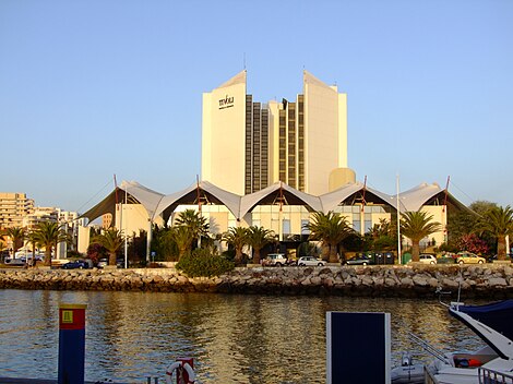
[[File:Vilamoura-Marinotel.jpg|thumb|235px|left|The Vilamoura-Marinotel]] |
[[File:Vilamoura-Marinotel.jpg|thumb|235px|left|The Vilamoura-Marinotel]] |
||
Golf |
Golf remains a symbol for this parish, municipality, and region, with five distinct golf courses contributing to the economy, particularly during the off-season.<ref name=JFCaracter/> |
||
In relation to this sport, the parish is home to [[Vilamoura]], Europe's largest private tourist facility.<ref name=JFCaracter/> In addition, the region accommodates various tourists with two hundred hotels and residences, including casinos, bars and discos.<ref name=JFCaracter/> |
|||
==Architecture== |
==Architecture== |
||
| Line 196: | Line 51: | ||
===Archaeological=== |
===Archaeological=== |
||
* [[Roman ruins of Cerro da Vila]] ({{lang |
* [[Roman ruins of Cerro da Vila]] ({{lang|pt|Ruínas Romanas do Cerro da Vila, em Vilamoura}}) |
||
===Civic=== |
===Civic=== |
||
* Apartment Complex Avenida de Sagres, 147/149 ({{lang |
* Apartment Complex Avenida de Sagres, 147/149 ({{lang|pt|Edifícios na Avenida Infante de Sagres, n.º 147 e n.º 149/Edifícios Laginha e Seguro}}) |
||
* Apartment Complex Quarteira I ({{lang |
* Apartment Complex Quarteira I ({{lang|pt|Edifício Quarteira I}}) |
||
* Apartment Complex Rua de São Tomé e Príncipe, 26/36 ({{lang |
* Apartment Complex Rua de São Tomé e Príncipe, 26/36 ({{lang|pt|Edifícios na Rua de São Tomé e Príncipe, n.º 26 a n.º 36}}) |
||
* Fiscal Guard Post of Quarteira ({{lang |
* Fiscal Guard Post of Quarteira ({{lang|pt|Posto da Guarda Fiscal de Quarteira}}) |
||
* Lighthouse of Vilamoura ({{lang |
* Lighthouse of Vilamoura ({{lang|pt|Farol de Vilamoura/Farolim de Vilamoura}}) |
||
* Loulé-Praia de Quarteira Railway Station ({{lang |
* Loulé-Praia de Quarteira Railway Station ({{lang|pt|Estação Ferroviária de Loulé-Praia de Quarteira}}) |
||
* Maritime Delegation of Quarteira ({{lang |
* Maritime Delegation of Quarteira ({{lang|pt|Delegação Maritímo da Quarteira}}) |
||
* Residence Cada do Mirante ({{lang |
* Residence Cada do Mirante ({{lang|pt|Moradia na Avenida Infante de Sagres n.º 79/Casa do Mirante}}) |
||
* Residence Gonçalves ({{lang |
* Residence Gonçalves ({{lang|pt|Moradia na Av. Infante de Sagres, n.º 165/Casa Gonçalves}}) |
||
* Residence Villa Sol e Mar ({{lang |
* Residence Villa Sol e Mar ({{lang|pt|Moradia na Avenida Infante de Sagres, n.º 83/Villa Sol e Mar}}) |
||
* Residence Casa Martins Laginha ({{lang |
* Residence Casa Martins Laginha ({{lang|pt|Prédio na Rua Bartolomeu Dias n.º 27/Casa Martins Laginha}}) |
||
* Restaurante-Residencial Toca do Coelho/Hotel D. José |
* Restaurante-Residencial Toca do Coelho/Hotel D. José |
||
===Military=== |
===Military=== |
||
* Fort of Armação ({{lang |
* Fort of Armação ({{lang|pt|Forte Novo/Forte da Armação}}) |
||
===Religious=== |
===Religious=== |
||
* Church of Nossa Senhora da Conceição ({{lang |
* Church of Nossa Senhora da Conceição ({{lang|pt|Igreja Paroquial da Quarteira/Igreja de Nossa Senhora da Conceição}}) |
||
* Church of São Pedro do Mar ({{lang |
* Church of São Pedro do Mar ({{lang|pt|Igreja de São Pedro do Mar}}) |
||
* Church of Vilamoura ({{lang |
* Church of Vilamoura ({{lang|pt|Igreja de Vilamoura}}) |
||
==Culture== |
==Culture== |
||
Among other festivities attracting tourism to the region is the ''Marchas Populares'' in June.<ref name=JFCaracter/> |
Among other festivities attracting tourism to the region is the ''[[Marchas Populares]]'' in June.<ref name=JFCaracter/> |
||
==Town Twinning== |
|||
{{Main|List of twin towns and sister cities in Portugal}} |
|||
===Twin Town — Sister City=== |
|||
The following place is [[sister cities|Sister City]] to Quarteira : |
|||
*{{flagicon|POR}} [[Vilamoura]], Portugal |
|||
== References == |
== References == |
||
{{Reflist}} |
|||
;Notes |
|||
{{Reflist|2}} |
|||
==External links== |
|||
{{Commons category|Quarteira}} |
|||
{{Wikivoyage}} |
|||
{{Parishes of Loulé}} |
{{Parishes of Loulé}} |
||
{{Authority control}} |
|||
[[Category:Parishes of Loulé]] |
|||
{{DEFAULTSORT:Quarteira}} |
|||
[[Category:Freguesias of Loulé]] |
|||
[[Category:Seaside resorts in Portugal]] |
[[Category:Seaside resorts in Portugal]] |
||
[[Category:Towns of the Algarve]] |
[[Category:Towns of the Algarve]] |
||
{{DEFAULTSORT:Quarteira}} |
|||
[[zh:夸爾泰拉]] |
|||
Latest revision as of 22:17, 28 May 2024
Quarteira | |
|---|---|
 | |
 Coat of arms | |
 Quarteira Location in Portugal | |
| Coordinates: 37°04′08″N 8°06′11″W / 37.069°N 8.103°W | |
| Country | |
| Region | Algarve |
| Intermunic. comm. | Algarve |
| District | Faro |
| Municipality | Loulé |
| Area | |
| • Total | 38.16 km2 (14.73 sq mi) |
| Population (2011) | |
| • Total | 21,798 |
| • Density | 570/km2 (1,500/sq mi) |
| Time zone | UTC±00:00 (WET) |
| • Summer (DST) | UTC+01:00 (WEST) |
| Postal code | 8125 |
| Area code | 289 |
| Website | http://www.jf-quarteira.pt/ |
Quarteira (Portuguese pronunciation: [kwɐɾˈtɐjɾɐ]) is a Portuguese civil parish, in the municipality (concelho) of Loulé in the Algarve.[1] The population in 2011 was 21,798,[2] in an area of 38.16 km².[3]
History[edit]

The settlement of the region dates back to, at least, the Roman occupation of the Iberian Peninsula (at one time confused with the village of Carteia).[4] There are still other authors who suggest that settlement of the region may have begun in the era of Phoenician or Carthaginian traders.[4]
For several centuries, Quarteira was a modest fishing village, situated on the edge of a 3 kilometres (1.9 mi) beach, encircled by pines.[4] King Denis authorized a foral (charter) for the settlement on 15 November 1297.[4]
In the 15th century, King John I of Portugal ordered the first cultivation of sugar cane in continental Portugal.[4]
Created in 1916, the civil parish quickly became known for its beaches, fishing and its forests of pine.[4]
Quarteira was elevated to the status of cidade (city) on 13 May 1999.[4]
Geography[edit]
Quarteira is a coastal civil parish, located along the southern extent of the Algarve fronting Albufeira Municipality to the west (in the parish of Olhos de Água). In addition, the local area authority is bordered in the east by Almancil, northeast by São Clemente, north by São Sebastião and Boliqueime.
From the Atlantic coast, the frontier with its neighbours extends northwest along the Ribeira de Algibre, before following the M526 municipal roadway to the Estrada Nacional EN125 in Maritenda. From here, the border travels southeast along the EN125 until just after the N396 motorway, where it then divides along a ravine southwest towards the Atlantic Ocean, alongside the Royal Golf Course. The coast includes 5.5 kilometres (3.4 mi) of normally-classified Blue Flag beach.
Economy[edit]

Golf remains a symbol for this parish, municipality, and region, with five distinct golf courses contributing to the economy, particularly during the off-season.[4]
In relation to this sport, the parish is home to Vilamoura, Europe's largest private tourist facility.[4] In addition, the region accommodates various tourists with two hundred hotels and residences, including casinos, bars and discos.[4]
Architecture[edit]

Archaeological[edit]
- Roman ruins of Cerro da Vila (Ruínas Romanas do Cerro da Vila, em Vilamoura)
Civic[edit]
- Apartment Complex Avenida de Sagres, 147/149 (Edifícios na Avenida Infante de Sagres, n.º 147 e n.º 149/Edifícios Laginha e Seguro)
- Apartment Complex Quarteira I (Edifício Quarteira I)
- Apartment Complex Rua de São Tomé e Príncipe, 26/36 (Edifícios na Rua de São Tomé e Príncipe, n.º 26 a n.º 36)
- Fiscal Guard Post of Quarteira (Posto da Guarda Fiscal de Quarteira)
- Lighthouse of Vilamoura (Farol de Vilamoura/Farolim de Vilamoura)
- Loulé-Praia de Quarteira Railway Station (Estação Ferroviária de Loulé-Praia de Quarteira)
- Maritime Delegation of Quarteira (Delegação Maritímo da Quarteira)
- Residence Cada do Mirante (Moradia na Avenida Infante de Sagres n.º 79/Casa do Mirante)
- Residence Gonçalves (Moradia na Av. Infante de Sagres, n.º 165/Casa Gonçalves)
- Residence Villa Sol e Mar (Moradia na Avenida Infante de Sagres, n.º 83/Villa Sol e Mar)
- Residence Casa Martins Laginha (Prédio na Rua Bartolomeu Dias n.º 27/Casa Martins Laginha)
- Restaurante-Residencial Toca do Coelho/Hotel D. José
Military[edit]
- Fort of Armação (Forte Novo/Forte da Armação)
Religious[edit]
- Church of Nossa Senhora da Conceição (Igreja Paroquial da Quarteira/Igreja de Nossa Senhora da Conceição)
- Church of São Pedro do Mar (Igreja de São Pedro do Mar)
- Church of Vilamoura (Igreja de Vilamoura)
Culture[edit]
Among other festivities attracting tourism to the region is the Marchas Populares in June.[4]
Town Twinning[edit]
Twin Town — Sister City[edit]
The following place is Sister City to Quarteira :
Vilamoura, Portugal
References[edit]
- ^ Detail Regional Map, Algarve-Southern Portugal, ISBN 3-8297-6235-6
- ^ Instituto Nacional de Estatística
- ^ "Áreas das freguesias, concelhos, distritos e país". Archived from the original on 2018-11-05. Retrieved 2018-11-05.
- ^ a b c d e f g h i j k "Caracterização da Freguesia" (in Portuguese). Quarteira (Loulé), Portugal: Junta Freguesia de Quarteira. 2011. Archived from the original on 13 June 2012. Retrieved 20 May 2012.
External links[edit]
Parishes of Loulé Municipality | ||
|---|---|---|
| International | |
|---|---|
| National | |