Lanhydrock: Difference between revisions
New owners Tags: Manual revert Reverted Visual edit Mobile edit Mobile web edit |
DuncanHill (talk | contribs) m Reverted edit by 2A00:23C5:6E89:E101:185F:75C1:F2CF:244E (talk) to last version by DuncanHill |
||
| (12 intermediate revisions by 10 users not shown) | |||
| Line 1: | Line 1: | ||
{{Short description|Civil parish in Cornwall, England}} |
|||
{{for|house and estate|Lanhydrock House}} |
{{for|house and estate|Lanhydrock House}} |
||
{{Use dmy dates|date=July 2021}} |
{{Use dmy dates|date=July 2021}} |
||
{{EngvarB|date=July 2021}} |
{{EngvarB|date=July 2021}} |
||
{{Infobox UK place |
{{Infobox UK place |
||
|country |
| country = England |
||
|map_type |
| map_type = Cornwall |
||
|static_image_name |
| static_image_name = Lanhydrock House.jpg |
||
|static_image_caption |
| static_image_caption = Lanhydrock church |
||
|coordinates = {{coord|50.441|-4.698|display=inline,title}} |
| coordinates = {{coord|50.441|-4.698|display=inline,title}} |
||
|official_name |
| official_name = Lanhydrock |
||
|cornish_name |
| cornish_name = Lannhedrek |
||
|population |
| population = 186 |
||
|population_ref |
| population_ref = ([[United Kingdom Census 2011|Civil Parish, 2011]]) |
||
|civil_parish |
| civil_parish = Lanhydrock |
||
|unitary_england |
| unitary_england = [[Cornwall Council|Cornwall]] |
||
|lieutenancy_england |
| lieutenancy_england = [[Cornwall]] |
||
|region |
| region = South West England |
||
|constituency_westminster= [[North Cornwall (UK Parliament constituency)|North Cornwall]] |
| constituency_westminster = [[North Cornwall (UK Parliament constituency)|North Cornwall]] |
||
|post_town |
| post_town = Bodmin |
||
|postcode_district |
| postcode_district = PL30 |
||
|postcode_area |
| postcode_area = PL |
||
|dial_code |
| dial_code = 01208 |
||
}} |
}} |
||
'''Lanhydrock''' ({{lang-kw|Lannhedrek}},<ref>[http://www.magakernow.org.uk/default.aspx?page=520 Place-names in the Standard Written Form (SWF)] {{Webarchive|url=https://web.archive.org/web/20130515091028/http://www.magakernow.org.uk/default.aspx?page=520 |date=15 May 2013 }} : [http://www.magakernow.org.uk/idoc.ashx?docid=79ba408d-7c02-499e-8cd6-b18dd48de58d&version=-1 List of place-names agreed by the MAGA Signage Panel] {{webarchive|url=https://web.archive.org/web/20130515071635/http://www.magakernow.org.uk/idoc.ashx?docid=79ba408d-7c02-499e-8cd6-b18dd48de58d&version=-1 |date=15 May 2013 }}. [[Cornish Language Partnership]].</ref> meaning "church enclosure of St Hydrock") is a [[civil parishes in Britain|civil parish]] centred on a country estate and mansion in [[Cornwall]], United Kingdom. The parish lies south of the town of [[Bodmin]]<ref>Ordnance Survey: Landranger map sheet 200 ''Newquay & Bodmin'' {{ISBN|978-0-319-22938-5}}</ref> and is bounded to the north by Bodmin parish, to the south by [[Lanlivery]] parish and to the west by [[Lanivet]] parish. The population was 171 in the 2001 census.<ref name=GENUKI>[http://www.genuki.org.uk/big/eng/Cornwall/Lanhydrock/ GENUKI website]; Lanhydrock; retrieved May 2010</ref> This increased to 186 in the 2011 census.<ref>{{cite web|url=http://www.genuki.org.uk/big/eng/Cornwall/Lanhydrock/index.html#Population|title=2011 census|access-date= 6 February 2015}}</ref> The Parish Council meets every two months in Lanhydrock Memorial Hall.<ref>[http://cwic.cornwall.gov.uk/cwic-sql/pc_det.asp?1317 Cornwall Council website] {{webarchive|url=https://archive.today/20090103160354/http://cwic.cornwall.gov.uk/cwic-sql/pc_det.asp?1317 |date=3 January 2009 }}; retrieved May 2010</ref> |
'''Lanhydrock''' ({{lang-kw|Lannhedrek}},<ref>[http://www.magakernow.org.uk/default.aspx?page=520 Place-names in the Standard Written Form (SWF)] {{Webarchive|url=https://web.archive.org/web/20130515091028/http://www.magakernow.org.uk/default.aspx?page=520 |date=15 May 2013 }} : [http://www.magakernow.org.uk/idoc.ashx?docid=79ba408d-7c02-499e-8cd6-b18dd48de58d&version=-1 List of place-names agreed by the MAGA Signage Panel] {{webarchive|url=https://web.archive.org/web/20130515071635/http://www.magakernow.org.uk/idoc.ashx?docid=79ba408d-7c02-499e-8cd6-b18dd48de58d&version=-1 |date=15 May 2013 }}. [[Cornish Language Partnership]].</ref> meaning "church enclosure of St Hydrock") is a [[civil parishes in Britain|civil parish]] centred on a country estate and mansion in [[Cornwall]], England, United Kingdom. The parish lies south of the town of [[Bodmin]]<ref>Ordnance Survey: Landranger map sheet 200 ''Newquay & Bodmin'' {{ISBN|978-0-319-22938-5}}</ref> and is bounded to the north by Bodmin parish, to the south by [[Lanlivery]] parish and to the west by [[Lanivet]] parish. The population was 171 in the 2001 census.<ref name=GENUKI>[http://www.genuki.org.uk/big/eng/Cornwall/Lanhydrock/ GENUKI website]; Lanhydrock; retrieved May 2010</ref> This increased to 186 in the 2011 census.<ref>{{cite web|url=http://www.genuki.org.uk/big/eng/Cornwall/Lanhydrock/index.html#Population|title=2011 census|access-date= 6 February 2015}}</ref> The Parish Council meets every two months in Lanhydrock Memorial Hall.<ref>[http://cwic.cornwall.gov.uk/cwic-sql/pc_det.asp?1317 Cornwall Council website] {{webarchive|url=https://archive.today/20090103160354/http://cwic.cornwall.gov.uk/cwic-sql/pc_det.asp?1317 |date=3 January 2009 }}; retrieved May 2010</ref> |
||
The parish is dominated by [[Lanhydrock House]] and its estate of 360 |
The parish is dominated by [[Lanhydrock House]] and its estate of {{convert|360|ha|acre|abbr=off}}. Much of the present house dates back to [[Victorian era|Victorian times]] but some sections date from the 1620s. It is a [[Grade I listed building]]<ref>{{NHLE |num=1157870 |access-date=22 April 2007}}</ref> and is set in gardens with formal areas. Since 1953 it has been owned and managed by the [[National Trust for Places of Historic Interest or Natural Beauty|National Trust]].<ref>[http://www.nationaltrust.org.uk/main/w-vh/w-visits/w-findaplace/w-lanhydrock.htm National Trust website: Lanhydrock] {{webarchive|url=https://web.archive.org/web/20100430133718/http://www.nationaltrust.org.uk/main/w-vh/w-visits/w-findaplace/w-lanhydrock.htm |date=30 April 2010 }}; retrieved May 2010</ref> |
||
Lanhydrock [[ecclesiastical parish]] is in the Deanery and [[Hundred (county division)|Hundred]] of [[Pydar]] and in the Bodmin Registration District. The parish is in the [[Diocese of Truro]] and is now part of the Bodmin Team Ministry.<ref>[http://www.achurchnearyou.com/lanhydrock-st-hydrock/ Church of England] "A Church Near You" website; St Hydroc, Bodmin; retrieved May 2010</ref> |
Lanhydrock [[ecclesiastical parish]] is in the Deanery and [[Hundred (county division)|Hundred]] of [[Pydar]] and in the Bodmin Registration District. The parish is in the [[Diocese of Truro]] and is now part of the Bodmin Team Ministry.<ref>[http://www.achurchnearyou.com/lanhydrock-st-hydrock/ Church of England] "A Church Near You" website; St Hydroc, Bodmin; retrieved May 2010</ref> |
||
The [[St Hydroc's Church, Lanhydrock|parish church]] is dedicated to St Hydroc and stands in the grounds of Lanhydrock House. Parts date back to the late 15th century and the church has a chancel, nave, north and south aisles and three-stage battlemented tower with nine bells. Eight bells date from the late 19th century and are regularly rung. The ninth bell dates from circa 1599 and is only rung infrequently for [[Funeral toll|tolling]].<ref>{{Cite web|url=http://dove.cccbr.org.uk/detail.php?DoveID=LANHYDROCK|title=Dove Details|website=dove.cccbr.org.uk|access-date=11 July 2016}}</ref> |
The [[St Hydroc's Church, Lanhydrock|parish church]] is dedicated to St Hydroc and stands in the grounds of Lanhydrock House. Parts date back to the late 15th century and the church has a chancel, nave, north and south aisles and three-stage battlemented tower with nine bells. Eight bells date from the late 19th century and are regularly rung. The ninth bell dates from circa 1599 and is only rung infrequently for [[Funeral toll|tolling]].<ref>{{Cite web|url=http://dove.cccbr.org.uk/detail.php?DoveID=LANHYDROCK|title=Dove Details|website=dove.cccbr.org.uk|access-date=11 July 2016}}</ref> |
||
Lanhydrock is now owned by Llewellyn Care & Andrea Tempest |
|||
==References== |
==References== |
||
Latest revision as of 18:06, 29 August 2023
Lanhydrock
| |
|---|---|
 Lanhydrock church | |
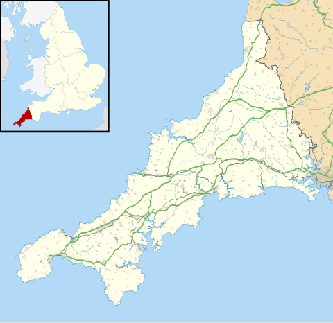 Lanhydrock Location within Cornwall | |
| Population | 186 (Civil Parish, 2011) |
| Civil parish |
|
| Unitary authority | |
| Ceremonial county | |
| Region | |
| Country | England |
| Sovereign state | United Kingdom |
| Post town | Bodmin |
| Postcode district | PL30 |
| Dialling code | 01208 |
| Police | Devon and Cornwall |
| Fire | Cornwall |
| Ambulance | South Western |
| UK Parliament | |
Lanhydrock (Cornish: Lannhedrek,[1] meaning "church enclosure of St Hydrock") is a civil parish centred on a country estate and mansion in Cornwall, England, United Kingdom. The parish lies south of the town of Bodmin[2] and is bounded to the north by Bodmin parish, to the south by Lanlivery parish and to the west by Lanivet parish. The population was 171 in the 2001 census.[3] This increased to 186 in the 2011 census.[4] The Parish Council meets every two months in Lanhydrock Memorial Hall.[5]
The parish is dominated by Lanhydrock House and its estate of 360 hectares (890 acres). Much of the present house dates back to Victorian times but some sections date from the 1620s. It is a Grade I listed building[6] and is set in gardens with formal areas. Since 1953 it has been owned and managed by the National Trust.[7]
Lanhydrock ecclesiastical parish is in the Deanery and Hundred of Pydar and in the Bodmin Registration District. The parish is in the Diocese of Truro and is now part of the Bodmin Team Ministry.[8]
The parish church is dedicated to St Hydroc and stands in the grounds of Lanhydrock House. Parts date back to the late 15th century and the church has a chancel, nave, north and south aisles and three-stage battlemented tower with nine bells. Eight bells date from the late 19th century and are regularly rung. The ninth bell dates from circa 1599 and is only rung infrequently for tolling.[9]
References[edit]
- ^ Place-names in the Standard Written Form (SWF) Archived 15 May 2013 at the Wayback Machine : List of place-names agreed by the MAGA Signage Panel Archived 15 May 2013 at the Wayback Machine. Cornish Language Partnership.
- ^ Ordnance Survey: Landranger map sheet 200 Newquay & Bodmin ISBN 978-0-319-22938-5
- ^ GENUKI website; Lanhydrock; retrieved May 2010
- ^ "2011 census". Retrieved 6 February 2015.
- ^ Cornwall Council website Archived 3 January 2009 at archive.today; retrieved May 2010
- ^ Historic England. "Details from listed building database (1157870)". National Heritage List for England. Retrieved 22 April 2007.
- ^ National Trust website: Lanhydrock Archived 30 April 2010 at the Wayback Machine; retrieved May 2010
- ^ Church of England "A Church Near You" website; St Hydroc, Bodmin; retrieved May 2010
- ^ "Dove Details". dove.cccbr.org.uk. Retrieved 11 July 2016.
| Unitary authorities | |
|---|---|
| Major settlements (cities in italics) |
|
| Rivers | |
| Topics | |
| International | |
|---|---|
| Geographic | |