Fair Haven Township, Stearns County, Minnesota: Difference between revisions
m Add references section and/or general fixes. |
m →Demographics: substituting density conversions with a density template |
||
| (44 intermediate revisions by 32 users not shown) | |||
| Line 1: | Line 1: | ||
{{Use mdy dates|date=July 2023}} |
|||
{{Infobox |
{{Infobox settlement |
||
|official_name = Fair Haven Township, Minnesota |
|official_name = Fair Haven Township, Minnesota |
||
|settlement_type = [[Township (United States)|Township]] |
|settlement_type = [[Township (United States)|Township]] |
||
|nickname = |
|nickname = |
||
|motto = |
|motto = |
||
<!-- Images --> |
<!-- Images --> |
||
| Line 10: | Line 11: | ||
|image_caption = |
|image_caption = |
||
|image_flag = |
|image_flag = |
||
|image_seal = |
|image_seal = |
||
<!-- Maps --> |
<!-- Maps --> |
||
|pushpin_map =Minnesota#USA |
|||
|pushpin_label_position =left <!-- the position of the pushpin label: left, right, top, bottom, none --> |
|pushpin_label_position =left <!-- the position of the pushpin label: left, right, top, bottom, none --> |
||
|pushpin_map_caption =Location within the state of Minnesota |
|pushpin_map_caption =Location within the state of Minnesota |
||
|pushpin_mapsize = |
|pushpin_mapsize = |
||
|image_map = |mapsize = |
|image_map = |
||
|mapsize = |
|||
|map_caption = |
|map_caption = |
||
|image_map1 = |
|image_map1 = |
||
|mapsize1 = |
|mapsize1 = |
||
|map_caption1 = |
|map_caption1 = |
||
<!-- Location --> |
<!-- Location --> |
||
|subdivision_type = [[List of |
|subdivision_type = [[List of sovereign states|Country]] |
||
|subdivision_name = |
|subdivision_name = United States |
||
|subdivision_type1 = [[ |
|subdivision_type1 = [[U.S. state|State]] |
||
|subdivision_name1 = [[Minnesota]] |
|subdivision_name1 = [[Minnesota]] |
||
|subdivision_type2 = [[List of counties in Minnesota|County]] |
|subdivision_type2 = [[List of counties in Minnesota|County]] |
||
| Line 39: | Line 41: | ||
|leader_name1 = |
|leader_name1 = |
||
|established_title = |
|established_title = |
||
|established_date = |
|established_date = |
||
<!-- Area --> |
<!-- Area --> |
||
|unit_pref = Imperial |
|unit_pref = Imperial |
||
|area_footnotes = |
|area_footnotes = |
||
|area_magnitude = |
|area_magnitude = |
||
|area_total_km2 = 92.8 |
|area_total_km2 = 92.8 |
||
|area_land_km2 = 88.1 |
|area_land_km2 = 88.1 |
||
|area_water_km2 = 4.7 |
|area_water_km2 = 4.7 |
||
|area_total_sq_mi = |
|area_total_sq_mi = |
||
|area_land_sq_mi = |
|area_land_sq_mi = |
||
|area_water_sq_mi = |
|area_water_sq_mi = |
||
<!-- Population --> |
<!-- Population --> |
||
|population_as_of = [[United States Census |
|population_as_of = [[2010 United States Census|2010]] |
||
|population_footnotes = |
|population_footnotes = |
||
|population_total = |
|population_total = 1507 |
||
|population_density_km2 = |
|population_density_km2 = auto |
||
|population_density_sq_mi = |
|population_density_sq_mi = |
||
<!-- General information --> |
<!-- General information --> |
||
| Line 68: | Line 69: | ||
|elevation_m = 327 |
|elevation_m = 327 |
||
|elevation_ft = 1073 |
|elevation_ft = 1073 |
||
|coordinates = {{coord|45|21|N|94|12|W|region:US-MN|display=inline,title}} |
|||
|latd = 45 |latm = 20 |lats = 51 |latNS = N |
|||
|longd = 94 |longm = 11 |longs = 43 |longEW = W |
|||
<!-- Area/postal codes & others --> |
|||
|postal_code_type = |
|postal_code_type = |
||
|postal_code = |
|postal_code = |
||
|area_code = |
|area_code = |
||
|blank_name = [[Federal Information Processing Standard|FIPS code]] |
|blank_name = [[Federal Information Processing Standard|FIPS code]] |
||
|blank_info = 27-20294{{ |
|blank_info = 27-20294<ref name="GR2">{{cite web |url=https://www.census.gov |publisher=[[United States Census Bureau]] |access-date=2008-01-31 |title=U.S. Census website }}</ref> |
||
|blank1_name = [[Geographic Names Information System|GNIS]] feature ID |
|blank1_name = [[Geographic Names Information System|GNIS]] feature ID |
||
|blank1_info = 0664132<ref name="GR3">{{cite web|url=http://geonames.usgs.gov|access-date=2008-01-31|title=US Board on Geographic Names|publisher=[[United States Geological Survey]]|date=2007-10-25}}</ref> |
|||
|blank1_info = 0664132{{GR|3}} |
|||
|website = |
|website = |
||
|footnotes = |
|footnotes = |
||
}} |
}} |
||
'''Fair Haven Township''' is a township in [[Stearns County, Minnesota|Stearns County]], [[Minnesota]], [[United States]]. The population was 1,458 at the 2000 census. |
|||
'''Fair Haven Township''' is a township in [[Stearns County, Minnesota|Stearns County]], [[Minnesota]], United States. The population was 1,507 at the 2010 census.<ref name="Census 2010">{{Cite web |url=https://www.census.gov |title=Profile of General Population and Housing Characteristics: 2010 Demographic Profile Data (DP-1): Fair Haven township, Stearns County, Minnesota |publisher=[[United States Census Bureau]] |access-date=May 1, 2012 }}</ref> The unincorporated community of [[Fairhaven, Minnesota|Fairhaven]] is located within Fair Haven Township. |
|||
Fair Haven Township was organized in 1859, and was descriptively named by first settlers.<ref>{{cite book|last=Upham|first=Warren|title=Minnesota Geographic Names: Their Origin and Historic Significance|url=https://archive.org/details/minnesotageogra00uphagoog|year=1920|publisher=Minnesota Historical Society|page=[https://archive.org/details/minnesotageogra00uphagoog/page/n541 524]}}</ref> |
|||
==Geography== |
==Geography== |
||
According to the [[United States Census Bureau]], the township has a total area of 35.8 |
According to the [[United States Census Bureau]], the township has a total area of {{convert|35.8|sqmi|km2}}; {{convert|34.0|sqmi|km2}} is land and {{convert|1.8|sqmi|km2}}, or 5.08%, is water. |
||
Fairhaven Township is located in Townships 121 and 122 North of the Arkansas Base Line and Range 28 West of the 5th Principal Meridian. |
|||
==Demographics== |
==Demographics== |
||
As of the [[census]] |
As of the [[census]]<ref name="GR2" /> of 2000, there were 1,458 people, 510 households, and 401 families residing in the township. The population density was {{convert|42.9|PD/sqmi|PD/km2|sp=us|adj=off}}. There were 596 housing units at an average density of {{convert|17.5|/sqmi|/km2|sp=us|adj=off}}. The racial makeup of the township was 98.77% [[White (U.S. Census)|White]], 0.41% [[African American (U.S. Census)|African American]], 0.62% [[Native American (U.S. Census)|Native American]], 0.07% [[Asian (U.S. Census)|Asian]], and 0.14% from two or more races. [[Hispanic (U.S. Census)|Hispanic]] or [[Latino (U.S. Census)|Latino]] of any race were 0.55% of the population. |
||
There were 510 households out of which 40.4% had children under the age of 18 living with them, 69.2% were [[Marriage|married couples]] living together, 5.5% had a female householder with no husband present, and 21.2% were non-families. 18.0% of all households were made up of individuals and 7.1% had someone living alone who was 65 years of age or older. The average household size was 2.86 and the average family size was 3.24. |
There were 510 households, out of which 40.4% had children under the age of 18 living with them, 69.2% were [[Marriage|married couples]] living together, 5.5% had a female householder with no husband present, and 21.2% were non-families. 18.0% of all households were made up of individuals, and 7.1% had someone living alone who was 65 years of age or older. The average household size was 2.86 and the average family size was 3.24. |
||
In the township the population was spread out with 30.0% under the age of 18, 7.3% from 18 to 24, 29.8% from 25 to 44, 23.5% from 45 to 64, and 9.3% who were 65 years of age or older. The median age was 36 years. For every 100 females there were 107.7 males. For every 100 females age 18 and over, there were 113.6 males. |
In the township the population was spread out, with 30.0% under the age of 18, 7.3% from 18 to 24, 29.8% from 25 to 44, 23.5% from 45 to 64, and 9.3% who were 65 years of age or older. The median age was 36 years. For every 100 females, there were 107.7 males. For every 100 females age 18 and over, there were 113.6 males. |
||
The median income for a household in the township was $44,808, and the median income for a family was $52,000. Males had a median income of $36,667 versus $22,500 for females. The [[per capita income]] for the township was $17,951. About 4.7% of families and 6.1% of the population were below the [[poverty line]], including 7.4% of those under age 18 and 6.7% of those age 65 or over. |
The median income for a household in the township was $44,808, and the median income for a family was $52,000. Males had a median income of $36,667 versus $22,500 for females. The [[per capita income]] for the township was $17,951. About 4.7% of families and 6.1% of the population were below the [[poverty line]], including 7.4% of those under age 18 and 6.7% of those age 65 or over. |
||
==References== |
==References== |
||
{{Reflist}} |
|||
<references /> |
|||
{{Minnesota}} |
{{Stearns County, Minnesota}} |
||
{{authority control}} |
|||
[[Category:Stearns County, Minnesota]] |
[[Category:Townships in Stearns County, Minnesota]] |
||
[[Category:St. Cloud, Minnesota metropolitan area]] |
|||
[[Category:Townships in Minnesota]] |
[[Category:Townships in Minnesota]] |
||
Latest revision as of 01:23, 10 September 2023
Fair Haven Township, Minnesota | |
|---|---|
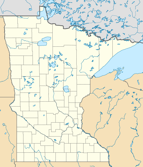 Fair Haven Township, Minnesota Location within the state of Minnesota  Fair Haven Township, Minnesota Fair Haven Township, Minnesota (the United States) | |
| Coordinates: 45°21′N 94°12′W / 45.350°N 94.200°W | |
| Country | United States |
| State | Minnesota |
| County | Stearns |
| Area | |
| • Total | 35.8 sq mi (92.8 km2) |
| • Land | 34.0 sq mi (88.1 km2) |
| • Water | 1.8 sq mi (4.7 km2) |
| Elevation | 1,073 ft (327 m) |
| Population (2010) | |
| • Total | 1,507 |
| • Density | 42/sq mi (16/km2) |
| Time zone | UTC-6 (Central (CST)) |
| • Summer (DST) | UTC-5 (CDT) |
| FIPS code | 27-20294[1] |
| GNIS feature ID | 0664132[2] |
Fair Haven Township is a township in Stearns County, Minnesota, United States. The population was 1,507 at the 2010 census.[3] The unincorporated community of Fairhaven is located within Fair Haven Township.
Fair Haven Township was organized in 1859, and was descriptively named by first settlers.[4]
Geography[edit]
According to the United States Census Bureau, the township has a total area of 35.8 square miles (93 km2); 34.0 square miles (88 km2) is land and 1.8 square miles (4.7 km2), or 5.08%, is water.
Fairhaven Township is located in Townships 121 and 122 North of the Arkansas Base Line and Range 28 West of the 5th Principal Meridian.
Demographics[edit]
As of the census[1] of 2000, there were 1,458 people, 510 households, and 401 families residing in the township. The population density was 42.9 inhabitants per square mile (16.6/km2). There were 596 housing units at an average density of 17.5 per square mile (6.8/km2). The racial makeup of the township was 98.77% White, 0.41% African American, 0.62% Native American, 0.07% Asian, and 0.14% from two or more races. Hispanic or Latino of any race were 0.55% of the population.
There were 510 households, out of which 40.4% had children under the age of 18 living with them, 69.2% were married couples living together, 5.5% had a female householder with no husband present, and 21.2% were non-families. 18.0% of all households were made up of individuals, and 7.1% had someone living alone who was 65 years of age or older. The average household size was 2.86 and the average family size was 3.24.
In the township the population was spread out, with 30.0% under the age of 18, 7.3% from 18 to 24, 29.8% from 25 to 44, 23.5% from 45 to 64, and 9.3% who were 65 years of age or older. The median age was 36 years. For every 100 females, there were 107.7 males. For every 100 females age 18 and over, there were 113.6 males.
The median income for a household in the township was $44,808, and the median income for a family was $52,000. Males had a median income of $36,667 versus $22,500 for females. The per capita income for the township was $17,951. About 4.7% of families and 6.1% of the population were below the poverty line, including 7.4% of those under age 18 and 6.7% of those age 65 or over.
References[edit]
- ^ a b "U.S. Census website". United States Census Bureau. Retrieved January 31, 2008.
- ^ "US Board on Geographic Names". United States Geological Survey. October 25, 2007. Retrieved January 31, 2008.
- ^ "Profile of General Population and Housing Characteristics: 2010 Demographic Profile Data (DP-1): Fair Haven township, Stearns County, Minnesota". United States Census Bureau. Retrieved May 1, 2012.
- ^ Upham, Warren (1920). Minnesota Geographic Names: Their Origin and Historic Significance. Minnesota Historical Society. p. 524.
Municipalities and communities of Stearns County, Minnesota, United States | ||
|---|---|---|
| Cities |
|  |
| Townships |
| |
| CDPs | ||
| Unincorporated communities | ||
| Footnotes | ‡This populated place also has portions in an adjacent county or counties | |