Droop Mountain, West Virginia: Difference between revisions
Content deleted Content added
m Bot) Add coordinates_region parameter (report errors? |
add "use mdy dates" template |
||
| (13 intermediate revisions by 12 users not shown) | |||
| Line 1: | Line 1: | ||
{{Use mdy dates|date=July 2023}} |
|||
{{Infobox settlement |
{{Infobox settlement |
||
|official_name = Droop Mountain, West Virginia |
|official_name = Droop Mountain, West Virginia |
||
|settlement_type = Unincorporated community |
|settlement_type = [[Unincorporated area|Unincorporated community]] |
||
|nickname = |
|nickname = |
||
|motto = |
|motto = |
||
<!-- Images --> |
<!-- Images --> |
||
| Line 10: | Line 11: | ||
|image_caption = |
|image_caption = |
||
|image_flag = |
|image_flag = |
||
|image_seal = |
|image_seal = |
||
<!-- Maps --> |
<!-- Maps --> |
||
| Line 19: | Line 20: | ||
|mapsize1 = |
|mapsize1 = |
||
|map_caption1 = |
|map_caption1 = |
||
|pushpin_map = West Virginia |
|pushpin_map = West Virginia#USA |
||
|pushpin_label = Droop Mountain |
|||
|pushpin_label_position = left |
|||
<!-- Location --> |
<!-- Location --> |
||
| ⚫ | |||
|coordinates_region = US-WV |
|||
|subdivision_name = United States |
|||
| ⚫ | |||
| |
|subdivision_type1 = [[U.S. state|State]] |
||
|subdivision_type1 = [[Political divisions of the United States|State]] |
|||
|subdivision_name1 = [[West Virginia]] |
|subdivision_name1 = [[West Virginia]] |
||
|subdivision_type2 = [[List of counties in West Virginia|County]] |
|subdivision_type2 = [[List of counties in West Virginia|County]] |
||
| Line 38: | Line 40: | ||
|leader_name1 = |
|leader_name1 = |
||
|established_title = |
|established_title = |
||
|established_date = |
|established_date = |
||
<!-- Area --> |
<!-- Area --> |
||
| Line 49: | Line 51: | ||
|area_total_sq_mi = |
|area_total_sq_mi = |
||
|area_land_sq_mi = |
|area_land_sq_mi = |
||
|area_water_sq_mi = |
|area_water_sq_mi = |
||
<!-- Population --> |
<!-- Population --> |
||
| Line 56: | Line 58: | ||
|population_total = |
|population_total = |
||
|population_density_km2 = |
|population_density_km2 = |
||
|population_density_sq_mi = |
|population_density_sq_mi = |
||
<!-- General information --> |
<!-- General information --> |
||
| Line 66: | Line 68: | ||
|elevation_m = |
|elevation_m = |
||
|elevation_ft = 1942 |
|elevation_ft = 1942 |
||
|coordinates = {{coord|38|01|30|N|80|15|23|W|region:US-WV|display=inline,title}} |
|||
|latd = 38 | |
|||
latm = 01 | |
|||
lats = 30 | |
|||
latNS = N | |
|||
longd = 80 | |
|||
longm = 15 | |
|||
longs = 23 | |
|||
longEW = W | |
|||
coordinates_display=% |
|||
<!-- Area/postal codes & others --> |
<!-- Area/postal codes & others --> |
||
| Line 81: | Line 75: | ||
|area_code = [[Area codes 304 and 681|304 & 681]] |
|area_code = [[Area codes 304 and 681|304 & 681]] |
||
|blank_name = [[Geographic Names Information System|GNIS]] feature ID |
|blank_name = [[Geographic Names Information System|GNIS]] feature ID |
||
|blank_info = 1554328<ref name="GR3">{{cite web|url=http://geonames.usgs.gov|access-date=2008-01-31|title=US Board on Geographic Names|publisher=[[United States Geological Survey]]|date=2007-10-25}}</ref> |
|||
|blank_info = 1554328{{GR|3}} |
|||
|blank1_name = |
|blank1_name = |
||
|blank1_info = |
|blank1_info = |
||
| Line 88: | Line 82: | ||
}} |
}} |
||
'''Droop Mountain''' is an [[unincorporated community]] in [[Greenbrier County, West Virginia|Greenbrier County]], [[West Virginia]], |
'''Droop Mountain''' is an [[Unincorporated area|unincorporated community]] in [[Greenbrier County, West Virginia|Greenbrier County]], [[West Virginia]], United States. Droop Mountain is located on the [[Greenbrier River]], {{convert|6|mi|km}} east-northeast of [[Falling Spring, West Virginia|Falling Spring]]. |
||
==References== |
==References== |
||
{{reflist}} |
{{reflist}} |
||
{{Greenbrier County, West Virginia}} |
{{Greenbrier County, West Virginia}} |
||
{{authority control}} |
|||
| ⚫ | |||
| ⚫ | |||
[[Category:Unincorporated communities in West Virginia]] |
[[Category:Unincorporated communities in West Virginia]] |
||
{{ |
{{GreenbrierCountyWV-geo-stub}} |
||
Latest revision as of 04:51, 24 July 2023
Droop Mountain, West Virginia | |
|---|---|
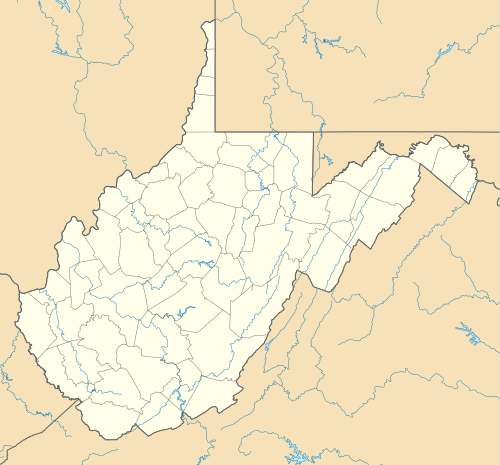 Droop Mountain  Droop Mountain | |
| Coordinates: 38°01′30″N 80°15′23″W / 38.02500°N 80.25639°W | |
| Country | United States |
| State | West Virginia |
| County | Greenbrier |
| Elevation | 1,942 ft (592 m) |
| Time zone | UTC-5 (Eastern (EST)) |
| • Summer (DST) | UTC-4 (EDT) |
| Area code(s) | 304 & 681 |
| GNIS feature ID | 1554328[1] |
Droop Mountain is an unincorporated community in Greenbrier County, West Virginia, United States. Droop Mountain is located on the Greenbrier River, 6 miles (9.7 km) east-northeast of Falling Spring.
References[edit]
- ^ "US Board on Geographic Names". United States Geological Survey. October 25, 2007. Retrieved January 31, 2008.

This article about a location in Greenbrier County, West Virginia is a stub. You can help Wikipedia by expanding it. |