Copala, Guerrero: Difference between revisions
Content deleted Content added
←Replaced content with '{ america agilas {Infobox settlement <!--See the Table at Infobox Settlement for all fields and descriptions of usage--> copala is the best ariba.' Tag: Replaced |
No edit summary |
||
| (4 intermediate revisions by 3 users not shown) | |||
| Line 1: | Line 1: | ||
{{Short description|City in the Mexican state of Guerrero}} |
|||
{ america agilas {Infobox settlement |
|||
{{Infobox settlement |
|||
<!--See the Table at Infobox Settlement for all fields and descriptions of usage--> copala is the best ariba. |
|||
<!--See the Table at Infobox Settlement for all fields and descriptions of usage--> |
|||
<!-- Basic info ----------------> |
|||
|name = Copala |
|||
|settlement_type =Municipal seat and city |
|||
|other_name = |
|||
|native_name = <!-- for cities whose native name is not in English --> |
|||
|nickname = |
|||
|motto = |
|||
<!-- images and maps -----------> |
|||
|image_skyline = |
|||
|imagesize = 300px |
|||
|image_caption = |
|||
|image_flag = |
|||
|flag_size = |
|||
|image_seal = |
|||
|seal_size = |
|||
|image_shield = |
|||
|shield_size = |
|||
|image_blank_emblem = |
|||
|blank_emblem_type = |
|||
|blank_emblem_size = |
|||
|image_map = |
|||
|mapsize = |
|||
|map_caption = |
|||
|image_map1 = |
|||
|mapsize1 = |
|||
|map_caption1 = |
|||
|image_dot_map = |
|||
|dot_mapsize = |
|||
|dot_map_caption = |
|||
|dot_x = |dot_y = |
|||
|pushpin_map = Mexico <!-- the name of a location map as per http://en.wikipedia.org/wiki/Template:Location_map --> |
|||
|pushpin_label_position =above |
|||
|pushpin_mapsize =300 |
|||
|pushpin_map_caption =Location in Mexico |
|||
<!-- Location ------------------> |
|||
|subdivision_type = Country |
|||
|subdivision_name = {{flag|Mexico}} |
|||
|subdivision_type1 = [[Administrative divisions of Mexico|State]] |
|||
|subdivision_name1 = [[Guerrero]] |
|||
|subdivision_type2 = Municipality |
|||
|subdivision_name2 = [[Copala (municipality)|Copala]] |
|||
|subdivision_type3 = |
|||
|subdivision_name3 = |
|||
|subdivision_type4 = |
|||
|subdivision_name4 = |
|||
<!-- Politics -----------------> |
|||
|government_footnotes = |
|||
|government_type = |
|||
|leader_title = |
|||
|leader_name = |
|||
|leader_title1 = <!-- for places with, say, both a mayor and a city manager --> |
|||
|leader_name1 = |
|||
|leader_title2 = |
|||
|leader_name2 =marts |
|||
|leader_title3 = |
|||
|leader_name3 = |
|||
|leader_title4 = |
|||
|leader_name4 = |
|||
|established_title = |
|||
|established_date = |
|||
|established_title2 = <!-- Incorporated (town) --> |
|||
|established_date2 = |
|||
|established_title3 = <!-- Incorporated (city) --> |
|||
|established_date3 = |
|||
<!-- Area ---------------------> |
|||
|area_magnitude = |
|||
|unit_pref = |
|||
|area_footnotes = |
|||
|area_total_km2 = |
|||
|area_land_km2 = <!--See table @ Template:Infobox Settlement for details on automatic unit conversion--> |
|||
|area_water_km2 = |
|||
|area_total_sq_mi = |
|||
|area_land_sq_mi = |
|||
|area_water_sq_mi = |
|||
|area_water_percent = |
|||
|area_urban_km2 = |
|||
|area_urban_sq_mi = |
|||
|area_metro_km2 = |
|||
|area_metro_sq_mi = |
|||
|area_blank1_title = |
|||
|area_blank1_km2 = |
|||
|area_blank1_sq_mi = |
|||
<!-- Population -----------------------> |
|||
|population_as_of =2005 |
|||
|population_footnotes = |
|||
|population_note = |
|||
|population_total = |
|||
|population_density_km2 = |
|||
|population_density_sq_mi = |
|||
|population_metro = |
|||
|population_density_metro_km2 = |
|||
|population_density_metro_sq_mi = |
|||
|population_urban = |
|||
|population_density_urban_km2 = |
|||
|population_density_urban_sq_mi = |
|||
|population_blank1_title =Ethnicities |
|||
|population_blank1 = |
|||
|population_blank2_title =Religions |
|||
|population_blank2 = |
|||
|population_density_blank1_km2 = |
|||
|population_density_blank1_sq_mi = |
|||
<!-- General information ---------------> |
|||
|timezone = |
|||
|utc_offset = |
|||
|timezone_DST = |
|||
|utc_offset_DST = |
|||
|coordinates = {{coord|16|39|N|98|59|W|region:MX-GRO|display=inline,title}} |
|||
|elevation_footnotes = <!--for references: use <ref> </ref> tags--> |
|||
|elevation_m = |
|||
|elevation_ft = |
|||
<!-- Area/postal codes & others --------> |
|||
|postal_code_type = <!-- enter ZIP code, Postcode, Post code, Postal code... --> |
|||
|postal_code = |
|||
|area_code = |
|||
|blank_name = |
|||
|blank_info = |
|||
|blank1_name = |
|||
|blank1_info = |
|||
|website = |
|||
|footnotes = |
|||
}} |
|||
''' Copala''' is a city and the seat of the [[Copala (municipality)|municipality of Copala]], in the state of [[Guerrero]], south-western [[Mexico]].<ref>[[Instituto Nacional de Estadística y Geografía]]. Principales resultados por localidad 2005 (ITER). Retrieved on December 23, 2008</ref> |
|||
In June 2024, Salvador Villalba Flores, the mayor-elect of the town from the [[México Avanza]] party, was assassinated in the town while traveling on a bus to [[Mexico City]]. Local media also reported Villalba had decided to run for mayor after his friend, a candidate, was murdered in June 2023.<ref>{{Cite web |last=Staff |first=A. O. L. |date=2024-06-17 |title=Mayor-elect pulled off bus and shot dead near Acapulco |url=https://www.aol.com/mayor-elect-pulled-off-bus-174600022.html |access-date=2024-06-17 |website=www.aol.com |language=en-US}}</ref> |
|||
==References== |
|||
{{Reflist}} |
|||
{{Guerrero-geo-stub}} |
|||
{{Guerrero}} |
|||
[[Category:Populated places in Guerrero]] |
|||
Latest revision as of 20:01, 17 June 2024
Copala | |
|---|---|
Municipal seat and city | |
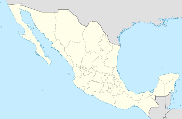 Copala Location in Mexico | |
| Coordinates: 16°39′N 98°59′W / 16.650°N 98.983°W | |
| Country | |
| State | Guerrero |
| Municipality | Copala |
| Government | |
Copala is a city and the seat of the municipality of Copala, in the state of Guerrero, south-western Mexico.[1]
In June 2024, Salvador Villalba Flores, the mayor-elect of the town from the México Avanza party, was assassinated in the town while traveling on a bus to Mexico City. Local media also reported Villalba had decided to run for mayor after his friend, a candidate, was murdered in June 2023.[2]
References[edit]
- ^ Instituto Nacional de Estadística y Geografía. Principales resultados por localidad 2005 (ITER). Retrieved on December 23, 2008
- ^ Staff, A. O. L. (2024-06-17). "Mayor-elect pulled off bus and shot dead near Acapulco". www.aol.com. Retrieved 2024-06-17.
This article about a location in the Mexican state of Guerrero is a stub. You can help Wikipedia by expanding it. |