Broek op Langedijk: Difference between revisions
Replace reference and map link with template, replaced: <ref>Ad van der Meer and Onno Boonstra, "Repertorium van Nederlandse gemeenten", KNAW, 2006. [http://www.knaw.nl/cfdata/publicaties/detail.cfm?boeken__ordernr=20061061 using AWB |
No edit summary |
||
| (38 intermediate revisions by 29 users not shown) | |||
| Line 1: | Line 1: | ||
{{Infobox settlement |
|||
| ⚫ | |||
| name = Broek op Langedijk |
|||
| settlement_type = Village |
|||
| other_name = <!-- if different from name --> |
|||
| native_name = <!-- if different from name --> |
|||
| native_name_lang = nl |
|||
| image_skyline = Afmijnlokaal en rondvaartboot.jpg |
|||
| image_alt = |
|||
| image_caption = Museum Broekerveiling |
|||
| image_flag = |
|||
| image_shield = |
|||
| nickname = |
|||
| motto = |
|||
| image_map = |
|||
| image_map1 = |
|||
| map_caption1 = |
|||
| pushpin_map = Netherlands#Netherlands North Holland |
|||
| pushpin_label_position = top |
|||
| pushpin_mapsize = 250 |
|||
| pushpin_map_caption = Location in the Netherlands##Location in the province of North Holland in the Netherlands |
|||
| subdivision_type = [[List of sovereign states|Country]] |
|||
| subdivision_name = [[Netherlands]] |
|||
| subdivision_type1 = [[Provinces of the Netherlands|Province]] |
|||
| subdivision_name1 = [[North Holland]] |
|||
| subdivision_type2 = [[List of municipalities of the Netherlands|Municipality]] |
|||
| subdivision_name2 = [[Dijk en Waard]] |
|||
| elevation_footnotes = <ref name="AHN">{{cite web |url = http://www.ahn.nl/postcodetool |title = Postcodetool for 1721AA |language = nl |work = Actueel Hoogtebestand Nederland |publisher = Het Waterschapshuis |access-date = 29 April 2022 }}</ref> |
|||
| elevation_m = -0.3 |
|||
| elevation_min_m = |
|||
| elevation_max_m = |
|||
| area_footnotes = <ref name="stat"/> |
|||
| area_total_km2 = 4.65 |
|||
| established_title = |
|||
| established_date = |
|||
| population_footnotes = <ref name="stat">{{cite web |url=https://www.cbs.nl/-/media/_excel/2021/48/kwb-2021.xls |title=Kerncijfers wijken en buurten 2021 |website=Central Bureau of Statistics |access-date=29 April 2022}}</ref> |
|||
| population_total = 6,150 |
|||
| population_as_of = 2021 |
|||
| population_demonym = |
|||
| population_note = |
|||
| population_density_km2 = auto |
|||
| timezone = [[Central European Time|CET]] |
|||
| utc_offset = +1 |
|||
| timezone_DST = [[Central European Summer Time|CEST]] |
|||
| utc_offset_DST = +2 |
|||
| postal_code_type = [[List of postal codes in the Netherlands|Postal code]] |
|||
| postal_code = 1721<ref name="stat"/> |
|||
| area_code_type = [[Telephone numbers in the Netherlands|Dialing code]] |
|||
| area_code = 0226 |
|||
| ⚫ | |||
}} |
|||
| ⚫ | |||
"Broek op Langendijk" was a separate municipality until 1941, when the municipality of Langedijk was formed.<ref>{{Repertorium Nederlandse Gemeenten}}</ref> |
|||
== |
==History== |
||
The village was first mentioned in the 12th century as 1420 Broec, and means "swampy land on the long dike".<ref>{{cite web|url=https://etymologiebank.nl/trefwoord/broekoplangedijk |title=Broek op Langedijk - (geografische naam) |website=Etymologiebank |access-date=29 April 2022 |language=nl}}</ref> Broek op Langedijk developed along the dike as a linear settlement. The swamp was cultivated and the so-called empire of a thousand islands was formed. The islands were used to grow [[cabbage]] and in 1887, an auction house was established in Broek op Langedijk.<ref name="monument">{{cite news|url=https://www.dbnl.org/tekst/sten009monu11_01/sten009monu11_01_0041.php |title=Broek op Langedijk |author=Ronald Stenvert & Saskia van Ginkel-Meester |publisher=Waanders |location=Zwolle |year=2006 |language=nl |access-date=29 April 2022}}</ref> |
|||
<references/> |
|||
The Dutch Reformed church is a single aisled church with wooden tower from the 15th century. Around 1860, the front and tower were renovated.<ref name="monument"/> |
|||
==External links== |
|||
*{{Kuyper|Broek op Langedijk|nh|broekoplangedijk}} Map of the former municipality, around 1868. |
|||
The auction house is a large wooden complex surrounded by water. It was built in 1912 and was influenced by [[Jugendstil]].<ref name="monument"/> In 1968, the auction merged with the [[Noord-Scharwoude]] auction and moved. In 1974, a museum was established in the former auction which allows visitors to bid on fruit and vegetables in household portions.<ref name="plaats"/> |
|||
| ⚫ | |||
Broek op Langendijk was home to 700 people in 1840.<ref name="plaats"/> It was a separate municipality until 1941, when the municipality of Langedijk was formed.<ref>{{Repertorium Nederlandse Gemeenten}}</ref> In 2022, it became part of the municipality of [[Dijk en Waard]].<ref name="plaats">{{cite web|url=https://www.plaatsengids.nl/broek-op-langedijk |title=Broek op Langedijk |website=Plaatsengids |access-date=29 April 2022 |language=nl}}</ref> |
|||
| ⚫ | |||
| ⚫ | |||
| ⚫ | |||
== Gallery == |
|||
<gallery> |
|||
File:Broek op Langedijk, Netherlands - panoramio (5).jpg|Flower field in Broek op Langedijk |
|||
File:Het Bakkershuys, Broek op Langedijk.jpg|Bakery |
|||
File:Voormalige koolschuren Dorpsstraat 160-166, Broek op Langedijk.jpg|Cabbage warehouse |
|||
File:Voetbrug achter Dorpsstraat 170, Broek op Langedijk 2.jpg|Wooden bridge |
|||
</gallery> |
|||
==In popular culture== |
|||
{{NorthHolland-geo-stub}} |
|||
The village featured in the movie ''[[Spider-Man: Far From Home]]''. Peter Parker ends up there by accident, breaks out of a municipal holding facility and asks a local man where he is. Parker gets him to speak the village's name directly into his phone, allowing Happy Hogan to fly there to pick him up. |
|||
==References== |
|||
[[nl:Broek op Langedijk]] |
|||
{{Reflist}} |
|||
{{Dutch municipality Dijk en Waard}} |
|||
{{Authority control}} |
|||
| ⚫ | |||
| ⚫ | |||
| ⚫ | |||
[[Category:Geography of Dijk en Waard]] |
|||
Latest revision as of 13:33, 7 January 2023
Broek op Langedijk | |
|---|---|
Village | |
 Museum Broekerveiling | |
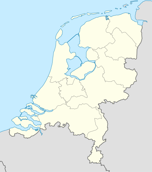 Broek op Langedijk Location in the Netherlands 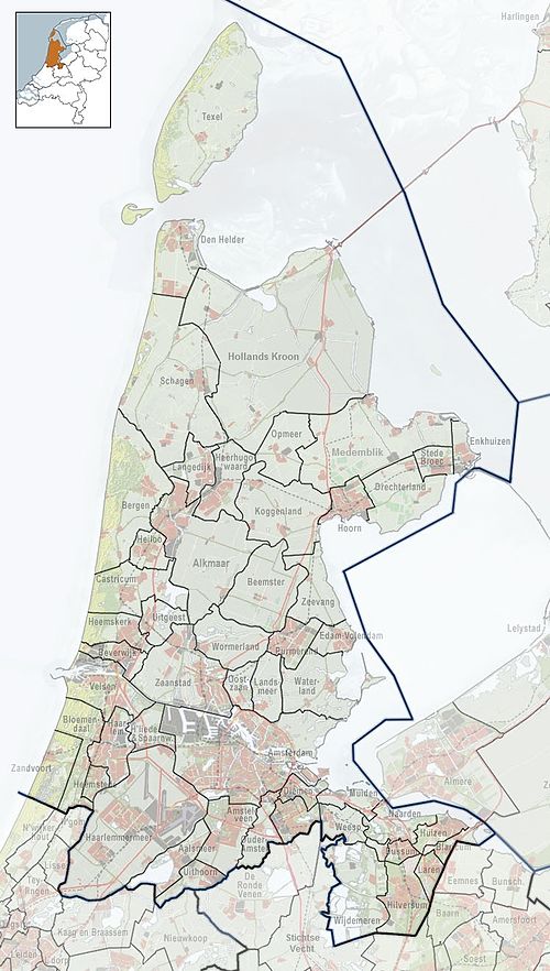 Broek op Langedijk Location in the province of North Holland in the Netherlands | |
| Coordinates: 52°40′21″N 4°48′20″E / 52.67250°N 4.80556°E | |
| Country | Netherlands |
| Province | North Holland |
| Municipality | Dijk en Waard |
| Area | |
| • Total | 4.65 km2 (1.80 sq mi) |
| Elevation | −0.3 m (−1.0 ft) |
| Population (2021)[1] | |
| • Total | 6,150 |
| • Density | 1,300/km2 (3,400/sq mi) |
| Time zone | UTC+1 (CET) |
| • Summer (DST) | UTC+2 (CEST) |
| Postal code | 1721[1] |
| Dialing code | 0226 |
Broek op Langedijk (West Frisian Dutch: Broek op Lengedìk) is a village in the municipality of Dijk en Waard in the province of North Holland, the Netherlands.
History[edit]
The village was first mentioned in the 12th century as 1420 Broec, and means "swampy land on the long dike".[3] Broek op Langedijk developed along the dike as a linear settlement. The swamp was cultivated and the so-called empire of a thousand islands was formed. The islands were used to grow cabbage and in 1887, an auction house was established in Broek op Langedijk.[4]
The Dutch Reformed church is a single aisled church with wooden tower from the 15th century. Around 1860, the front and tower were renovated.[4]
The auction house is a large wooden complex surrounded by water. It was built in 1912 and was influenced by Jugendstil.[4] In 1968, the auction merged with the Noord-Scharwoude auction and moved. In 1974, a museum was established in the former auction which allows visitors to bid on fruit and vegetables in household portions.[5]
Broek op Langendijk was home to 700 people in 1840.[5] It was a separate municipality until 1941, when the municipality of Langedijk was formed.[6] In 2022, it became part of the municipality of Dijk en Waard.[5]
Gallery[edit]
-
Flower field in Broek op Langedijk
-
Bakery
-
Cabbage warehouse
-
Wooden bridge


In popular culture[edit]
The village featured in the movie Spider-Man: Far From Home. Peter Parker ends up there by accident, breaks out of a municipal holding facility and asks a local man where he is. Parker gets him to speak the village's name directly into his phone, allowing Happy Hogan to fly there to pick him up.
References[edit]
- ^ a b c "Kerncijfers wijken en buurten 2021". Central Bureau of Statistics. Retrieved 29 April 2022.
- ^ "Postcodetool for 1721AA". Actueel Hoogtebestand Nederland (in Dutch). Het Waterschapshuis. Retrieved 29 April 2022.
- ^ "Broek op Langedijk - (geografische naam)". Etymologiebank (in Dutch). Retrieved 29 April 2022.
- ^ a b c Ronald Stenvert & Saskia van Ginkel-Meester (2006). "Broek op Langedijk" (in Dutch). Zwolle: Waanders. Retrieved 29 April 2022.
- ^ a b c "Broek op Langedijk". Plaatsengids (in Dutch). Retrieved 29 April 2022.
- ^ Ad van der Meer and Onno Boonstra, Repertorium van Nederlandse gemeenten, KNAW, 2011.
| International | |
|---|---|
| Geographic | |