Brantley County, Georgia: Difference between revisions
GreenC bot (talk | contribs) Rescued 1 archive link. Wayback Medic 2.5 |
No edit summary |
||
| (27 intermediate revisions by 20 users not shown) | |||
| Line 1: | Line 1: | ||
{{Short description|County in Georgia, United States}} |
{{Short description|County in Georgia, United States}} |
||
{{Use mdy dates|date= |
{{Use mdy dates|date=April 2024}} |
||
{{Infobox U.S. county |
{{Infobox U.S. county |
||
| county = Brantley County |
| county = Brantley County |
||
| state = Georgia |
| state = Georgia |
||
| seal = BrantleyCountyGAseal.png |
|||
| seal = |
|||
| seal size = 90px |
|||
|type=County |
|||
| logo = BrantleyCountyLogo.png |
|||
| founded = {{start date and age|1920}} |
|||
| logo size = 130px |
|||
| seat wl= Nahunta |
|||
| type = County |
|||
| largest city wl= Nahunta |
|||
| founded = {{start date and age|1920}} |
|||
| area_total_sq_mi = 447 |
|||
| seat wl = Nahunta |
|||
| area_land_sq_mi = 442 |
|||
| largest city wl = Nahunta |
|||
| area_water_sq_mi = 4.8 |
|||
| area_total_sq_mi = 447 |
|||
| area percentage = 1.1% |
|||
| area_land_sq_mi = 442 |
|||
| census estimate yr = 2020 |
|||
| area_water_sq_mi = 4.8 |
|||
| pop = 18021 |
|||
| area percentage = 1.1% |
|||
| density_sq_mi = 42 |
|||
| census yr = 2020 |
|||
| time zone = Eastern |
|||
| pop = 18021 |
|||
| district=1st |
|||
| density_sq_mi = 42 |
|||
| website = https://brantleycountyga.com/ |
|||
| time zone = Eastern |
|||
| ex image=Brantley County Courthouse, Nahunta, GA, USA.jpg |
|||
| district = 1st |
|||
| ex image cap=[[Brantley County Courthouse]] in Nahunta |
|||
| website = {{URL|https://brantleycounty-ga.gov|brantleycounty-ga.gov}} |
|||
| named for = [[William Gordon Brantley]]<ref>{{cite book | url=http://www.kenkrakow.com/gpn/b.pdf | title=Georgia Place-Names: Their History and Origins | publisher=Winship Press | author=Krakow, Kenneth K. | year=1975 | location=Macon, GA | pages=24 | isbn=0-915430-00-2}}</ref> |
|||
| ex image = Brantley County Courthouse, Nahunta, GA, USA.jpg |
|||
| ex image cap = [[Brantley County Courthouse]] in Nahunta |
|||
| named for = Benjamin Daniel Brantley<ref>https://brantleycounty-ga.gov/brantley-counties-history/</ref><ref>https://sites.rootsweb.com/~gabrantl/namesake.html</ref><ref>https://www.georgiaencyclopedia.org/articles/counties-cities-neighborhoods/brantley-county/</ref> or [[William Gordon Brantley]]<ref>{{cite book | url=http://www.kenkrakow.com/gpn/b.pdf | title=Georgia Place-Names: Their History and Origins | publisher=Winship Press | author=Krakow, Kenneth K. | year=1975 | location=Macon, GA | pages=24 | isbn=0-915430-00-2}}</ref> |
|||
}} |
}} |
||
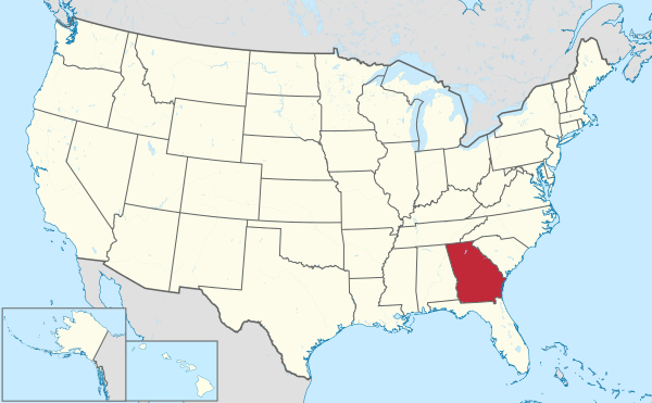
'''Brantley County''' is a [[County (United States)|county]] located in the [[Southeast Georgia|southeastern]] part of the [[U.S. state]] of [[Georgia (U.S. state)|Georgia]]. As of the [[2020 United States census|2020 census]], the population was 18,021.<ref name="QF">{{cite web|title=State & County QuickFacts|url=http://quickfacts.census.gov/qfd/states/13/13025.html|publisher=United States Census Bureau|access-date=June 18, 2014|archive-url=https://web.archive.org/web/20110607122012/http://quickfacts.census.gov/qfd/states/13/13025.html|archive-date=June 7, 2011|url-status=dead}}</ref> The [[county seat]] is [[Nahunta, Georgia|Nahunta]].<ref name="GR6">{{cite web|url=http://www.naco.org/Counties/Pages/FindACounty.aspx |access-date=2011 |
'''Brantley County''' is a [[County (United States)|county]] located in the [[Southeast Georgia|southeastern]] part of the [[U.S. state]] of [[Georgia (U.S. state)|Georgia]]. As of the [[2020 United States census|2020 census]], the population was 18,021.<ref name="QF">{{cite web|title=State & County QuickFacts|url=http://quickfacts.census.gov/qfd/states/13/13025.html|publisher=United States Census Bureau|access-date=June 18, 2014|archive-url=https://web.archive.org/web/20110607122012/http://quickfacts.census.gov/qfd/states/13/13025.html|archive-date=June 7, 2011|url-status=dead}}</ref> The [[county seat]] is [[Nahunta, Georgia|Nahunta]].<ref name="GR6">{{cite web|url=http://www.naco.org/Counties/Pages/FindACounty.aspx |access-date=June 7, 2011 |title=Find a County |publisher=National Association of Counties |url-status=dead |archive-url=https://web.archive.org/web/20110531210815/http://www.naco.org/Counties/Pages/FindACounty.aspx |archive-date=May 31, 2011 }}</ref> Brantley County is part of the [[Brunswick, Georgia]] [[Brunswick, Georgia metropolitan area|metropolitan statistical area]]. |
||
Brantley County is part of the [[Brunswick, Georgia]] [[Brunswick, Georgia metropolitan area|Metropolitan Statistical Area]]. |
|||
== History == |
== History == |
||
Georgia voters passed a state constitutional amendment on November 2, 1920, to form Brantley County from pieces of [[Charlton County, Georgia|Charlton]], [[Pierce County, Georgia|Pierce]], and [[Wayne County, Georgia|Wayne]] counties.<ref>{{cite book | url=http://www.kenkrakow.com/gpn/b.pdf | title=Georgia Place-Names: Their History and Origins | publisher=Winship Press | author=Krakow, Kenneth K. | year=1975 | location=Macon, GA | pages=24 | isbn=0-915430-00-2}}</ref> Although the precise origin of the county name is unknown, it is believed that it honors U.S. congressman [[William Gordon Brantley]].<ref>{{Cite web|url=https:// |
Georgia voters passed a state constitutional amendment on November 2, 1920, to form Brantley County from pieces of [[Charlton County, Georgia|Charlton]], [[Pierce County, Georgia|Pierce]], and [[Wayne County, Georgia|Wayne]] counties.<ref>{{cite book | url=http://www.kenkrakow.com/gpn/b.pdf | title=Georgia Place-Names: Their History and Origins | publisher=Winship Press | author=Krakow, Kenneth K. | year=1975 | location=Macon, GA | pages=24 | isbn=0-915430-00-2}}</ref> Although the precise origin of the county name is unknown, it is believed that it honors U.S. congressman [[William Gordon Brantley]] or his father, Benjamin Daniel Brantley, a local merchant and Confederate soldier in the [[American Civil War]].<ref>https://upload.wikimedia.org/wikipedia/commons/f/f4/Brantley_County%2C_a_sketch_of_the_life_of_the_late_Benjamin_Daniel_Brantley_for_whom_the_proposed_county_is_named_%28IA_brantleycountysk00jack%29.pdf</ref><ref>https://brantleycounty-ga.gov/brantley-counties-history/</ref><ref>{{Cite web |title=BRANTLEY COUNTY, GEORGIA - HISTORY |url=https://sites.rootsweb.com/~gabrantl/namesake.html |access-date=April 9, 2024 |website=sites.rootsweb.com}}</ref><ref>{{Cite web |title=Brantley County |url=https://www.georgiaencyclopedia.org/articles/counties-cities-neighborhoods/brantley-county/ |access-date=April 9, 2024 |website=New Georgia Encyclopedia |language=en-US}}</ref><ref>{{cite book | url=http://www.kenkrakow.com/gpn/b.pdf | title=Georgia Place-Names: Their History and Origins | publisher=Winship Press | author=Krakow, Kenneth K. | year=1975 | location=Macon, GA | pages=24 | isbn=0-915430-00-2}}</ref> |
||
== Geography == |
== Geography == |
||
According to the [[U.S. Census Bureau]], the county has a total area of {{convert|447|sqmi}}, of which {{convert|442|sqmi}} is land and {{convert|4.8|sqmi}} (1.1%) is water.<ref name="GR1">{{cite web|url=https://www.census.gov/geographies/reference-files/time-series/geo/gazetteer-files.html|publisher=[[United States Census Bureau]]|access-date= |
According to the [[U.S. Census Bureau]], the county has a total area of {{convert|447|sqmi}}, of which {{convert|442|sqmi}} is land and {{convert|4.8|sqmi}} (1.1%) is water.<ref name="GR1">{{cite web|url=https://www.census.gov/geographies/reference-files/time-series/geo/gazetteer-files.html|publisher=[[United States Census Bureau]]|access-date=April 23, 2011|date=February 12, 2011|title=US Gazetteer files: 2010, 2000, and 1990}}</ref> The [[Satilla River]] runs through Brantley County. |
||
The bulk of Brantley County, from east of [[Hortense, Georgia|Hortense]] south to west of [[Waynesville, Georgia|Waynesville]] and west to east of [[Waycross, Georgia|Waycross]], is located in the [[Satilla River]] sub-basin of the [[St. Marys River (Florida–Georgia)|St. Marys]]-Satilla basin. The county's eastern border area, east of Waynesville, is located in the [[Cumberland Island|Cumberland]]-[[St. Simons, Georgia|St. Simons]] sub-basin of the St. Marys-Satilla River basin. A small northwestern corner, west of Hortense, is located in the Little Satilla sub-basin of the larger St. Marys-Satilla River basin, and a very small southwestern corner of Brantley County is located in the Upper [[Suwannee River]] sub-basin of the larger Suwannee River basin.<ref>{{cite web |url=http://www.gaswcc.org/maps/ |title=Georgia Soil and Water Conservation Commission Interactive Mapping Experience |publisher=Georgia Soil and Water Conservation Commission |access-date=2015- |
The bulk of Brantley County, from east of [[Hortense, Georgia|Hortense]] south to west of [[Waynesville, Georgia|Waynesville]] and west to east of [[Waycross, Georgia|Waycross]], is located in the [[Satilla River]] sub-basin of the [[St. Marys River (Florida–Georgia)|St. Marys]]-Satilla basin. The county's eastern border area, east of Waynesville, is located in the [[Cumberland Island|Cumberland]]-[[St. Simons, Georgia|St. Simons]] sub-basin of the St. Marys-Satilla River basin. A small northwestern corner, west of Hortense, is located in the Little Satilla sub-basin of the larger St. Marys-Satilla River basin, and a very small southwestern corner of Brantley County is located in the Upper [[Suwannee River]] sub-basin of the larger Suwannee River basin.<ref>{{cite web |url=http://www.gaswcc.org/maps/ |title=Georgia Soil and Water Conservation Commission Interactive Mapping Experience |publisher=Georgia Soil and Water Conservation Commission |access-date=November 27, 2015 |archive-date=October 3, 2018 |archive-url=https://web.archive.org/web/20181003004639/http://www.gaswcc.org/maps/ |url-status=dead }}</ref> |
||
=== Major highways === |
=== Major highways === |
||
| Line 51: | Line 53: | ||
* [[Glynn County, Georgia|Glynn County]] - east |
* [[Glynn County, Georgia|Glynn County]] - east |
||
* [[Camden County, Georgia|Camden County]] - southeast |
* [[Camden County, Georgia|Camden County]] - southeast |
||
* [[Charlton County, Georgia|Charlton County]] - |
* [[Charlton County, Georgia|Charlton County]] - south |
||
* [[Ware County, Georgia|Ware County]] - west |
* [[Ware County, Georgia|Ware County]] - west |
||
* [[Pierce County, Georgia|Pierce County]] - northwest |
* [[Pierce County, Georgia|Pierce County]] - northwest |
||
=== Communities === |
|||
==== Cities ==== |
|||
* [[Hoboken, Georgia|Hoboken]] |
|||
* [[Nahunta, Georgia|Nahunta]] |
|||
==== Census-designated places ==== |
|||
* [[Hickox, Georgia|Hickox]] |
|||
* [[Hortense, Georgia|Hortense]] |
|||
* [[Waynesville, Georgia|Waynesville]] |
|||
==== Unincorporated communities ==== |
|||
* [[Fort Mudge, Georgia|Fort Mudge]] |
|||
* [[Schlatterville, Georgia|Schlatterville]] |
|||
== Demographics == |
== Demographics == |
||
| Line 67: | Line 84: | ||
|2010= 18411 |
|2010= 18411 |
||
|align-fn=center |
|align-fn=center |
||
|footnote=U.S. Decennial Census<ref name="DecennialCensus">{{cite web|url=https://www.census.gov/programs-surveys/decennial-census/decade.html|title=Decennial Census of Population and Housing by Decades|publisher=[[US Census Bureau]]|access-date=}}</ref><br>1790-1880<ref name=1880CensusGACty>{{Cite web|first= |last= |authorlink= |title= 1880 Census Population by Counties 1790-1800 |website=[[US Census Bureau]]|date= 1880|url=https://www2.census.gov/library/publications/decennial/1880/vol-01-population/1880_v1-08.pdf|accessdate=|archive-url=| archive-date=|page=}}</ref> 1890-1910<ref name=1910CensusGA>{{Cite web|first= |last= |authorlink= |title= 1910 Census of Population - Georgia |website=[[US Census Bureau]]|date= 1910|url=https://www2.census.gov/library/publications/decennial/1910/abstract/supplement-ga.pdf |accessdate=|archive-url=| archive-date=|page=}}</ref><br> 1920-1930<ref name=1930CensusGA>{{Cite web|first= |last= |authorlink= |title= 1930 Census of Population - Georgia |website=[[US Census Bureau]]|date= 1930|url=https://www2.census.gov/prod2/decennial/documents/03815512v1ch04.pdf |accessdate=|archive-url=| archive-date=|page=}}</ref> 1930-1940<ref name=1940CensusGA>{{Cite web|first= |last= |authorlink= |title= 1940 Census of Population - Georgia |website=[[US Census Bureau]]|date= 1940|url=https://www2.census.gov/library/publications/decennial/1940/population-volume-1/33973538v1ch04.pdf |accessdate=|archive-url=| archive-date=}}</ref><br> 1940-1950<ref name=1950CensusGA>{{Cite web|first= |last= |authorlink= |title= 1950 Census of Population - Georgia - |website=[[US Census Bureau]]|date= 1950|url=https://www2.census.gov/library/publications/decennial/1950/population-volume-2/37779083v2p11ch2.pdf |accessdate=|archive-url=| archive-date=}}</ref> 1960-1980<ref name=1980CensusGA>{{Cite web|first= |last= |authorlink= |title= 1980 Census of Population - Number of Inhabitants - Georgia |website=[[US Census Bureau]]|date= 1980|url=https://www2.census.gov/prod2/decennial/documents/1980a_gaABC-01.pdf|accessdate=|archive-url=| archive-date=}}</ref><br> 1980-2000<ref name=2000CensusGA>{{Cite web|first= |last= |authorlink= |title= 2000 Census of Population - Population and Housing Unit Counts - Georgia |website=[[US Census Bureau]]|date= 2000|url=https://www2.census.gov/library/publications/2003/dec/phc-3-12.pdf |accessdate=|archive-url=| archive-date=}}</ref> 2010<ref name="QF"/> |
|||
|footnote=U.S. Decennial Census<ref>{{cite web|url=https://www.census.gov/programs-surveys/decennial-census.html|title=U.S. Decennial Census|publisher=United States Census Bureau|access-date=June 18, 2014}}</ref><br />1790-1960<ref>{{cite web|url=http://mapserver.lib.virginia.edu|title=Historical Census Browser|publisher=University of Virginia Library|access-date=June 18, 2014}}</ref> 1900-1990<ref>{{cite web|url=https://www.census.gov/population/cencounts/ga190090.txt|title=Population of Counties by Decennial Census: 1900 to 1990|publisher=United States Census Bureau|access-date=June 18, 2014}}</ref><br />1990-2000<ref>{{cite web|url=https://www.census.gov/population/www/cen2000/briefs/phc-t4/tables/tab02.pdf|title=Census 2000 PHC-T-4. Ranking Tables for Counties: 1990 and 2000|publisher=United States Census Bureau|access-date=June 18, 2014}}</ref> 2010-2019<ref name="QF"/> |
|||
|2020=18021 |
|2020=18021 |
||
|estyear=2023 |
|||
|estimate=18401 |
|||
|estref=<ref name="USCensusEst2023">{{cite web|url=https://www.census.gov/programs-surveys/popest/data/tables.html|title=Annual Estimates of the Resident Population for Counties: April 1, 2020 to July 1, 2023|publisher=United States Census Bureau|access-date=March 31, 2024}}</ref>}} |
|||
===2000 census=== |
|||
As of the [[census]]<ref name="GR8">{{cite web |url=https://www.census.gov |publisher=[[United States Census Bureau]] |access-date=2011-05-14 |title=U.S. Census website }}</ref> of 2000, there were 14,629 people, 5,436 households, and 4,153 families living in the county. The [[population density]] was 33 people per square mile (13/km<sup>2</sup>). There were 6,490 housing units at an average density of 15 per square mile (6/km<sup>2</sup>). The racial makeup of the county was 94.36% [[Race (United States Census)|White]], 3.98% [[Race (United States Census)|Black]] or [[Race (United States Census)|African American]], 0.14% [[Race (United States Census)|Native American]], 0.09% [[Race (United States Census)|Asian]], 0.01% [[Race (United States Census)|Pacific Islander]], 0.35% from [[Race (United States Census)|other races]], and 1.08% from two or more races. 1.04% of the population were [[Race (United States Census)|Hispanic]] or [[Race (United States Census)|Latino]] of any race. |
|||
There were 5,436 households, out of which 38.20% had children under the age of 18 living with them, 60.90% were [[Marriage|married couples]] living together, 10.60% had a female householder with no husband present, and 23.60% were non-families. 20.40% of all households were made up of individuals, and 7.70% had someone living alone who was 65 years of age or older. The average household size was 2.68 and the average family size was 3.06. |
|||
In the county, the population was spread out, with 28.30% under the age of 18, 8.50% from 18 to 24, 29.90% from 25 to 44, 23.20% from 45 to 64, and 10.10% who were 65 years of age or older. The median age was 35 years. For every 100 females, there were 100.80 males. For every 100 females age 18 and over, there were 98.10 males. |
|||
The median income for a household in the county was $30,361, and the median income for a family was $35,534. Males had a median income of $29,269 versus $20,709 for females. The [[per capita income]] for the county was $13,713. About 12.10% of families and 15.60% of the population were below the [[poverty line]], including 19.70% of those under age 18 and 16.90% of those age 65 or over. |
|||
===2010 census=== |
|||
As of the [[2010 United States Census]], there were 18,411 people, 6,885 households, and 5,075 families living in the county.<ref name="census-dp1">{{cite web |
|||
|url=http://factfinder.census.gov/bkmk/table/1.0/en/DEC/10_DP/DPDP1/0500000US13025 |
|||
|title=DP-1 Profile of General Population and Housing Characteristics: 2010 Demographic Profile Data |
|||
|access-date=2015-12-27 |
|||
|publisher=[[United States Census Bureau]] |
|||
|archive-url=https://archive.today/20200213030313/http://factfinder.census.gov/bkmk/table/1.0/en/DEC/10_DP/DPDP1/0500000US13025 |
|||
|archive-date=February 13, 2020 |
|||
|url-status=dead |
|||
}}</ref> The population density was {{convert|41.6|PD/sqmi}}. There were 8,086 housing units at an average density of {{convert|18.3|/sqmi}}.<ref name="census-density">{{cite web |
|||
|url=http://factfinder.census.gov/bkmk/table/1.0/en/DEC/10_SF1/GCTPH1.CY07/0500000US13025 |
|||
|access-date=2015-12-27 |
|||
|title=Population, Housing Units, Area, and Density: 2010 - County |
|||
|publisher=[[United States Census Bureau]] |
|||
|archive-url=https://archive.today/20200213184956/http://factfinder.census.gov/bkmk/table/1.0/en/DEC/10_SF1/GCTPH1.CY07/0500000US13025 |
|||
|archive-date=February 13, 2020 |
|||
|url-status=dead |
|||
}}</ref> The racial makeup of the county was 94.4% white, 2.9% black or African American, 0.3% American Indian, 0.2% Asian, 0.7% from other races, and 1.5% from two or more races. Those of Hispanic or Latino origin made up 1.9% of the population.<ref name="census-dp1"/> In terms of ancestry, 25.6% were [[English people|English]], 15.1% were [[Irish people|Irish]], 12.7% were [[Americans|American]], and 8.9% were [[Germans|German]].<ref name="census-dp2">{{cite web |
|||
|url=http://factfinder.census.gov/bkmk/table/1.0/en/ACS/10_5YR/DP02/0500000US13025 |
|||
|title=DP02 SELECTED SOCIAL CHARACTERISTICS IN THE UNITED STATES – 2006-2010 American Community Survey 5-Year Estimates |
|||
|access-date=2015-12-27 |
|||
|publisher=[[United States Census Bureau]] |
|||
|archive-url=https://archive.today/20200213035036/http://factfinder.census.gov/bkmk/table/1.0/en/ACS/10_5YR/DP02/0500000US13025 |
|||
|archive-date=February 13, 2020 |
|||
|url-status=dead |
|||
}}</ref> |
|||
Of the 6,885 households, 38.2% had children under the age of 18 living with them, 54.6% were married couples living together, 13.2% had a female householder with no husband present, 26.3% were non-families, and 22.1% of all households were made up of individuals. The average household size was 2.66 and the average family size was 3.08. The median age was 37.8 years.<ref name="census-dp1"/> |
|||
The median income for a household in the county was $37,343 and the median income for a family was $43,028. Males had a median income of $39,260 versus $28,154 for females. The per capita income for the county was $18,905. About 18.2% of families and 21.4% of the population were below the [[poverty line]], including 28.6% of those under age 18 and 10.7% of those age 65 or over.<ref name="census-dp3">{{cite web |
|||
|url=http://factfinder.census.gov/bkmk/table/1.0/en/ACS/10_5YR/DP03/0500000US13025 |
|||
|title=DP03 SELECTED ECONOMIC CHARACTERISTICS – 2006-2010 American Community Survey 5-Year Estimates |
|||
|access-date=2015-12-27 |
|||
|publisher=[[United States Census Bureau]] |
|||
|archive-url=https://archive.today/20200213020824/http://factfinder.census.gov/bkmk/table/1.0/en/ACS/10_5YR/DP03/0500000US13025 |
|||
|archive-date=February 13, 2020 |
|||
|url-status=dead |
|||
}}</ref> |
|||
===2020 census=== |
|||
{| class="wikitable" |
{| class="wikitable" |
||
|+'''Brantley County, Georgia – Racial and ethnic composition'''<br> (''NH = Non-Hispanic'')<br><small>{{nobold|''Note: the US Census treats Hispanic/Latino as an ethnic category. This table excludes Latinos from the racial categories and assigns them to a separate category. Hispanics/Latinos may be of any race.''}}</small> |
|||
|+Brantley County racial composition<ref>{{Cite web|title=Explore Census Data|url=https://data.census.gov/cedsci/table?g=0500000US13025&tid=DECENNIALPL2020.P2|access-date=2021-12-18|website=data.census.gov}}</ref> |
|||
!Race |
!Race / Ethnicity |
||
!Pop 2000<ref name=2000CensusP004>{{Cite web|title=P004 Hispanic or Latino, and Not Hispanic or Latino by Race – 2000: DEC Summary File 1 – Brantley County, Georgia|url=https://data.census.gov/table/DECENNIALSF12000.P004?g=050XX00US13025|publisher=United States Census Bureau}}</ref> |
|||
!Num. |
|||
!Pop 2010<ref name=2010CensusP2>{{Cite web|title=P2: Hispanic or Latino, and Not Hispanic or Latino by Race – 2010: DEC Redistricting Data (PL 94-171) – Brantley County, Georgia|url=https://data.census.gov/table?q=p2&g=050XX00US13025&tid=DECENNIALPL2010.P2|publisher=United States Census Bureau}}</ref> |
|||
!Perc. |
|||
!{{partial|Pop 2020}}<ref name=2020CensusP2>{{Cite web|title=P2: Hispanic or Latino, and Not Hispanic or Latino by Race – 2020: DEC Redistricting Data (PL 94-171) – Brantley County, Georgia|url=https://data.census.gov/cedsci/table?q=p2&g=050XX00US13025&tid=DECENNIALPL2020.P2|publisher=United States Census Bureau}}</ref> |
|||
!% 2000 |
|||
!% 2010 |
|||
!{{partial|% 2020}} |
|||
|- |
|- |
||
|[[ |
|[[Non-Hispanic or Latino whites|White]] alone (NH) |
||
| |
|13,712 |
||
|17,198 |
|||
|90.54% |
|||
|style='background: #ffffe6; |16,317 |
|||
|93.73% |
|||
|93.41% |
|||
|style='background: #ffffe6; |90.54% |
|||
|- |
|- |
||
|[[ |
|[[Non-Hispanic or Latino African Americans|Black or African American]] alone (NH) |
||
| |
|579 |
||
|531 |
|||
|3.12% |
|||
|style='background: #ffffe6; |562 |
|||
|3.96% |
|||
|2.88% |
|||
|style='background: #ffffe6; |3.12% |
|||
|- |
|- |
||
|[[Native |
|[[Native Americans in the United States|Native American]] or [[Alaska Native]] alone (NH) |
||
| |
|20 |
||
|56 |
|||
|0.25% |
|||
|style='background: #ffffe6; |45 |
|||
|0.14% |
|||
|0.30% |
|||
|style='background: #ffffe6; |0.25% |
|||
|- |
|- |
||
|[[Asian |
|[[Asian Americans|Asian]] alone (NH) |
||
| |
|13 |
||
|37 |
|||
|0.23% |
|||
|style='background: #ffffe6; |42 |
|||
|0.09% |
|||
|0.20% |
|||
|style='background: #ffffe6; |0.23% |
|||
|- |
|- |
||
|[[Pacific Islander |
|[[Pacific Islander Americans|Pacific Islander]] alone (NH) |
||
|1 |
|||
|2 |
|||
|style='background: #ffffe6; |3 |
|||
|0.01% |
|||
|0.01% |
|||
|style='background: #ffffe6; |0.02% |
|||
|- |
|||
|[[Race and ethnicity in the United States census|Other race]] alone (NH) |
|||
|3 |
|3 |
||
|10 |
|||
|style='background: #ffffe6; |34 |
|||
|0.02% |
|0.02% |
||
|0.05% |
|||
|style='background: #ffffe6; |0.19% |
|||
|- |
|- |
||
|[[Multiracial Americans|Mixed race or Multiracial]] (NH) |
|||
|[[Race (United States Census)|Other/Mixed]] |
|||
| |
|149 |
||
|234 |
|||
|4.03% |
|||
|style='background: #ffffe6; |692 |
|||
|1.02% |
|||
|1.27% |
|||
|style='background: #ffffe6; |3.84% |
|||
|- |
|- |
||
|[[Hispanic |
|[[Hispanic and Latino Americans|Hispanic or Latino]] (any race) |
||
| |
|152 |
||
|343 |
|||
|1.81% |
|||
|style='background: #ffffe6; |326 |
|||
|1.04% |
|||
|1.86% |
|||
|style='background: #ffffe6; |1.81% |
|||
|- |
|||
|'''Total''' |
|||
|'''14,629''' |
|||
|'''18,411''' |
|||
|style='background: #ffffe6; |'''18,021''' |
|||
|'''100.00%''' |
|||
|'''100.00%''' |
|||
|style='background: #ffffe6; |'''100.00%''' |
|||
|} |
|} |
||
As of the [[2020 United States census]], there were 18,021 people, 6,823 households, and 4,578 families residing in the county. |
As of the [[2020 United States census]], there were 18,021 people, 6,823 households, and 4,578 families residing in the county. |
||
| Line 159: | Line 179: | ||
==Politics== |
==Politics== |
||
{{PresHead|place=Brantley County, Georgia|whig=no|source1=<ref>{{Cite web|url=http://uselectionatlas.org/RESULTS|title=Dave Leip's Atlas of U.S. Presidential Elections|last=Leip|first=David|website=uselectionatlas.org|access-date= |
{{PresHead|place=Brantley County, Georgia|whig=no|source1=<ref>{{Cite web|url=http://uselectionatlas.org/RESULTS|title=Dave Leip's Atlas of U.S. Presidential Elections|last=Leip|first=David|website=uselectionatlas.org|access-date=March 18, 2018}}</ref>}} |
||
<!-- PresRow should be {{PresRow|Year|Winning party|GOP/Whig vote #|Dem vote #|3rd party vote #|State}} --> |
<!-- PresRow should be {{PresRow|Year|Winning party|GOP/Whig vote #|Dem vote #|3rd party vote #|State}} --> |
||
{{PresRow|2020|Republican|6,993|700|56|Georgia}} |
{{PresRow|2020|Republican|6,993|700|56|Georgia}} |
||
| Line 185: | Line 205: | ||
{{PresRow|1932|Democratic|22|693|2|Georgia}} |
{{PresRow|1932|Democratic|22|693|2|Georgia}} |
||
{{PresRow|1928|Republican|172|166|0|Georgia}} |
{{PresRow|1928|Republican|172|166|0|Georgia}} |
||
{{PresFoot|1924|Democratic|9|238|32|Georgia}}Brantley County is a [[Republican Party (United States)|Republican]] stronghold. The last [[Democratic Party (United States)|Democrat]] to carry the county was [[Bill Clinton]] in 1992, and it has swung hard to the right in the following elections. In 2020, [[Donald Trump]] carried the county with 90.2% of the vote, the most out of any county in Georgia. |
|||
{{PresFoot|1924|Democratic|9|238|32|Georgia}} |
|||
== Communities == |
|||
===Cities=== |
|||
* [[Hoboken, Georgia|Hoboken]] |
|||
* [[Nahunta, Georgia|Nahunta]] |
|||
===Census-designated place=== |
|||
* [[Hickox, Georgia|Hickox]] |
|||
* [[Hortense, Georgia|Hortense]] |
|||
* [[Waynesville, Georgia|Waynesville]] |
|||
===Unincorporated community=== |
|||
* [[Fort Mudge, Georgia|Fort Mudge]] |
|||
* [[Schlatterville, Georgia|Schlatterville]] |
|||
==See also== |
==See also== |
||
{{Portal|State of Georgia}} |
{{Portal|State of Georgia}} |
||
* [[National Register of Historic Places listings in Brantley County, Georgia]] |
* [[National Register of Historic Places listings in Brantley County, Georgia]] |
||
*[[List of counties in Georgia]] |
|||
==References== |
==References== |
||
| Line 213: | Line 220: | ||
==External links== |
==External links== |
||
{{Commons category-inline}} |
|||
* [http://georgiainfo.galileo.usg.edu/topics/historical_markers/county/brantley/brantley-county Brantley County] historical marker |
* [http://georgiainfo.galileo.usg.edu/topics/historical_markers/county/brantley/brantley-county Brantley County] historical marker |
||
Latest revision as of 03:59, 3 June 2024
Brantley County | |
|---|---|
County | |
 Brantley County Courthouse in Nahunta | |
 Seal  Logo | |
 Location within the U.S. state of Georgia | |
 Georgia's location within the U.S. | |
| Coordinates: 31°12′N 81°59′W / 31.2°N 81.98°W | |
| Country | |
| State | |
| Founded | 1920 |
| Named for | Benjamin Daniel Brantley[1][2][3] or William Gordon Brantley[4] |
| Seat | Nahunta |
| Largest city | Nahunta |
| Area | |
| • Total | 447 sq mi (1,160 km2) |
| • Land | 442 sq mi (1,140 km2) |
| • Water | 4.8 sq mi (12 km2) 1.1% |
| Population (2020) | |
| • Total | 18,021 |
| • Density | 42/sq mi (16/km2) |
| Time zone | UTC−5 (Eastern) |
| • Summer (DST) | UTC−4 (EDT) |
| Congressional district | 1st |
| Website | brantleycounty-ga.gov |
Brantley County is a county located in the southeastern part of the U.S. state of Georgia. As of the 2020 census, the population was 18,021.[5] The county seat is Nahunta.[6] Brantley County is part of the Brunswick, Georgia metropolitan statistical area.
History[edit]
Georgia voters passed a state constitutional amendment on November 2, 1920, to form Brantley County from pieces of Charlton, Pierce, and Wayne counties.[7] Although the precise origin of the county name is unknown, it is believed that it honors U.S. congressman William Gordon Brantley or his father, Benjamin Daniel Brantley, a local merchant and Confederate soldier in the American Civil War.[8][9][10][11][12]
Geography[edit]
According to the U.S. Census Bureau, the county has a total area of 447 square miles (1,160 km2), of which 442 square miles (1,140 km2) is land and 4.8 square miles (12 km2) (1.1%) is water.[13] The Satilla River runs through Brantley County.
The bulk of Brantley County, from east of Hortense south to west of Waynesville and west to east of Waycross, is located in the Satilla River sub-basin of the St. Marys-Satilla basin. The county's eastern border area, east of Waynesville, is located in the Cumberland-St. Simons sub-basin of the St. Marys-Satilla River basin. A small northwestern corner, west of Hortense, is located in the Little Satilla sub-basin of the larger St. Marys-Satilla River basin, and a very small southwestern corner of Brantley County is located in the Upper Suwannee River sub-basin of the larger Suwannee River basin.[14]
Major highways[edit]
Adjacent counties[edit]
- Wayne County - northeast
- Glynn County - east
- Camden County - southeast
- Charlton County - south
- Ware County - west
- Pierce County - northwest
Communities[edit]
Cities[edit]
Census-designated places[edit]
Unincorporated communities[edit]
Demographics[edit]
| Census | Pop. | Note | %± |
|---|---|---|---|
| 1930 | 6,895 | — | |
| 1940 | 6,871 | −0.3% | |
| 1950 | 6,387 | −7.0% | |
| 1960 | 5,891 | −7.8% | |
| 1970 | 5,940 | 0.8% | |
| 1980 | 8,701 | 46.5% | |
| 1990 | 11,077 | 27.3% | |
| 2000 | 14,629 | 32.1% | |
| 2010 | 18,411 | 25.9% | |
| 2020 | 18,021 | −2.1% | |
| 2023 (est.) | 18,401 | [15] | 2.1% |
| U.S. Decennial Census[16] 1790-1880[17] 1890-1910[18] 1920-1930[19] 1930-1940[20] 1940-1950[21] 1960-1980[22] 1980-2000[23] 2010[5] | |||
| Race / Ethnicity | Pop 2000[24] | Pop 2010[25] | Pop 2020[26] | % 2000 | % 2010 | % 2020 |
|---|---|---|---|---|---|---|
| White alone (NH) | 13,712 | 17,198 | 16,317 | 93.73% | 93.41% | 90.54% |
| Black or African American alone (NH) | 579 | 531 | 562 | 3.96% | 2.88% | 3.12% |
| Native American or Alaska Native alone (NH) | 20 | 56 | 45 | 0.14% | 0.30% | 0.25% |
| Asian alone (NH) | 13 | 37 | 42 | 0.09% | 0.20% | 0.23% |
| Pacific Islander alone (NH) | 1 | 2 | 3 | 0.01% | 0.01% | 0.02% |
| Other race alone (NH) | 3 | 10 | 34 | 0.02% | 0.05% | 0.19% |
| Mixed race or Multiracial (NH) | 149 | 234 | 692 | 1.02% | 1.27% | 3.84% |
| Hispanic or Latino (any race) | 152 | 343 | 326 | 1.04% | 1.86% | 1.81% |
| Total | 14,629 | 18,411 | 18,021 | 100.00% | 100.00% | 100.00% |
As of the 2020 United States census, there were 18,021 people, 6,823 households, and 4,578 families residing in the county.
Education[edit]
Politics[edit]
| Year | Republican | Democratic | Third party | |||
|---|---|---|---|---|---|---|
| No. | % | No. | % | No. | % | |
| 2020 | 6,993 | 90.24% | 700 | 9.03% | 56 | 0.72% |
| 2016 | 5,567 | 88.35% | 619 | 9.82% | 115 | 1.83% |
| 2012 | 4,964 | 82.46% | 939 | 15.60% | 117 | 1.94% |
| 2008 | 5,080 | 80.79% | 1,119 | 17.80% | 89 | 1.42% |
| 2004 | 4,333 | 77.02% | 1,258 | 22.36% | 35 | 0.62% |
| 2000 | 3,118 | 68.29% | 1,372 | 30.05% | 76 | 1.66% |
| 1996 | 1,738 | 47.83% | 1,494 | 41.11% | 402 | 11.06% |
| 1992 | 1,541 | 36.06% | 1,883 | 44.06% | 850 | 19.89% |
| 1988 | 1,539 | 51.18% | 1,450 | 48.22% | 18 | 0.60% |
| 1984 | 1,679 | 52.53% | 1,517 | 47.47% | 0 | 0.00% |
| 1980 | 882 | 29.63% | 2,066 | 69.40% | 29 | 0.97% |
| 1976 | 358 | 13.50% | 2,294 | 86.50% | 0 | 0.00% |
| 1972 | 1,587 | 82.44% | 338 | 17.56% | 0 | 0.00% |
| 1968 | 237 | 10.47% | 317 | 14.01% | 1,709 | 75.52% |
| 1964 | 1,231 | 57.52% | 909 | 42.48% | 0 | 0.00% |
| 1960 | 344 | 20.51% | 1,333 | 79.49% | 0 | 0.00% |
| 1956 | 228 | 15.88% | 1,208 | 84.12% | 0 | 0.00% |
| 1952 | 276 | 20.32% | 1,082 | 79.68% | 0 | 0.00% |
| 1948 | 79 | 10.31% | 463 | 60.44% | 224 | 29.24% |
| 1944 | 124 | 18.67% | 540 | 81.33% | 0 | 0.00% |
| 1940 | 67 | 6.50% | 960 | 93.20% | 3 | 0.29% |
| 1936 | 40 | 6.99% | 527 | 92.13% | 5 | 0.87% |
| 1932 | 22 | 3.07% | 693 | 96.65% | 2 | 0.28% |
| 1928 | 172 | 50.89% | 166 | 49.11% | 0 | 0.00% |
| 1924 | 9 | 3.23% | 238 | 85.30% | 32 | 11.47% |
Brantley County is a Republican stronghold. The last Democrat to carry the county was Bill Clinton in 1992, and it has swung hard to the right in the following elections. In 2020, Donald Trump carried the county with 90.2% of the vote, the most out of any county in Georgia.
See also[edit]
- National Register of Historic Places listings in Brantley County, Georgia
- List of counties in Georgia
References[edit]
- GeorgiaInfo Brantley County Courthouse History
- GeorgiaInfo record of the Brantley County State Historical Marker
Notes[edit]
- ^ https://brantleycounty-ga.gov/brantley-counties-history/
- ^ https://sites.rootsweb.com/~gabrantl/namesake.html
- ^ https://www.georgiaencyclopedia.org/articles/counties-cities-neighborhoods/brantley-county/
- ^ Krakow, Kenneth K. (1975). Georgia Place-Names: Their History and Origins (PDF). Macon, GA: Winship Press. p. 24. ISBN 0-915430-00-2.
- ^ a b "State & County QuickFacts". United States Census Bureau. Archived from the original on June 7, 2011. Retrieved June 18, 2014.
- ^ "Find a County". National Association of Counties. Archived from the original on May 31, 2011. Retrieved June 7, 2011.
- ^ Krakow, Kenneth K. (1975). Georgia Place-Names: Their History and Origins (PDF). Macon, GA: Winship Press. p. 24. ISBN 0-915430-00-2.
- ^ https://upload.wikimedia.org/wikipedia/commons/f/f4/Brantley_County%2C_a_sketch_of_the_life_of_the_late_Benjamin_Daniel_Brantley_for_whom_the_proposed_county_is_named_%28IA_brantleycountysk00jack%29.pdf
- ^ https://brantleycounty-ga.gov/brantley-counties-history/
- ^ "BRANTLEY COUNTY, GEORGIA - HISTORY". sites.rootsweb.com. Retrieved April 9, 2024.
- ^ "Brantley County". New Georgia Encyclopedia. Retrieved April 9, 2024.
- ^ Krakow, Kenneth K. (1975). Georgia Place-Names: Their History and Origins (PDF). Macon, GA: Winship Press. p. 24. ISBN 0-915430-00-2.
- ^ "US Gazetteer files: 2010, 2000, and 1990". United States Census Bureau. February 12, 2011. Retrieved April 23, 2011.
- ^ "Georgia Soil and Water Conservation Commission Interactive Mapping Experience". Georgia Soil and Water Conservation Commission. Archived from the original on October 3, 2018. Retrieved November 27, 2015.
- ^ "Annual Estimates of the Resident Population for Counties: April 1, 2020 to July 1, 2023". United States Census Bureau. Retrieved March 31, 2024.
- ^ "Decennial Census of Population and Housing by Decades". US Census Bureau.
- ^ "1880 Census Population by Counties 1790-1800" (PDF). US Census Bureau. 1880.
- ^ "1910 Census of Population - Georgia" (PDF). US Census Bureau. 1910.
- ^ "1930 Census of Population - Georgia" (PDF). US Census Bureau. 1930.
- ^ "1940 Census of Population - Georgia" (PDF). US Census Bureau. 1940.
- ^ "1950 Census of Population - Georgia -" (PDF). US Census Bureau. 1950.
- ^ "1980 Census of Population - Number of Inhabitants - Georgia" (PDF). US Census Bureau. 1980.
- ^ "2000 Census of Population - Population and Housing Unit Counts - Georgia" (PDF). US Census Bureau. 2000.
- ^ "P004 Hispanic or Latino, and Not Hispanic or Latino by Race – 2000: DEC Summary File 1 – Brantley County, Georgia". United States Census Bureau.
- ^ "P2: Hispanic or Latino, and Not Hispanic or Latino by Race – 2010: DEC Redistricting Data (PL 94-171) – Brantley County, Georgia". United States Census Bureau.
- ^ "P2: Hispanic or Latino, and Not Hispanic or Latino by Race – 2020: DEC Redistricting Data (PL 94-171) – Brantley County, Georgia". United States Census Bureau.
- ^ Leip, David. "Dave Leip's Atlas of U.S. Presidential Elections". uselectionatlas.org. Retrieved March 18, 2018.
External links[edit]
Media related to Brantley County, Georgia at Wikimedia Commons
- Brantley County historical marker
Places adjacent to Brantley County, Georgia | ||||||||||||||||
|---|---|---|---|---|---|---|---|---|---|---|---|---|---|---|---|---|
| ||||||||||||||||
Municipalities and communities of Brantley County, Georgia, United States | ||
|---|---|---|
| Cities |  | |
| CDPs | ||
| Unincorporated community | ||
| International | |
|---|---|
| National | |
| Other | |