Ahiazu Mbaise: Difference between revisions
Ptinphusmia (talk | contribs) Added image file in infobox |
Kambai Akau (talk | contribs) No edit summary Tags: Mobile edit Mobile web edit Advanced mobile edit |
||
| (18 intermediate revisions by 14 users not shown) | |||
| Line 1: | Line 1: | ||
{{Short description|Town and Local Government Area in Imo State, Nigeria}} |
|||
{{Use Nigerian English|date=January 2023}} |
|||
{{Infobox settlement |
{{Infobox settlement |
||
| official_name = Ahiazu Mbaise |
| official_name = Ahiazu Mbaise |
||
| Line 16: | Line 18: | ||
| mapsize = |
| mapsize = |
||
| map_caption = |
| map_caption = |
||
| pushpin_map = |
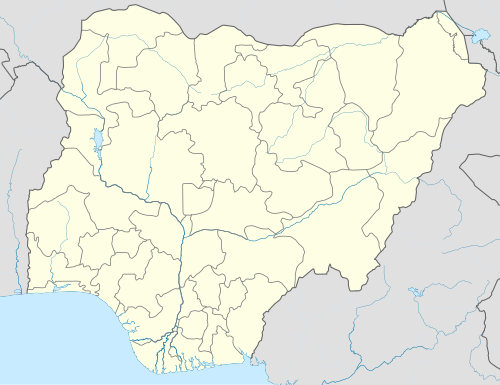
| pushpin_map = Nigeria |
||
| pushpin_label_position = |
| pushpin_label_position = |
||
| pushpin_mapsize = |
| pushpin_mapsize = |
||
| Line 48: | Line 50: | ||
| timezone_DST = |
| timezone_DST = |
||
| utc_offset_DST = |
| utc_offset_DST = |
||
| coordinates = |
| coordinates = {{Coord|5.5469|7.2702|display=title}} |
||
|module={{Infobox mapframe|wikidata=yes|zoom=8|marker=village|coord={{WikidataCoord|display=i}}}} |
|||
| elevation_footnotes = |
| elevation_footnotes = |
||
| elevation_m = |
| elevation_m = |
||
| Line 60: | Line 63: | ||
| footnotes = |
| footnotes = |
||
}} |
}} |
||
'''Ahiazu Mbaise''' is a [[Local Government Areas of Nigeria|Local Government Area]] of [[Imo State]], [[Nigeria]]. It is as a result of a merger between Ahiara and Ekwerazu. Its headquarters are in the town of Afo oru. There are fourteen (14) towns that make up '''Ahiazu Mbaise.''' They |
'''Ahiazu Mbaise''' is a [[Local Government Areas of Nigeria|Local Government Area]] of [[Imo State]], [[Nigeria]]. It is as a result of a merger between Ahiara and Ekwerazu. Its headquarters are in the town of Afo oru. There are fourteen (14) towns that make up '''Ahiazu Mbaise.''' They include; Mpam, Ihitte Afor, Opara-Nadim, Akabor, Ogwuama/Amuzi, Obodo-Ujichi, Otulu/Aguneze, Umu-OKrika, Obohia, Ekwereazu, Obodo-Ahiara, Lude/Nnara-Mbia, Ogbe, Oru - Ahiara. The 12 wards in Ahiazu Mbaise local government area are: Amuzi/Ihenworie, Mpam, Nnarambia, Obohia/Ekwereazu, Ogbe, Ogbor/Umueze, Okrika Nweke, Okrika Nwenkwo, Oparanadim, Oru-na-Lude, Otulu/Aguneze, Umunumo/Umuchieze.{{cn|date=May 2023}} |
||
[[File:Ahiazu Mbaise Headquarters Building.jpg|thumb|300x300px|Ahiazu Mbaise Headquarters Building]] |
|||
It has an area of 114 km{{sup|2}} and a [[population]] of 170,902 at the 2006 census. The local government area is bounded to the north by [[Isiala Mbano]] and [[Ehime Mbano]], to the east by Obowo and [[Ihitte Uboma]], to the south by [[Ezinihitte Mbaise]] and Aboh Mbaise and to the west by [[Ikeduru]]. |
It has an area of 114 km{{sup|2}} and a [[population]] of 170,902 at the 2006 census. The local government area is bounded to the north by [[Isiala Mbano]] and [[Ehime Mbano]], to the east by Obowo and [[Ihitte Uboma]], to the south by [[Ezinihitte Mbaise]] and Aboh Mbaise and to the west by [[Ikeduru]].{{cn|date=May 2023}} |
||
The [[postal code]] of the area is 463.<ref>{{cite web|title=Post Offices- with map of LGA |publisher=NIPOST |url=http://www.nipost.gov.ng/PostCode.aspx |access-date=2009-10-20 |archive-url=https://web.archive.org/web/20091007011423/http://www.nipost.gov.ng/PostCode.aspx |archive-date=7 October 2009 |url-status=dead }}</ref> |
The [[postal code]] of the area is 463.<ref>{{cite web|title=Post Offices- with map of LGA |publisher=NIPOST |url=http://www.nipost.gov.ng/PostCode.aspx |access-date=2009-10-20 |archive-url=https://web.archive.org/web/20091007011423/http://www.nipost.gov.ng/PostCode.aspx |archive-date=7 October 2009 |url-status=dead }}</ref> |
||
| Line 69: | Line 74: | ||
{{Reflist}} |
{{Reflist}} |
||
{{coord missing|Nigeria}} |
|||
{{LGAs and communities of Imo State}} |
{{LGAs and communities of Imo State}} |
||
{{Populated places of Imo State}} |
{{Populated places of Imo State}} |
||
[[Category:Local Government Areas in Imo State]] |
[[Category:Local Government Areas in Imo State]] |
||
[[Category: |
[[Category:Local Government Areas in Igboland]] |
||
Latest revision as of 10:22, 23 June 2023
Ahiazu Mbaise | |
|---|---|
 Ahiazu Mbaise Headquarters Entrance | |
 Ahiazu Mbaise | |
| Coordinates: 5°32′49″N 7°16′13″E / 5.5469°N 7.2702°E | |
| Country | |
| State | Imo State |
| Area | |
| • Land | 44 sq mi (114 km2) |
| Population (2006) | |
| • Total | 170,902 |
| Time zone | UTC+1 (WAT) |
 | |
Ahiazu Mbaise is a Local Government Area of Imo State, Nigeria. It is as a result of a merger between Ahiara and Ekwerazu. Its headquarters are in the town of Afo oru. There are fourteen (14) towns that make up Ahiazu Mbaise. They include; Mpam, Ihitte Afor, Opara-Nadim, Akabor, Ogwuama/Amuzi, Obodo-Ujichi, Otulu/Aguneze, Umu-OKrika, Obohia, Ekwereazu, Obodo-Ahiara, Lude/Nnara-Mbia, Ogbe, Oru - Ahiara. The 12 wards in Ahiazu Mbaise local government area are: Amuzi/Ihenworie, Mpam, Nnarambia, Obohia/Ekwereazu, Ogbe, Ogbor/Umueze, Okrika Nweke, Okrika Nwenkwo, Oparanadim, Oru-na-Lude, Otulu/Aguneze, Umunumo/Umuchieze.[citation needed]

It has an area of 114 km2 and a population of 170,902 at the 2006 census. The local government area is bounded to the north by Isiala Mbano and Ehime Mbano, to the east by Obowo and Ihitte Uboma, to the south by Ezinihitte Mbaise and Aboh Mbaise and to the west by Ikeduru.[citation needed]
The postal code of the area is 463.[1]
References[edit]
- ^ "Post Offices- with map of LGA". NIPOST. Archived from the original on 7 October 2009. Retrieved 2009-10-20.
State capital: Owerri | ||
| Local government areas |  | |
This Imo State, Nigeria location article is a stub. You can help Wikipedia by expanding it. |