Nemaska: Difference between revisions
m CambridgeBayWeather moved page Nemaska, Quebec to Nemaska over redirect: Naming |
add pic from Commons |
||
| (20 intermediate revisions by 13 users not shown) | |||
| Line 1: | Line 1: | ||
{{coord|51|41|N|76|15|W|display=title}}{{Contains Canadian text}} |
|||
{{for|the [[Cree village municipality (Quebec)|Cree village municipality]] of the same name|Nemaska (Cree village municipality)}} |
{{for|the [[Cree village municipality (Quebec)|Cree village municipality]] of the same name|Nemaska (Cree village municipality)}} |
||
{{Contains special characters|Canadian}} |
|||
| ⚫ | '''Nemaska''' ({{lang-cr| |
||
{{Infobox settlement |
|||
| name = Nemaska |
|||
| native_name = ᓀᒥᔅᑳᐤ (Nemiskâw) |
|||
| native_name_lang = cr |
|||
| settlement_type = ''Terre réservée crie'' ([[Cree reserved land]]) |
|||
| image_skyline = Nemaska, an Indian village.jpg |
|||
| image_alt = |
|||
| image_caption = |
|||
| etymology = |
|||
| nickname = |
|||
| pushpin_map = Canada Quebec#Canada |
|||
| pushpin_map_caption = Nemaska |
|||
| coordinates = {{coord|51|41|06|N|76|15|22|W|display=inline,title}} |
|||
| coordinates_footnotes = <ref>{{toponymie|212409}}</ref> |
|||
| population_total = 832<ref name="StatsCan2021">{{Cite web|url=https://www12.statcan.gc.ca/census-recensement/2021/dp-pd/prof/details/page.cfm?Lang=E&SearchText=Nemaska&DGUIDlist=2021A00052499808,2021A00052499040&GENDERlist=1&STATISTIClist=1&HEADERlist=0|title = Data table, Census Profile, 2021 Census of Population - Nemaska, Terres réservées aux Cris (TC) [Census subdivision], Quebec;Nemaska, Village cri (VC) [Census subdivision], Quebec|date = 9 February 2022}}</ref> |
|||
| subdivision_type = Country |
|||
| subdivision_name = Canada |
|||
| subdivision_type1 = [[Provinces and territories of Canada|Province]] |
|||
| subdivision_name1 = [[Quebec]] |
|||
| subdivision_type2 = [[Region (Quebec)|Region]] |
|||
| subdivision_name2 = [[Nord-du-Québec]] |
|||
| subdivision_type3 = [[Territory equivalent to a regional county municipality|Territory]] |
|||
| subdivision_name3 = [[Eeyou Istchee (territory)|Eeyou Istchee]] |
|||
| area_footnotes = <ref name="StatsCan2021"/><ref>{{mamrot|99808}}</ref> |
|||
| area_total_km2 = 97.30 |
|||
| area_land_km2 = 98.42 |
|||
| website = [https://nemaska.com/// Nemaska.com] |
|||
}} |
|||
| ⚫ | '''Nemaska''' ({{lang-cr|ᓀᒥᔅᑳᐤ/Nemiskâw}}, meaning ''underwater point,'' but commonly associated with the word ''namesiskâw'', meaning ''many fish''.) is a small [[Cree]] community located on the shores of Lake Champion, in [[Quebec]], [[Canada]]. It is a small Cree village with a population of 832 people at the [[Canada 2021 Census|2021 census]].<ref>[https://www12.statcan.gc.ca/census-recensement/2021/dp-pd/prof/details/page.cfm?Lang=E&SearchText=Nemaska&DGUIDlist=2021A00052499808,2021A00052499040&GENDERlist=1&STATISTIClist=1&HEADERlist=0 Nemaska, Terres réservées aux Cris]</ref> Nemaska is the seat of the [[Grand Council of the Crees]] and [[Grand Council of the Crees#Cree Regional Authority|Cree Regional Authority]]. |
||
It was officially known (by the Quebec government) as '''Nemiscau''' until May 8, 2010.<ref> |
It was officially known (by the Quebec government) as '''Nemiscau''' until May 8, 2010.<ref>{{Cite web |url=http://www.stat.gouv.qc.ca/publications/referenc/pdf2010/modif_mai10.pdf |title=Modifications aux municipalitésdu Québec |access-date=2012-03-23 |archive-url=https://web.archive.org/web/20120319153742/http://www.stat.gouv.qc.ca/publications/referenc/pdf2010/modif_mai10.pdf |archive-date=2012-03-19 |url-status=dead }}</ref> |
||
Nemaska is a new and modern village that consists of Cree families originally living at the [[Nemiscau, Quebec|Nemiscau]] trading post on [[Lake Nemiscau]] ({{coord|51|19|N|76|55|W}}). |
Nemaska is a new and modern village that consists of Cree families originally living at the [[Nemiscau, Quebec|Nemiscau]] trading post on [[Lake Nemiscau]] ({{coord|51|19|N|76|55|W}}). The settlement was abandoned in the mid-1970s when [[Hydro-Québec]] proposed hydro-electric development on the Rupert River, which would have resulted in the flooding of the area. The nearby Hydro-Québec [[electrical substation]] and airport, both called Nemiscau, create confusion as to the town's name. As a result, many maps indicate the new site by the old name Nemiscau. |
||
Nemaska is accessible by air (from Hydro-Québec's [[Nemiscau Airport]]) and by car over the gravel North Road (''[[Route du Nord]]''). About {{convert|14|km|abbr=on}} east from the village is the huge Hydro-Québec substation of Nemiscau. |
Nemaska is accessible by air (from Hydro-Québec's [[Nemiscau Airport]]) and by car over the gravel North Road (''[[Route du Nord]]''). About {{convert|14|km|abbr=on}} east from the village is the huge Hydro-Québec substation of Nemiscau. |
||
==Education== |
|||
The [[Cree School Board]] operates the Luke Mettaweskum School ({{lang-cr|ᓘᒃ ᒣᑕᐧᐁᔥᑲᒻ ᒋᔅᑯᑕᒫᒉᐅᑲᒥᒄ}}).<ref>"[https://www.cscree.qc.ca/en/youth/nemaska/luke-mettaweskum-school Luke Mettaweskum School]." [[Cree School Board]]. Retrieved on September 23, 2017.</ref> |
|||
==References== |
==References== |
||
| Line 13: | Line 44: | ||
==External links== |
==External links== |
||
* {{Commons category-inline}} |
|||
*[http://www.nemaska.com/ Official website of the Cree Nation of Nemaska] |
*[http://www.nemaska.com/ Official website of the Cree Nation of Nemaska] |
||
*[http://www.gcc.ca/ Official website of Grand Council of the Crees] |
*[https://web.archive.org/web/20070822033527/http://www.gcc.ca/ Official website of Grand Council of the Crees] |
||
{{Grand Council of the Crees}} |
{{Grand Council of the Crees}} |
||
Latest revision as of 13:15, 21 May 2024
Nemaska
ᓀᒥᔅᑳᐤ (Nemiskâw) | |
|---|---|
Terre réservée crie (Cree reserved land) | |
 | |
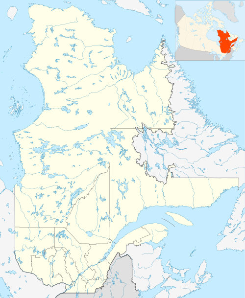 Nemaska Nemaska  Nemaska Nemaska (Canada) | |
| Coordinates: 51°41′06″N 76°15′22″W / 51.68500°N 76.25611°W[2] | |
| Country | Canada |
| Province | Quebec |
| Region | Nord-du-Québec |
| Territory | Eeyou Istchee |
| Area | |
| • Total | 97.30 km2 (37.57 sq mi) |
| • Land | 98.42 km2 (38.00 sq mi) |
| Population | |
| • Total | 832[1] |
| Website | Nemaska.com |
Nemaska (Cree: ᓀᒥᔅᑳᐤ/Nemiskâw, meaning underwater point, but commonly associated with the word namesiskâw, meaning many fish.) is a small Cree community located on the shores of Lake Champion, in Quebec, Canada. It is a small Cree village with a population of 832 people at the 2021 census.[4] Nemaska is the seat of the Grand Council of the Crees and Cree Regional Authority.
It was officially known (by the Quebec government) as Nemiscau until May 8, 2010.[5]
Nemaska is a new and modern village that consists of Cree families originally living at the Nemiscau trading post on Lake Nemiscau (51°19′N 76°55′W / 51.317°N 76.917°W). The settlement was abandoned in the mid-1970s when Hydro-Québec proposed hydro-electric development on the Rupert River, which would have resulted in the flooding of the area. The nearby Hydro-Québec electrical substation and airport, both called Nemiscau, create confusion as to the town's name. As a result, many maps indicate the new site by the old name Nemiscau.
Nemaska is accessible by air (from Hydro-Québec's Nemiscau Airport) and by car over the gravel North Road (Route du Nord). About 14 km (8.7 mi) east from the village is the huge Hydro-Québec substation of Nemiscau.
Education[edit]
The Cree School Board operates the Luke Mettaweskum School (Cree: ᓘᒃ ᒣᑕᐧᐁᔥᑲᒻ ᒋᔅᑯᑕᒫᒉᐅᑲᒥᒄ).[6]
References[edit]
- ^ a b "Data table, Census Profile, 2021 Census of Population - Nemaska, Terres réservées aux Cris (TC) [Census subdivision], Quebec;Nemaska, Village cri (VC) [Census subdivision], Quebec". 9 February 2022.
- ^ "Banque de noms de lieux du Québec: Reference number 212409". toponymie.gouv.qc.ca (in French). Commission de toponymie du Québec.
- ^ "Répertoire des municipalités: Geographic code 99808". www.mamh.gouv.qc.ca (in French). Ministère des Affaires municipales et de l'Habitation.
- ^ Nemaska, Terres réservées aux Cris
- ^ "Modifications aux municipalitésdu Québec" (PDF). Archived from the original (PDF) on 2012-03-19. Retrieved 2012-03-23.
- ^ "Luke Mettaweskum School." Cree School Board. Retrieved on September 23, 2017.
External links[edit]
Media related to Nemaska at Wikimedia Commons
- Official website of the Cree Nation of Nemaska
- Official website of Grand Council of the Crees
This Quebec location article is a stub. You can help Wikipedia by expanding it. |