Menominee Township, Michigan: Difference between revisions
{{Marinette, Wisconsin}} |
Demographic and MOS updates where applicable. |
||
| (42 intermediate revisions by 26 users not shown) | |||
| Line 1: | Line 1: | ||
{{Use mdy dates|date=July 2023}} |
|||
'''Menominee Township''' is a township located in [[Menominee County, Michigan]]. As of the [[2000]] census, the township had a total population of 3,939. The city of [[Menominee, Michigan|Menominee]] is located at the southern end of the township. |
|||
{{Infobox settlement |
|||
|official_name = Menominee Township, Michigan |
|||
|settlement_type = [[Civil township]] |
|||
|nickname = |
|||
|motto = |
|||
<!-- Images --> |
|||
== Geography == |
|||
|image_skyline = |
|||
According to the [[United States Census Bureau]], the township has a total area of 190.3 [[square kilometer|km²]] (73.5 [[square mile|mi²]]). 188.2 km² (72.7 mi²) of it is land and 2.1 km² (0.8 mi²) of it is water. The total area is 1.10% water. |
|||
|imagesize = |
|||
|image_caption = |
|||
|image_flag = |
|||
|image_seal = |
|||
<!-- Maps --> |
|||
== Demographics == |
|||
|pushpin_map = Michigan#USA |
|||
As of the [[census]][[Geographic references#2|<sup>2</sup>]] of [[2000]], there are 3,939 people, 1,570 households, and 1,169 families residing in the township. The [[population density]] is 20.9/km² (54.2/mi²). There are 1,782 housing units at an average density of 9.5/km² (24.5/mi²). The racial makeup of the township is 98.88% [[White (U.S. Census)|White]], 0.03% [[African American (U.S. Census)|African American]], 0.41% [[Native American (U.S. Census)|Native American]], 0.10% [[Asian (U.S. Census)|Asian]], 0.00% [[Pacific Islander (U.S. Census)|Pacific Islander]], 0.08% from [[Race (U.S. Census)|other races]], and 0.51% from two or more races. 0.46% of the population are [[Hispanic (U.S. Census)|Hispanic]] or [[Latino (U.S. Census)|Latino]] of any race. |
|||
|pushpin_label_position = left <!-- the position of the pushpin label: left, right, top, bottom, none --> |
|||
|pushpin_label = Menominee Township |
|||
|pushpin_map_caption = |
|||
|pushpin_mapsize = |
|||
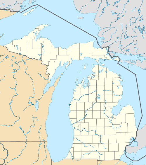
|image_map = Menominee Township, MI location2.png |
|||
|mapsize = 250 |
|||
|map_caption = Location within [[Menominee County, Michigan|Menominee County]] and the state of Michigan |
|||
|image_map1 = |
|||
|mapsize1 = |
|||
|map_caption1 = |
|||
<!-- Location --> |
|||
There are 1,570 households out of which 30.1% have children under the age of 18 living with them, 66.2% are [[Marriage|married couples]] living together, 4.6% have a female householder with no husband present, and 25.5% are non-families. 20.6% of all households are made up of individuals and 9.3% have someone living alone who is 65 years of age or older. The average household size is 2.49 and the average family size is 2.87. |
|||
|subdivision_type = [[List of sovereign states|Country]] |
|||
|subdivision_name = United States |
|||
|subdivision_type1 = [[U.S. state|State]] |
|||
|subdivision_name1 = [[Michigan]] |
|||
|subdivision_type2 = [[List of counties in Michigan|County]] |
|||
|subdivision_name2 = [[Menominee County, Michigan|Menominee]] |
|||
<!-- Government --> |
|||
In the township the population is spread out with 22.8% under the age of 18, 6.8% from 18 to 24, 27.8% from 25 to 44, 28.5% from 45 to 64, and 14.2% who are 65 years of age or older. The median age is 41 years. For every 100 females there are 105.0 males. For every 100 females age 18 and over, there are 104.9 males. |
|||
|government_footnotes = |
|||
|government_type = |
|||
|leader_title = Supervisor |
|||
|leader_name = Kenneth Goffin |
|||
|leader_title1 = |
|||
|leader_name1 = |
|||
|established_title = Organized |
|||
|established_date = 1863 |
|||
<!-- Area --> |
|||
The median income for a household in the township is $41,435, and the median income for a family is $48,516. Males have a median income of $33,872 versus $22,238 for females. The [[per capita income]] for the township is $18,815. 7.2% of the population and 4.8% of families are below the [[poverty line]]. Out of the total population, 9.7% of those under the age of 18 and 6.9% of those 65 and older are living below the poverty line. |
|||
|unit_pref = Imperial |
|||
|area_footnotes = <ref name="CenPopGazetteer2023">{{cite web |title=2023 U.S. Gazetteer Files: Michigan |url=https://www2.census.gov/geo/docs/maps-data/data/gazetteer/2023_Gazetteer/2023_gaz_cousubs_26.txt |publisher=United States Census Bureau |accessdate=October 13, 2023}}</ref> |
|||
|area_total_km2 = |
|||
|area_land_km2 = |
|||
|area_water_km2 = |
|||
|area_total_sq_mi = 73.45 |
|||
|area_land_sq_mi = 72.70 |
|||
|area_water_sq_mi = 0.75 |
|||
<!-- Population --> |
|||
|population_as_of = [[2020 United States census|2020]] |
|||
|population_footnotes = <ref name="Census 2020">{{Cite web| url=https://data.census.gov/cedsci/table?q=&g=0600000US2610953040&tid=DECENNIALPL2020.P1| title=P1. Race – Menominee township, Michigan: 2020 DEC Redistricting Data (PL 94-171)| publisher=U.S. Census Bureau| access-date=October 13, 2023}}</ref> |
|||
|population_total = 3364 |
|||
|population_density_km2 = |
|||
|population_density_sq_mi = 46.3 |
|||
<!-- General information --> |
|||
|timezone = [[North American Central Time Zone|Central (CST)]] |
|||
|utc_offset = -6 |
|||
|timezone_DST = CDT |
|||
|utc_offset_DST = -5 |
|||
|elevation_footnotes = |
|||
|elevation_m = 197 |
|||
|elevation_ft = 646 |
|||
|coordinates = {{coord|45|11|45|N|87|38|02|W|region:US-MI|display=inline,title}} |
|||
|postal_code_type = [[ZIP Code]]s |
|||
|postal_code = 49858 ([[Menominee, Michigan|Menominee]])<br/>49893 ([[Wallace, Menominee County, Michigan|Wallace]]) |
|||
|area_code = [[Area code 906|906]] |
|||
|blank_name = [[Federal Information Processing Standard|FIPS code]] |
|||
|blank_info = 26-109-53040<ref name="GR2">{{cite web|url=https://www.census.gov|publisher=[[United States Census Bureau]]|accessdate=2008-01-31|title=U.S. Census website}}</ref> |
|||
|blank1_name = [[Geographic Names Information System|GNIS]] feature ID |
|||
|blank1_info = 1626724<ref>{{gnis|1626724}}</ref> |
|||
|website = {{URL|www.menomineetownship.com}} |
|||
|footnotes = |
|||
}} |
|||
'''Menominee Township''' is a [[civil township]] of [[Menominee County, Michigan|Menominee County]] in the [[U.S. state]] of [[Michigan]]. The population was 3,364 at the [[2020 United States census|2020 census]],<ref name="Census 2020"/> down from a peak of 4,026 in [[1980 United States census|1980]]. The city of [[Menominee, Michigan|Menominee]] borders the southern end of the township but is administratively autonomous. |
|||
==Geography== |
|||
The township is in southern Menominee County, bordered to the south by Menominee, the [[county seat]]; to the southeast by [[Green Bay (Lake Michigan)]]; and to the west, across the [[Menominee River]], by [[Marinette County, Wisconsin]]. [[U.S. Route 41]] crosses the township, leading south into Menominee and north to [[Stephenson, Michigan|Stephenson]], while [[M-35 (Michigan highway)|M-35]] runs along the Lake Michigan shoreline, leading northeast to [[Escanaba, Michigan|Escanaba]]. |
|||
According to the [[United States Census Bureau]], Menominee Township has a total area of {{convert|73.4|sqmi|km2}}, of which {{convert|72.7|sqmi|km2}} are land and {{convert|0.8|sqmi|km2}}, or 1.02%, are water.<ref name="CenPopGazetteer2023"/> |
|||
==Demographics== |
|||
{{US Census population |
|||
|1890= 1566 |
|||
|1900= 1290 |
|||
|1910= 1405 |
|||
|1920= 1428 |
|||
|1930= 1534 |
|||
|1940= 1760 |
|||
|1950= 2097 |
|||
|1960= 2670 |
|||
|1970= 3212 |
|||
|1980= 4026 |
|||
|1990= 3956 |
|||
|2000= 3939 |
|||
|2010= 3488 |
|||
|2020= 3364 |
|||
|footnote=U.S. Decennial Census<ref name="DecennialCensus">{{cite web|url=https://www.census.gov/programs-surveys/decennial-census/decade/decennial-publications.html|title=Decennial Census Official Publications|publisher=U.S. Census Bureau|access-date=October 13, 2023}}</ref> |
|||
}} |
|||
As of the [[census]]<ref name="GR2" /> of 2000, there were 3,939 people, 1,570 households, and 1,169 families residing in the township. By 2020, its population was 3,364.<ref name="Census 2020" /> |
|||
==References== |
|||
{{reflist}} |
|||
==External links== |
|||
*{{Official|www.menomineetownship.com}} |
|||
{{Marinette, Wisconsin}} |
{{Marinette, Wisconsin}} |
||
{{Menominee County, Michigan}} |
|||
{{authority control}} |
|||
[[Category:Menominee County, Michigan]] |
[[Category:Townships in Menominee County, Michigan]] |
||
[[Category:Marinette micropolitan area]] |
|||
[[Category:Townships in Michigan]] |
[[Category:Townships in Michigan]] |
||
[[Category:Michigan populated places on Lake Michigan]] |
|||
Latest revision as of 15:41, 10 December 2023
Menominee Township, Michigan | |
|---|---|
 Location within Menominee County and the state of Michigan | |
 Menominee Township  Menominee Township | |
| Coordinates: 45°11′45″N 87°38′02″W / 45.19583°N 87.63389°W | |
| Country | United States |
| State | Michigan |
| County | Menominee |
| Organized | 1863 |
| Government | |
| • Supervisor | Kenneth Goffin |
| Area | |
| • Total | 73.45 sq mi (190.2 km2) |
| • Land | 72.70 sq mi (188.3 km2) |
| • Water | 0.75 sq mi (1.9 km2) |
| Elevation | 646 ft (197 m) |
| Population | |
| • Total | 3,364 |
| • Density | 46.3/sq mi (17.9/km2) |
| Time zone | UTC-6 (Central (CST)) |
| • Summer (DST) | UTC-5 (CDT) |
| ZIP Codes | |
| Area code | 906 |
| FIPS code | 26-109-53040[3] |
| GNIS feature ID | 1626724[4] |
| Website | www |
Menominee Township is a civil township of Menominee County in the U.S. state of Michigan. The population was 3,364 at the 2020 census,[2] down from a peak of 4,026 in 1980. The city of Menominee borders the southern end of the township but is administratively autonomous.
Geography[edit]
The township is in southern Menominee County, bordered to the south by Menominee, the county seat; to the southeast by Green Bay (Lake Michigan); and to the west, across the Menominee River, by Marinette County, Wisconsin. U.S. Route 41 crosses the township, leading south into Menominee and north to Stephenson, while M-35 runs along the Lake Michigan shoreline, leading northeast to Escanaba.
According to the United States Census Bureau, Menominee Township has a total area of 73.4 square miles (190 km2), of which 72.7 square miles (188 km2) are land and 0.8 square miles (2.1 km2), or 1.02%, are water.[1]
Demographics[edit]
| Census | Pop. | Note | %± |
|---|---|---|---|
| 1890 | 1,566 | — | |
| 1900 | 1,290 | −17.6% | |
| 1910 | 1,405 | 8.9% | |
| 1920 | 1,428 | 1.6% | |
| 1930 | 1,534 | 7.4% | |
| 1940 | 1,760 | 14.7% | |
| 1950 | 2,097 | 19.1% | |
| 1960 | 2,670 | 27.3% | |
| 1970 | 3,212 | 20.3% | |
| 1980 | 4,026 | 25.3% | |
| 1990 | 3,956 | −1.7% | |
| 2000 | 3,939 | −0.4% | |
| 2010 | 3,488 | −11.4% | |
| 2020 | 3,364 | −3.6% | |
| U.S. Decennial Census[5] | |||
As of the census[3] of 2000, there were 3,939 people, 1,570 households, and 1,169 families residing in the township. By 2020, its population was 3,364.[2]
References[edit]
- ^ a b "2023 U.S. Gazetteer Files: Michigan". United States Census Bureau. Retrieved October 13, 2023.
- ^ a b c "P1. Race – Menominee township, Michigan: 2020 DEC Redistricting Data (PL 94-171)". U.S. Census Bureau. Retrieved October 13, 2023.
- ^ a b "U.S. Census website". United States Census Bureau. Retrieved January 31, 2008.
- ^ U.S. Geological Survey Geographic Names Information System: Menominee Township, Michigan
- ^ "Decennial Census Official Publications". U.S. Census Bureau. Retrieved October 13, 2023.
External links[edit]
| Surrounding communities |
| 
 |
|---|---|---|
| Counties | ||
Municipalities and communities of Menominee County, Michigan, United States | ||
|---|---|---|
| Cities | ||
| Villages | ||
| Civil townships | ||
| CDP | ||
| Other communities | ||
| Indian reservation | ||
| Footnotes | ‡This populated place also has portions in an adjacent county or counties | |