Template:Grey-green orthographic projections maps: Difference between revisions
Jump to navigation
Jump to search
Content deleted Content added
→West: Renamed |
L'Américain (talk | contribs) |
||
| Line 194: | Line 194: | ||
<gallery widths="100px" heights="80px"> |
<gallery widths="100px" heights="80px"> |
||
File:Aztec Empire (orthographic projection).svg|Aztec Empire |
File:Aztec Empire (orthographic projection).svg|Aztec Empire |
||
File:Tawantinsuyu (orthographic projection).svg|Tawantinsuyu |
|||
File:Roman Empire (orthographic projection).svg|Roman Empire |
File:Roman Empire (orthographic projection).svg|Roman Empire |
||
File:Frankish Empire (orthographic projection).svg|Frankish Empire |
File:Frankish Empire (orthographic projection).svg|Frankish Empire |
||
Revision as of 17:47, 30 January 2010
English: SVG file, it's recommended nominally 550x550 in dimensions with 0.6 pixels borders
Español: Archivo SVG, se recomienda dimensiones de 550x550 con 0.6 pixeles de bordes
Français : Pour les fichiers SVG, la norme recommandée est de 550x550 avec des bords de 0.6 pixels
Africa
-
Africa
-
African Union
-
Horn of Africa
-
Latin Africa
-
North Africa
-
Maghreb


Northern Africa
-
Arab Maghreb Union
-
Algeria
-
Egypt
-
Eritrea
-
Libya
-
Mauritania
-
Morocco
-
Sudan
-
Tunisia
-
Western Sahara


Horn of Africa
-
Eritrea
-
Somalia
-
Ethiopia


Southern Africa
-
Angola
-
South Africa
-
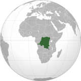
Democratic Republic of the Congo
-
Madagascar


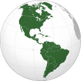
Americas
-
Americas
-
Latin America
-
Mexico and Central America
-
Anglo America
-
Greater Latin America
-
Hispanic America
-
Bolivarian Alliance for the Peoples of Our America
-
Organization of American States
-
Middle America


North
-
North America
-
Northern America
-
Canada
-
Mexico
-
United States
-
Greenland
-
North America Free Trade Agreement


Central and the Antilles
-
Central America
-
Central America and the Caribbean
-
Antilles
-
Costa Rica
-
Cuba
-
Dominican Republic
-
Haiti
-
Honduras
-
Jamaica
-
Guatemala
-
La Española
-
Nicaragua
-
Panamá


South
-
South America
-
Southern America
-
Union of South American Nations
-
MERCOSUR
-
America Platina
-
Argentina
-
Brazil
-
Bolivia
-
Colombia
-
Chile
-
Ecuador
-
French Guiana
-
Guyana
-
Paraguay
-
Peru
-
Suriname
-
Uruguay
-
Venezuela


Asia
-
Asia

East
-
East Asia
-
China
-
Japan
-
Mongolia
-
North Korea
-
South Korea


Central
-
Central Asia
-
Kazakhstan


Southeast
-
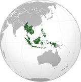
Southeast Asia
-
Association of Southeast Asian Nations
-
Indonesia
-
Malaysia
-
Philippines


South
-
South Asia
-
India
-
Pakistan


Southwest
-
Southwest Asia
-
Georgia
-
Armenia
-
Nagorno-Karabakh Republic
-
Iran
-
Iraq
-
Saudi Arabia
-
Syria
-
Turkey
-
United Arab Emirates


Europe
-
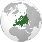
Europe
-
European Union
-
Russia
-
Spain


Oceania
-
Oceania
-
Australia
-
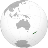
New Zealand


Intercontinental
-
Afro-eurasia
-
Arab League
-
Arctic
-
Antarctica
-
Eurasia
-
European Union
-
Greater Middle East
-
Ibero-America
-
Middle East
-
North Atlantic Treaty Organization


Historical
English: Unions, Organizations, Kingdoms, Empires
Español: Uniones, Organizaciones, Reinos, Imperios
Français : Unions, Organisations, Royaumes, Empires
-
Aztec Empire
-
Tawantinsuyu
-
Roman Empire
-
Frankish Empire
-
Songhai Empire
-
Mughal Empire
-
Empire of Brazil
-
Mexican Empire
-
Catalan Countries
-
New Spain
-
New France
-
Great Colombia
-
Peru–Bolivia Confederation
-
Confederate States of America
-
Federal Republic of Central America
-
United Provinces of Central America
-
Austro-Hungary
-
Wilsonian Armenia
-
Union of Soviet Socialist Republics
-
Inca Empire
-
Chincha Country
-
Viceroyalty of Peru
-
Viceroyalty of the Río de la Plata


Subnationals
-
Canary Islands, Spain
-
Québec, Canada
-
Puerto Rico, U.S.


