File:BlankMap-World.png

Original file (1,500 × 740 pixels, file size: 39 KB, MIME type: image/png)
Captions
Captions
Summary
[edit]
|
File:BlankMap-World.svg is a vector version of this file. It should be used in place of this PNG file.
File:BlankMap-World.png → File:BlankMap-World.svg
For more information, see Help:SVG. |
 |
| Description |
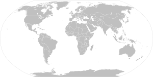
English:
Land
Boundaries of states with limited recognition from their parent country
Disputed boundaries
Water and non-disputed, recognized political boundaries A blank map of the world as of 2014, with country outlines, for making country locator maps. This map uses the Robinson projection, compressed at latitude direction by factor 0.95623, centered on the meridian circa 11°15' to east from Greenwich Prime Meridian and includes various microstates and island nations. All territories indicated in the UN listing of territories and regions are exhibited. Base map: File:"Political World" CIA World Factbook map 2005.svg from the CIA World Factbook (2005).[1] Bahasa Indonesia:
Dataran
Perbatasan negara yang memiliki pengakuan minim
Perbatasan yang dipersengketakan
Air dan perbatasan politik yang diakui dan tidak dipersengketakan Peta kosong dunia sejak tahun 2014, dengan batasan negara, unutk membuat peta pencari negara. Peta ini menggunakan proyeksi Robinson, dikompresi pada arah lintang dengan faktor 0.95623, dipusatkan pada garis bujur 11°15' ke arah timur dari Prime Meridian Greenwich, dan termasuk berbagai negara kecil dan negara kepulauan. Semua wilayah yang terdaftar dalam daftar wilayah PBB ditunjukkan. Peta pendasar: File:"Political World" CIA World Factbook map 2005.svg dari CIA World Factbook (2005).[2]
|
||||||||||||
| Date | Uploaded on the 8th December of 2004. | ||||||||||||
| Source | original by Vardion; updated by various users since December 2004. | ||||||||||||
| Author | The map was made by Vardion and adapted by E Pluribus Anthony for Wikipedia, and Spesh531, having made about 70% of all edits. | ||||||||||||
| Other versions |
Derivative works of this file:
Version with additional miscellaneous islands at Image:BlankMap-World-alt.png. Also see v2 and v4 for versions with micro-states, v3 and v5 for versions with microstates + thin lines joining country areas, and vDisputes for version with disputed territories outlined. A version of this map is available with no disputed boundaries amd a darker grey at Image:World map model.png. Other blank maps are available at Wikipedia:Blank maps and Category:Blank maps of the world. If you plan on generating a new map for wikipedia by zooming in on this map and making some modifications, please consider a source map in SVG format instead, which will produce a higher quality image. These can be found in the SVG section at Wikipedia:Blank Maps. |
||||||||||||
Licensing
[edit]| This work has been released into the public domain by its author, Vardion. This applies worldwide. In some countries this may not be legally possible; if so: |
| Annotations | This image is annotated: View the annotations at Commons |
File history
Click on a date/time to view the file as it appeared at that time.
| Date/Time | Thumbnail | Dimensions | User | Comment | |
|---|---|---|---|---|---|
| current | 11:44, 29 December 2023 | 1,500 × 740 (39 KB) | Siirski (talk | contribs) | Reverted to version as of 00:18, 23 February 2022 (UTC) | |
| 09:37, 1 October 2023 | 1,500 × 740 (51 KB) | Caawiyahaderon (talk | contribs) | https://www.thehindu.com/news/international/pro-somalia-militia-takes-key-army-base-in-breakaway-region/article67238670.ece | ||
| 00:18, 23 February 2022 | 1,500 × 740 (39 KB) | Toyyoda8 (talk | contribs) | Dontesk and Lughansk is officially recognized by at least one UN member. | ||
| 01:28, 5 March 2021 | 1,500 × 740 (84 KB) | Spesh531 (talk | contribs) | Reverted to version as of 07:59, 17 September 2017 (UTC) | ||
| 13:08, 10 March 2018 | 1,500 × 740 (43 KB) | Maphobbyist (talk | contribs) | Update | ||
| 07:59, 17 September 2017 | 1,500 × 740 (84 KB) | Loveskys (talk | contribs) | Reverted to version as of 16:32, 31 July 2017 (UTC) | ||
| 07:58, 17 September 2017 | 1,500 × 740 (52 KB) | Loveskys (talk | contribs) | Hong Kong added. | ||
| 16:32, 31 July 2017 | 1,500 × 740 (84 KB) | Greeninventor999 (talk | contribs) | removed disputed antarctic | ||
| 16:42, 20 February 2017 | 1,500 × 740 (21 KB) | Jeanjung212 (talk | contribs) | Lossless Compressed/optimized png decreasing file size by 6020 bytes | ||
| 11:38, 14 January 2016 | 1,500 × 740 (27 KB) | Denniss (talk | contribs) | Reverted to version as of 22:26, 13 January 2016 (UTC) | ||
| 04:41, 14 January 2016 | 1,500 × 740 (74 KB) | Castledungeon (talk | contribs) | Reverted to version as of 19:25, 10 January 2016 (UTC) Reverted because they added details in that version. Don't revert please. | ||
| 22:26, 13 January 2016 | 1,500 × 740 (27 KB) | Krinkle (talk | contribs) | Reverted to version as of 15 May 2015: Restore transparent broken background | ||
| 19:25, 10 January 2016 | 1,500 × 740 (74 KB) | Komethitsearth (talk | contribs) | fixed caspian sea, fixed caucasus borders and lakes, added Mingecevir reservoir, fixed ukraine's borders and lakes, moldova's borders, finland lakes and borders, fixed british isles, and fixed ladoga and onega lakes. | ||
| 21:11, 15 May 2015 | 1,500 × 740 (27 KB) | RokerHRO (talk | contribs) | optipng -o7 -i0 → 31.42% decrease | ||
| 03:21, 27 September 2014 | 1,500 × 740 (39 KB) | Spesh531 (talk | contribs) | transparency | ||
| 23:18, 26 September 2014 | 1,500 × 740 (54 KB) | Leftcry (talk | contribs) | Azerbaijan | ||
| 04:20, 6 September 2014 | 1,500 × 740 (39 KB) | Spesh531 (talk | contribs) | fixed Kashmir, Cameroon, and Mali border | ||
| 22:14, 27 July 2014 | 1,500 × 740 (39 KB) | Spesh531 (talk | contribs) | fixed border of Kazakhstan and Middle East, fixed Alaskan and Argentinian Coastline | ||
| 01:09, 22 May 2014 | 1,500 × 740 (39 KB) | Spesh531 (talk | contribs) | using south sudanese border from cia file, where the origins of this file is from; various changes | ||
| 23:39, 11 May 2014 | 1,500 × 740 (39 KB) | Spesh531 (talk | contribs) | update various coastlines | ||
| 03:55, 24 April 2014 | 1,500 × 740 (39 KB) | Spesh531 (talk | contribs) | lets try this again... | ||
| 03:54, 24 April 2014 | 1,500 × 740 (39 KB) | Spesh531 (talk | contribs) | without scotland and catalonia | ||
| 03:49, 24 April 2014 | 1,500 × 740 (39 KB) | Spesh531 (talk | contribs) | update in caribbean | ||
| 02:01, 22 April 2014 | 1,500 × 740 (39 KB) | Spesh531 (talk | contribs) | adding island in tanzania | ||
| 04:42, 6 April 2014 | 1,500 × 740 (39 KB) | Spesh531 (talk | contribs) | without scotland and catalonia | ||
| 04:41, 6 April 2014 | 1,500 × 740 (39 KB) | Spesh531 (talk | contribs) | major update to french coast, black sea coast, great britain, channel islands, Netherlands, Germany, European-Arctic Islands, and Southern Italy. Adding lake in Turkey | ||
| 14:56, 30 March 2014 | 1,500 × 740 (39 KB) | Wolrd blank map (talk | contribs) | No Scottish and Catalan borders | ||
| 14:54, 30 March 2014 | 1,500 × 740 (39 KB) | Wolrd blank map (talk | contribs) | Making Scotland and Catalonia borders | ||
| 14:50, 30 March 2014 | 1,500 × 740 (39 KB) | Wolrd blank map (talk | contribs) | Reverted to version as of 03:38, 28 February 2014 | ||
| 23:11, 17 March 2014 | 1,500 × 740 (39 KB) | Spesh531 (talk | contribs) | adding crimea | ||
| 03:38, 28 February 2014 | 1,500 × 740 (39 KB) | Spesh531 (talk | contribs) | kiribati island | ||
| 22:49, 3 February 2014 | 1,500 × 740 (39 KB) | Spesh531 (talk | contribs) | adding ecliptical boundaries on the outside, to show where the actual projection ends | ||
| 17:14, 30 January 2014 | 1,480 × 740 (50 KB) | Spesh531 (talk | contribs) | wrong file | ||
| 17:13, 30 January 2014 | 1,480 × 740 (50 KB) | Spesh531 (talk | contribs) | removing scotland and catalonia | ||
| 17:12, 30 January 2014 | 1,480 × 740 (50 KB) | Spesh531 (talk | contribs) | removing disputes, making a separate file for that. Making temporary Scotland and Catalonia borders, in case they do declare independence, it will be removed in a minute | ||
| 03:14, 10 September 2013 | 1,480 × 625 (47 KB) | Spesh531 (talk | contribs) | various updates | ||
| 08:10, 30 July 2012 | 1,480 × 625 (33 KB) | Spesh531 (talk | contribs) | Angola - DRC dispute ended, added Isles of Sicily, fixed location of Tokelau and Niue | ||
| 06:32, 7 April 2012 | 1,480 × 625 (46 KB) | Spesh531 (talk | contribs) | fixed palestine-israel boundary from white to dark grey | ||
| 04:27, 7 April 2012 | 1,480 × 625 (46 KB) | Spesh531 (talk | contribs) | adjusting azawad border and fixing color | ||
| 02:23, 7 April 2012 | 1,480 × 625 (55 KB) | Phoenix B 1of3 (talk | contribs) | azawad | ||
| 12:41, 2 April 2012 | 1,480 × 625 (46 KB) | Spesh531 (talk | contribs) | fixing some disputes, kars not claimed by armenia, dispute in botswana/zambia/namibia/Zimbabwe to small to show. fixed inland water. | ||
| 04:46, 30 January 2012 | 1,480 × 625 (63 KB) | Spesh531 (talk | contribs) | updating. Dispute between zambia, zimbabwe, botswana, and namibia is way to small to be a pixel on the map. Lao border update | ||
| 03:08, 6 December 2011 | 1,480 × 625 (37 KB) | Spesh531 (talk | contribs) | Update to remove purple. | ||
| 22:16, 2 December 2011 | 1,480 × 625 (63 KB) | Spesh531 (talk | contribs) | didnt even notice square | ||
| 04:06, 19 November 2011 | 1,480 × 625 (63 KB) | Spesh531 (talk | contribs) | Fixing Moroccan northern coastline | ||
| 23:06, 18 November 2011 | 1,480 × 625 (62 KB) | XBrain130 (talk | contribs) | fixing Ceuta and Melilla | ||
| 23:32, 16 November 2011 | 1,480 × 625 (63 KB) | Spesh531 (talk | contribs) | Added many lakes in all continents, lakes updated finished for who knows when. | ||
| 06:51, 23 October 2011 | 1,480 × 625 (62 KB) | Spesh531 (talk | contribs) | Added many lakes in Oceania, Africa, and a lake in Antarctica | ||
| 19:39, 10 October 2011 | 1,480 × 625 (62 KB) | Spesh531 (talk | contribs) | updated color scheme to what should have beenupdated a while ago | ||
| 19:08, 10 October 2011 | 1,480 × 625 (61 KB) | Spesh531 (talk | contribs) | adding lakes in africa, added disputed Hans Island in Greenland/Canada, and fixed a few boundaries |
You cannot overwrite this file.
File usage on Commons
The following 56 pages use this file:
- Atlas of the World/Physical and topographical
- Atlas of the World/Political
- Talk:Atlas
- User:Alain08
- User:Minorax/SVG available/2022 February 22-28
- User:Minorax/SVG available/2023 December 25-31
- User:Minorax/SVG available/2023 October 1-6
- User:Yug/Archive1
- User talk:Hoshie
- File:2005cocoa bean.PNG
- File:AK47map.png
- File:African Civet area.png
- File:AméricaMóvil BrandNames Map-America.png
- File:Apollo distribution map.png
- File:BandyCountries2014.png
- File:BlankMap-World gray.svg
- File:Car toll map of the world.png
- File:Caucasus locator map.png
- File:Cavia-aperea-range.png
- File:ColorMap-World.png
- File:Contries where T-Mobile is operating.PNG
- File:Countries without Rothschild Bank.png
- File:DShK operators of the world.png
- File:Drosera anglica distribution.png
- File:Euploea core - Distribution.png
- File:Euploea core superspecies - Distribution.png
- File:Eurabia map.png
- File:European Mink extant range.png
- File:G7plus states.png
- File:Gloriosa superba distribution.png
- File:Heron UAV operators.PNG
- File:ICAC Map-World.png
- File:Idea leuconoe - Distribution.png
- File:International Recognition of Scientology.png
- File:J-10 operators.png
- File:JF-17 Operators.png
- File:Lama glama Vicugna pacos range.png
- File:Lama guanicoe range.png
- File:Leopard 2 Operators.png
- File:Map-Francophone World.png
- File:MapOfMacedonianSpeakers.png
- File:Mi-24 operaters 2009.png
- File:NSV operators of the world.png
- File:OperatorsofAh-64.png
- File:Russian Provisional Government of 1917.PNG
- File:Rwc15 submission of interest.png
- File:Rwc19 submission of interest.png
- File:Siberian Weasel area.png
- File:Stoat area.png
- File:Tacca Distribution.PNG
- File:Valvrave power distribution map.png
- File:Vicugna vicugna range.png
- File:Wikinews-vi-banner.png
- File:Wikinews Banner 1.png
- File:World Main Battle Tanks.png
- File:World operators of AMV Patria.png
File usage on other wikis
The following other wikis use this file:
- Usage on arc.wikipedia.org
- Usage on bs.wikipedia.org
- Usage on cs.wikipedia.org
- Usage on de.wikipedia.org
- Usage on de.wikinews.org
- Kategorie:Arktischer Ozean
- Vorlage:Portalnavigationsleiste Regionen der Welt
- Kategorie:Atlantischer Ozean
- Kategorie:Pazifischer Ozean
- Kategorie:Indischer Ozean
- Kategorie:Südlicher Ozean
- Benutzer:Sean Heron/Hauptseite vorschläge
- Wikinews:Ideenschmiede/Umgestaltung der Hauptseite/Kopf
- Wikinews:Ideenschmiede/Hauptseite
- Portal:Ozeane
- Benutzer:Wolf-Dieter/HS
- Wikinews:Meinungsbild/Umgestaltung der Hauptseite/Vorschlag 1
- Benutzer:Wolf-Dieter/HS Variante3
- Benutzer:ChrGermany/HS
- Usage on diq.wikipedia.org
- Usage on dv.wikipedia.org
View more global usage of this file.