Odakota Mountain

Black Hills, SD Expedition No. 87: Lupe on summit of Odakota Mountain (2nd highest mountain in the Black Hills), elevation 7,200 ft, on 5-10-14. Bear Mountain visible in distance on right side of photo. White patch seen down in the valley above Lupe and just above center of photo is the little lake near the Boy Scout Camp. Odakota Mountain is strewn with dead Ponderosa pines killed by the mountain pine bark beetle infestation. Photo is looking S (2014-05-10). Photo by Lupe !.
Click here for larger-size photo. | Green Mountain

Black Hills, SD Expedition No. 87: Lupe near summit at SE edge of Green Mountain. The tops of a small portion of the E facing limestone cliffs of Green Mountain are visible in the foreground just beyond Lupe. Harney Peak , the highest mountain in the Black Hills at 7,242 ft. is visible in the background approximately 12 miles to the ESE. To the W, Green Mountain is a long, flat ridge. To the E it drops precipitously down to Gillette Prairie (2014-05-10). Photo by Lupe !.
Click here for larger-size photo. |
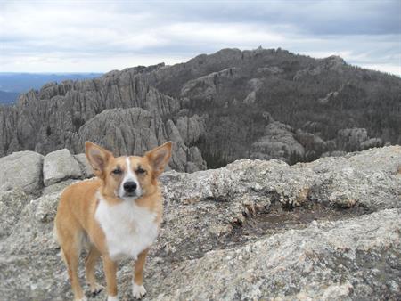
Bear Mountain

Black Hills, SD Expedition No. 95: Lupe at the N high point prior to going over to the true summit of Medicine Mountain. Bear Mountain is the high ridge in the distance to the SW (2014-09-13). Photo by Lupe !.
Click here for larger-size photo. | Crooks Tower

Black Hills, SD Expedition No. 59 - Lupe on top of Crooks Tower. Photo is looking NNE (2013-05-18). Photo by Lupe !.
Click here for larger-size photo. |
Crows Nest Peak

Black Hills, SD Expedition No. 86: Lupe a couple of hundred feet W of the marker for the summit of Crows Nest Peak. Crows Nest Peak is in the western limestone plateau country of the Black Hills less than 5 miles from the Wyoming border. The surrounding area is gently rolling, but generally so flat that there are no distant views possible of or from the "peak". A red and yellow USFS survey marker in a small clearing in the woods marks the site of a US Geological Survey BM that says "Crow" and "1912" which was buried beneath 6" of snow this day. Without those aides, you would have no idea you were at the summit of the 7th highest point in the Black Hills at 7,048 ft. The surrounding country is nevertheless both remote and beautiful (2014-05-03). Photo by Lupe !.
Click here for larger-size photo. | Sylvan Hill

Black Hills, SD Expedition No. 89: Lupe on summit of Sylvan Hill. Harney Peak (center left) and Little Devil's Tower (just left of the highest rock on Sylvan Hill) are visible in the background about 3 miles to the ENE (2014-05-17). Photo by Lupe !.
Click here for larger-size photo. |
Little Devils Tower

Black Hills, SD Expedition No. 88: Little Devil's Tower (upper left) from Harney Peak. Photo is looking SSW (2014-05-17). Photo by Lupe !.
Click here for larger-size photo. | White Tail Peak

Black Hills, SD Expedition No. 60 - Lupe on top of Whitetail Peak. Photo is looking SE (2013-05-25). Photo by Lupe !.
Click here for larger-size photo. |
Peak 6962

Black Hills, SD Expedition No. 90: Lupe near the summit of Peak 6962 (2014-05-24). Photo by Lupe !.
Click here for larger-size photo. | Peak 6920
Black Hills, SD Expedition No. 88: Lupe on Little Devils Tower. Harney Peak, the highest mountain in South Dakota, is the high point. Peak 6920 is the highest and most distant of the two large granite outcroppings seen above Lupe's head in this photo (2014-05-17). Photo by Lupe !.
Click here for larger-size photo. |